
Springport, New York facts for kids
Quick facts for kids
Springport, New York
|
|
|---|---|

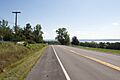
NY State Route 90, near Union Springs
|
|

Location in Cayuga County and New York
|
|

Springport, New York
Location in New York
|
|
| Country | United States |
| State | New York |
| County | Cayuga |
| Government | |
| • Type | Town Council |
| Area | |
| • Total | 26.83 sq mi (69.49 km2) |
| • Land | 21.41 sq mi (55.45 km2) |
| • Water | 5.42 sq mi (14.04 km2) |
| Elevation | 535 ft (163 m) |
| Population
(2010)
|
|
| • Total | 2,367 |
| • Estimate
(2016)
|
2,295 |
| • Density | 107.20/sq mi (41.39/km2) |
| Time zone | UTC-5 (Eastern (EST)) |
| • Summer (DST) | UTC-4 (EDT) |
| ZIP code |
13160
|
| Area code(s) | 315 |
| FIPS code | 36-011-70376 |
| GNIS feature ID | 0979515 |
Springport is a small town located in Cayuga County, New York, United States. In 2010, about 2,367 people lived there. The town's name comes from the many natural springs and the "ports" (places for boats) on the nearby lake. Springport is on the western edge of Cayuga County, southwest of the city of Auburn.
Contents
History of Springport
Early Days: The Cayuga People
Long ago, the area where Springport is now was home to the Cayuga tribe. These were Native American people. In 1688, a group called the Jesuits started a mission to the Cayuga tribe. Later, in 1779, during the American Revolution, the Sullivan Expedition destroyed the Cayuga villages.
Settlers Arrive
After the American Revolution, the land was set aside for the Cayuga people who returned. But in 1789, they gave this land to New York State. This allowed new settlers to move in. At first, there were some disagreements with the Cayuga. However, more and more settlers arrived. By 1799, most of the Cayuga, and some Tuscarora, had moved away from the area.
Forming the Town
The town of Springport was officially created in 1823. It was formed from parts of two other towns: Scipio and Aurelius. Early on, the town's economy was helped by its mineral springs and gypsum (a type of mineral). The village of Union Springs, which is part of Springport, became its own village in 1848.
Geography of Springport
Land and Water
Springport covers a total area of about 69.5 square kilometers (26.8 square miles). Most of this is land, about 55.4 square kilometers (21.4 square miles). The rest, about 14.1 square kilometers (5.4 square miles), is water.
Lakes and Rivers
Cayuga Lake forms the western border of the town. This lake also marks the edge of Seneca County. A stream called Great Gully Creek flows into Cayuga Lake south of a hamlet named Farleys. This creek also helps form the southern boundary of the town.
Roads and Islands
New York State Route 90 is a main road that runs north and south along Cayuga Lake. It crosses New York State Route 326 north of Union Springs. There is also a small island called Frontenac Island in Cayuga Lake, near Union Springs. It is one of the few islands in the Finger Lakes region.
Population and People
How Many People Live Here?
The population of Springport changes over time. In 2000, there were 2,256 people living in the town. By 2010, the population had grown slightly to 2,367 people.
| Historical population | |||
|---|---|---|---|
| Census | Pop. | %± | |
| 1830 | 1,528 | — | |
| 1840 | 1,890 | 23.7% | |
| 1850 | 2,041 | 8.0% | |
| 1860 | 2,129 | 4.3% | |
| 1870 | 175 | −91.8% | |
| 1880 | 21,252 | 12,044.0% | |
| 1890 | 1,991 | −90.6% | |
| 1900 | 1,770 | −11.1% | |
| 1910 | 1,447 | −18.2% | |
| 1920 | 1,146 | −20.8% | |
| 1930 | 1,316 | 14.8% | |
| 1940 | 1,418 | 7.8% | |
| 1950 | 1,534 | 8.2% | |
| 1960 | 1,700 | 10.8% | |
| 1970 | 1,911 | 12.4% | |
| 1980 | 2,210 | 15.6% | |
| 1990 | 2,198 | −0.5% | |
| 2000 | 2,256 | 2.6% | |
| 2010 | 2,367 | 4.9% | |
| 2016 (est.) | 2,295 | −3.0% | |
| U.S. Decennial Census | |||
Who Lives in Springport?
In 2000, most people in Springport were White (about 97.87%). There were also smaller groups of African American, Native American, and Asian residents. About 0.71% of the population was Hispanic or Latino.
There were 865 households in the town. About 33.8% of these households had children under 18 living there. Most households (59.9%) were married couples. The average household had 2.61 people.
Age and Income
The population in Springport is spread across different age groups. About 26.4% of the people were under 18 years old. The median age (the middle age) in the town was 39 years.
In 2000, the average income for a household in Springport was $44,792. For families, the average income was $51,842.
Communities and Places in Springport
Springport is made up of several smaller communities and interesting locations:
- Cayuga Junction – A small community located north of Union Springs, right by Cayuga Lake.
- Crossroads – Another small community found north of Union Springs.
- Farleys – A community situated south of Union Springs, also by Cayuga Lake.
- Farley Point – A piece of land that sticks out into Cayuga Lake, near Farleys.
- Frontenac Island – A small island in Cayuga Lake near Union Springs. This island was very important for ceremonies to the Cayuga people. Today, it is part of the Union Springs village.
- Gwau-gwah – This was once a main village for the Cayuga people, located north of Union Springs.
- Howland Point – Another piece of land that extends into Cayuga Lake, north of Union Springs.
- Oakwood – A community in the northeastern part of Springport, located on NY-326.
- Powers Corner – A community northeast of Union Springs, also on NY-326.
- Union Springs – This is the main village in the town. It's located near the center of Springport, on NY-90 and right on the shore of Cayuga Lake.
Images for kids
-
NY State Route 90, near Union Springs
-

Location in Cayuga County and New York
See also
 In Spanish: Springport (Nueva York) para niños
