St. Vrain Creek facts for kids
Quick facts for kids Saint Vrain Creek |
|
|---|---|

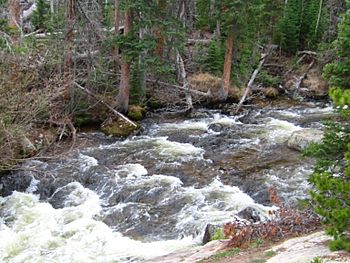
St. Vrain Creek in Rocky Mountain National Park
|
|
| Physical characteristics | |
| Main source | Confluence of North St. Vrain and South St. Vrain 40°13′14″N 105°52′26″W / 40.22056°N 105.87389°W |
| River mouth | Confluence with South Platte 4,737 ft (1,444 m) 40°16′17″N 104°52′26″W / 40.27139°N 104.87389°W |
| Basin features | |
| Progression | South Platte—Platte— Missouri—Mississippi |
| Basin size | 993 sq mi (2,570 km2) |
St. Vrain Creek, also sometimes called the St. Vrain River, is an important waterway in north central Colorado, USA. It flows into the South Platte River. The creek is about 32 miles (52 kilometers) long. It helps drain water from the hills north of Boulder. It also drains the flat lands near Longmont, known as the Colorado Piedmont.
Contents
Where St. Vrain Creek Begins
St. Vrain Creek starts when two smaller streams join together. These streams are called North St. Vrain Creek and South St. Vrain Creek. They meet near the town of Lyons. The creek's different branches begin high up in the mountains. These mountains are part of the Front Range, which is a section of the Rocky Mountains.
Middle St. Vrain Creek
Middle St. Vrain Creek begins near the continental divide. This is a high ridge where water flows to either the Atlantic or Pacific oceans. This part of the creek flows down a canyon. It follows along State Highway 7 and goes past a place called Raymond. It then joins with the shorter South St. Vrain Creek.
North St. Vrain Creek
North St. Vrain Creek starts near Allenspark. It flows through a wild canyon to the east. This part of the creek follows along U.S. Highway 36. Both the North and South branches meet at Lyons. This meeting point is at the mouth of the canyon.
The Creek's Journey East
After the two branches join at Lyons, the combined stream flows southeast. It passes through farms and ranches. It goes south of a town called Hygiene. Then, it enters the city of Longmont.
Through Longmont and Beyond
In Longmont, the creek flows through the southern part of the city. There are greenway trails and parks along its banks. East of Longmont, the creek turns northeast. It winds through a wide valley with more ranches. It flows under Interstate 25. Finally, St. Vrain Creek joins the South Platte River. This meeting point is near the old Fort St. Vrain. It is about 4 miles (6.4 kilometers) northwest of Platteville.
Other Creeks Joining St. Vrain
St. Vrain Creek is joined by other smaller creeks along its path.
- Left Hand Creek flows into St. Vrain Creek south of Longmont.
- Boulder Creek joins St. Vrain Creek east of Longmont.
Naming the Creek
The creek was named after a pioneer trader named Ceran St. Vrain. He was an important person in the early history of the area.
 | William L. Dawson |
 | W. E. B. Du Bois |
 | Harry Belafonte |

