
St Ann's, Nottingham facts for kids
Quick facts for kids St Ann's |
|
|---|---|
 The St Ann's bus on Brewster Road |
|

St Ann's
|
|
| Population | 19,316 (Ward 2011) |
| OS grid reference | SK 58028 40898 |
| Unitary authority | |
| Ceremonial county | |
| Region | |
| Country | England |
| Sovereign state | United Kingdom |
| Post town | NOTTINGHAM |
| Postcode district | NG3 |
| Dialling code | 0115 |
| Police | Nottinghamshire |
| Fire | Nottinghamshire |
| Ambulance | East Midlands |
| EU Parliament | East Midlands |
| UK Parliament |
|
| St Ann's | |
|---|---|

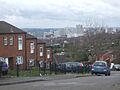
Vista over Nottingham (2016)
|
|
| Location | Nottingham, UK |
| Status | Stable |
| Area | 1,068 acres (432 ha) |
| Population (2005) | 15000 |
| Construction | |
| Contractors | George Wimpey |
| Authority | City of Nottingham |
| Style | Radburn |
St Ann's is a large area in the city of Nottingham, England. It is part of the ceremonial county of Nottinghamshire. In 2011, about 19,316 people lived there.
Contents
Exploring St Ann's History
The Ancient Well and Early Settlements
The name St Ann's might come from an old well in the area. People once believed this well had special healing powers. Records from 1301 called it 'The Brodewell'. It was also known as 'Oswell' or 'Robin Hood's Well'.
Around 1500, monks took over the spring. They built a small church next to it. They named the site after St. Ann. Other old names for parts of the area include Peas Hill (from 1230) and Clay Fields.
Developing the Area: From Farms to Homes
St Ann's began to develop around 1750. Charles Morley, a local businessman, made pottery there. He was known for his brown beer jugs.
In the 1830s, the Clay Fields area was divided into smaller pieces. Before 1845, this land was mostly empty. It was part of a larger open area.
After the Nottingham Enclosure Act of 1845, the city council could develop the land. This is when the area became known as St Ann's.
Building the Community: St. Ann's Church and 'New Town'
A church, St. Ann's Church, was built in the 1860s. It was made to serve the growing community. The first stone was laid on September 23, 1863. The church opened on September 26, 1864. It was connected to St. Mary the Virgin Church in Nottingham.
The Enclosure Act of 1845 allowed the city to use about 1068 acres (432 hectares) of the Clay Fields. This land was used for housing. By 1880, a new area called 'New Town' was finished. It was built for working-class families.
The houses were simple cottages. The area had shops like a butcher and a baker. There were also many pubs and a market. For the first time in Britain, there were allotments. These were small plots of land where people could grow their own vegetables.
These houses were built before new health rules came in. Many had shared toilets in yards and open sewers. This led to health problems like dysentery and cholera. Sadly, infant mortality was three times higher than the national average.

Changes in the 20th Century: Slum Clearance and New Designs
Starting in the 1930s, older houses like these began to be torn down. This process, called slum clearance, continued until 1970. The old houses were removed, and residents moved to other areas.
In 1970, the old streets were replaced. A new housing style called Radburn was used. This style meant houses faced away from main roads. Walkways connected homes, making it confusing for visitors.
The new houses were built quickly using prefabricated techniques. Early residents liked their new homes. However, they found the estate's design confusing. Radburn designs have become less popular over time. Their maze-like paths can make communities feel isolated.

St Ann's Geography
St Ann's is located east of Nottingham city centre. Thorneywood is to the northeast. Carlton Road forms the unofficial border with Sneinton to the south.
St Ann's Community and People
Population and Diversity
Like other parts of Nottingham, St Ann's has many working-class residents. The area has been affected by the decline of manufacturing jobs. Many people here face challenges.
St Ann's is a diverse area with a strong community spirit. In 2005, about 15,000 people lived there. People from many countries call St Ann's home. This includes people from Pakistan, Afghanistan, the West Indies, Iran, Romania, Greece, Portugal, Italy, Spain, Turkey, Somalia, Sudan, Brazil, Mexico, Guinea, Thailand, China, Japan, and South Korea.
Community Hubs
The area has a Pakistani Community Centre. It also has the African Caribbean National Artistic Center (ACNA). These places help bring people together.
St Ann's Economy
Past Industries
In the 1800s, St Ann's was known for lace and textile manufacturing. These were common industries in Nottingham at the time.
Modern Economy and Local Shops
As of 2023, St Ann's has fewer pubs, restaurants, and shops. There are not many places for people to gather. There are also no major supermarket chains.
However, there is a weekly St Ann's Market every Tuesday morning. You can also find several ethnic supermarkets. These include Jamaican, Pakistani, Somali, Portuguese, Italian, and Greek shops. Murat (Kurdish/Turkish) and Asiana (Oriental) are two of the main ethnic supermarkets.
Culture and Community Life
The Healing Well and Local Traditions
The area's name comes from St Ann's Well. This spring was once believed to have amazing healing powers. It was also known as The Brodewell and Robin Hood's Well.
People from Nottingham used to walk to St Ann's Well on Easter Monday. They would celebrate with a party. The well was covered by a spired building for a time. This building was later removed for a railway.
Local Attractions
Stonebridge City Farm is an urban farm in the community. It does not charge an admission fee. It's a great place to visit animals and learn about farming.
The last pub in the area, the Sycamore Inn, closed in April 2014.
Important Landmarks
Historic Architecture
Some terraces north of Victoria Park are special. They show a style of home building that was once common. Many similar buildings were lost due to war damage or slum clearance.
St Ann's Allotments
The St Ann's Allotments is the oldest and largest allotment site in England. It was created in the 1830s. It is now a Grade 2* listed site. This means it is of "Special Historic Interest." The allotments have received money from the National Lottery for restoration. They have also been featured on TV shows like the BBC's The One Show.
Getting Around St Ann's
Past Railway Connections
The Nottingham Suburban Railway used to run through St Ann's. It connected Trent Lane junction in Sneinton with Daybrook. However, part of the line was damaged in 1941. The railway stopped running completely in 1951.
Bus Services
St Ann's is served by Nottingham City Transport buses.
- 39: Nottingham → St Ann's (Beacon Hill Rise) → Thorneywood → Carlton Valley
- 40: Nottingham → St Ann's → Sherwood → City Hospital Campus
- 40B: Nottingham → St Ann's → The Wells Road Top
- 41: Nottingham → St Ann's
- 42: Nottingham → St Ann's
Education in St Ann's
Blue Bell Hill Primary School is on Gordon Road. Our Lady & St. Edwards Primary is also there. The Wells Academy provides secondary education. The new St Ann's Well Academy is on Hungerhill Road. Other schools include Sycamore Academy and Huntingdon Academy.
Religion in St Ann's
| Religion in St Ann's (Ward 2011) | ||||
|---|---|---|---|---|
| religion | per cent | |||
| Christianity | 43.3% | |||
| Buddhism | 1.3% | |||
| Hinduism | 2.2% | |||
| Judaism | 0.3% | |||
| Islam | 9.3% | |||
| Sikhism | 1.4% | |||
| Others | 0.4% | |||
| No Religion | 33.5% | |||
| Unknown / None | 8.3% | |||
The main church for the area is St. Ann with Emmanuel. The RCCG Covenant Restoration Assembly St Anns meets in Blue Bell Hill Community Centre.
There are also two Mosques in the area. One is in the Pakistani Centre and another is the Islamic Center.
Sports and Recreation
St Ann's itself has few sports facilities. However, nearby is the National Ice Centre. This is an Olympic-sized ice rink. It is home to the Nottingham Panthers ice hockey team. It also hosts major music events.
Other nearby sports venues include Nottingham Racecourse for horse racing. There is also the Nottingham Greyhound Stadium for dog racing.
St Ann's in Media
Nottingham filmmaker Shane Meadows used St Ann's for some scenes. This was for his 2006 drama This Is England.
Ray Gosling, a broadcaster and writer, lived in St Ann's. He wrote about the area. He also introduced a film about the area by Thames Television.
Images for kids
-
Vista over Nottingham (2016)
