Stapylton, Queensland facts for kids
Quick facts for kids StapyltonGold Coast, Queensland |
|||||||||||||||
|---|---|---|---|---|---|---|---|---|---|---|---|---|---|---|---|

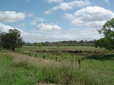
Paddocks along Bruckner Road, 2014
|
|||||||||||||||
| Population | 430 (2021 census) | ||||||||||||||
| • Density | 28.7/km2 (74/sq mi) | ||||||||||||||
| Postcode(s) | 4207 | ||||||||||||||
| Area | 15.0 km2 (5.8 sq mi) | ||||||||||||||
| Time zone | AEST (UTC+10:00) | ||||||||||||||
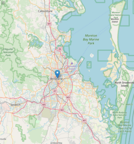
| Location |
|
||||||||||||||
| LGA(s) | City of Gold Coast | ||||||||||||||
| State electorate(s) | Coomera | ||||||||||||||
| Federal Division(s) | Fadden | ||||||||||||||
|
|||||||||||||||
Stapylton is a place in Queensland, Australia, located in the City of Gold Coast. It's a mix of different types of areas, like homes and businesses. In 2021, about 430 people lived here.
Contents
Where is Stapylton?
Stapylton is bordered on its western side by the Albert River. The Pacific Motorway also runs along this western edge.
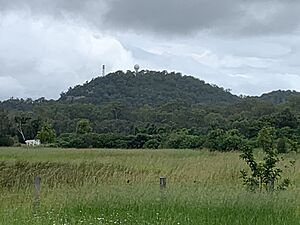
In the northern part of Stapylton, you'll find two mountains:
- Mount Stapylton (also called Yellowwood Mountain) is about 152 meters (499 feet) high.
- Quinns Hill is about 42 meters (138 feet) high.
Stapylton's History
The area was named after a surveyor named Granville William Chetwynd Stapylton. Sadly, he died in 1840 near Mount Lindesay.
The first train station after Beenleigh on the South Coastline opened in Stapylton in 1889.
Stapylton State School opened its doors on May 18, 1920. It was located near Hester Drive and Stapylton Jacobs Well Road. The school closed down in 1961.
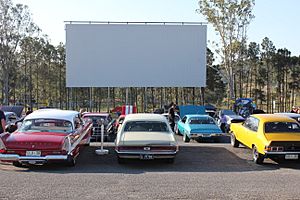
The Yatala drive-in theatre first opened on October 27, 1974. It's a fun place where people can watch movies from their cars.
Stapylton used to be part of the Shire of Albert. But in 1995, it became part of the City of Gold Coast.
Who Lives in Stapylton?
In 2021, 430 people lived in Stapylton. Slightly more than half were male (57.3%), and 42.7% were female. The average age of people living here was 45 years old. This is a bit older than the average age for all of Australia, which is 38.
Most people (69.1%) living in Stapylton were born in Australia. Other countries where people were born include New Zealand (5.6%), England (3.0%), and South Africa (2.1%).
When it comes to languages, most people (81.6%) spoke only English at home. Some other languages spoken include German, Ndebele, and Maltese.
What Happens in Stapylton?
Stapylton is home to Australia's first "green" waste-to-energy power plant. This plant turns waste into energy, which is good for the environment.
You can also find the Mount Stapylton Weather station here. It has a tall radar tower, 30 meters (98 feet) high, which was finished in 2006. There are also several quarries and a landfill and recycling center.
Besides a transport service center and take-away restaurants near the motorway, Stapylton has an industrial park. Big stores like Aldi and Harvey Norman are here. There are also three quarries and the Yatala twin drive-in movie theater. You can also find the Ecomemorial Park crematorium in Stapylton.
Learning in Stapylton
There are no schools directly in Stapylton. Kids usually go to schools in nearby areas. The closest primary school is Mount Warren Park State School. For high school, students might go to Beenleigh State High School or Ormeau Woods State High School.
Fun Things to Do
The Yatala drive-in theater is a popular spot. It's located at 100 Stapylton Jacobs Well Road. This drive-in has two big screens and covers about 10 acres (4 hectares) of land. It's a great place to watch movies outdoors.
Sports and Teams
The Supercars team Dick Johnson Racing is based in Stapylton. This is a famous racing team that competes in Australia's top touring car series.
 | Chris Smalls |
 | Fred Hampton |
 | Ralph Abernathy |


