Sterling, Virginia facts for kids
Quick facts for kids
Sterling, Virginia
|
|
|---|---|

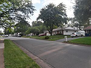
Houses in the Sterling Park neighborhood, June 2023
|
|
| Country | |
| State | |
| County | |
| Area | |
| • Total | 5.48 sq mi (14.19 km2) |
| • Land | 5.45 sq mi (14.12 km2) |
| • Water | 0.03 sq mi (0.07 km2) |
| Elevation | 295 ft (90 m) |
| Population
(2020)
|
|
| • Total | 30,337 |
| • Density | 5,565/sq mi (2,148.5/km2) |
| Time zone | UTC−5 (Eastern (EST)) |
| • Summer (DST) | UTC−4 (EDT) |
| ZIP code |
20164
|
| FIPS code | 51-75376 |
| GNIS feature ID | 2584925 |
Sterling, Virginia, is a community in Loudoun County, Virginia, United States. It is known as a census-designated place (CDP). This means it is an area identified by the government for statistics, but it is not an official town or city. In 2020, about 30,337 people lived in the CDP.
The area called "Sterling" by the United States Postal Service is much larger. It includes other places like Arcola, Cascades, and Sugarland Run. This larger area, sometimes called "Greater Sterling," is home to part of Washington Dulles International Airport. It also has the National Weather Service office that helps forecast weather for the Baltimore–Washington Metropolitan Area.
Contents
Sterling's History
In 1962, the area now known as Sterling Park was mostly large farms. One farm belonged to Jesse Hughes, a well-known person in Loudoun County. Another big farm was run by Fred Franklin Tavenner. This farm was special because it used "scientific methods" for farming, thanks to a U.S. grant.
Big changes came to the area when Dulles International Airport started being built in 1959. This made land prices go up a lot. In 1961, a company called M.T. Broyhill & Sons decided to buy a large amount of land. They planned to build a new community there.
The Broyhills bought about 1,762 acres of land. They wanted to build Sterling Park on both sides of the new Route 28. However, officials wanted Route 28 to be clear for airport access. So, Sterling Park was built east of Route 28. The developers had to build their own main road, which is now Sterling Boulevard.
Marvin Broyhill Jr. had ideas for Sterling Park homes. He wanted them to be affordable, around $17,000. He also wanted them to have air conditioning, which was unusual for homes in that price range back then. Homeowners were also supposed to have access to golf, tennis, and pools without extra fees. Many of these ideas, except for free golf, came true.
At first, Sterling Park had rules about who could live there. Only people of the "Caucasian race" were allowed. This was a common rule in the U.S. before the 1960s. However, these rules became illegal with the Fair Housing Act. By August 1966, the first African American family moved into Sterling Park. By then, about 5,000 people lived in the community.
Some historic places in Sterling are listed on the National Register of Historic Places. These include the Broad Run Bridge and Tollhouse and the Arcola Elementary School.
Sterling's Geography
Sterling is located at an average height of about 289 feet (88 meters) above sea level. The original center of Sterling is at 39°00'22.4"N 77°25'43.0"W.
Sterling is part of the Chesapeake Bay watershed. This means that water from Sterling eventually flows into the Chesapeake Bay. The larger Sterling area also borders the Potomac River.
Sterling's Population
In 2020, the population of Sterling was 30,337 people. This was an increase from 27,822 people in 2010.
According to estimates from 2022, there were about 31,058 people living in Sterling. Many different groups of people live here. About 47.1% of the population were Hispanics or Latinos. The community is very diverse, with people from many different backgrounds.
The average age in Sterling was about 35.4 years old. About 24.1% of the people were under 18 years old.
Communities in Sterling
Sterling is made up of several different communities, each with its own character:
- Broad Run Farms is a residential area that started in 1952. It has larger lots and many old trees. The Potomac River is to its north.
- Cascades is a large, planned community covering about 2,500 acres. It is located in the northeastern part of Loudoun County.
- Countryside is a housing development that began in the 1970s. It has single-family homes, town homes, and condominiums. It also has a shopping center.
- Dulles is an area known for businesses. Many companies, including the former headquarters of AOL, have offices here. Dulles Town Center is a shopping mall located within Dulles.
- Lowes Island is a part of Cascades. It is known for its golf course and club grounds. Residents can use either "Potomac Falls, VA" or "Sterling, VA" as their mailing address.
- Potomac Falls is another name for the northern part of Sterling, along the Potomac River. It includes communities like Cascades and Countryside. It has shopping areas, schools, and golf courses.
- Sterling Park was one of the first planned communities in eastern Loudoun County. It was built starting in 1961. It has homes, businesses, churches, parks, and a community center.
- Sugarland Run was built in the 1970s. It has townhouses, apartments, and single-family homes. It also has over 26 miles of walking paths, a community swimming pool, and a playground.
Sterling's Economy
Sterling is home to many businesses and branch offices of large companies. Some companies with headquarters in Sterling include Neustar and Electronic Instrumentation and Technology. Other major companies like Alcatel-Lucent and M.C. Dean, Inc. have offices here.
Several United States government agencies also have offices in Sterling. These include U.S. Customs and Border Protection and the Drug Enforcement Administration.
Education in Sterling
Sterling has several public schools for students of all ages.
High Schools
There are three public high schools in Sterling for grades 9-12:
- Dominion High School
- Park View High School
- Potomac Falls High School
Middle Schools
Sterling has three public middle schools for grades 6-8:
- River Bend Middle School
- Seneca Ridge Middle School
- Sterling Middle School
Elementary Schools
There are twelve public elementary schools in Sterling for grades PK-5:
- Algonkian Elementary School
- Countryside Elementary School
- Forest Grove Elementary School
- Guilford Elementary School
- Horizon Elementary School
- Lowes Island Elementary School
- Meadlowland Elementary School
- Potowmack Elementary School
- Rolling Ridge Elementary School
- Sterling Elementary School
- Sugarland Elementary School
- Sully Elementary School
Higher Education
For students seeking college education, Northern Virginia Community College has a campus in Loudoun County on Leesburg Pike. Nearby, in Ashburn, The George Washington University has its Virginia Science and Technology Campus.
Getting Around Sterling
The main roads that help people travel around Sterling include Route 28, West Church Road, South Sterling Boulevard, Leesburg Pike, and Cascades Parkway.
Fun Things to Do in Sterling
Sterling offers many places for recreation and fun activities.
Claude Moore Park is a large park covering 357 acres. It has three main areas:
- Claude Moore Recreation Center has an Olympic-size indoor pool, a children's pool, an exercise area, and a gym.
- The sportplex has fields for baseball and softball.
- The nature area has hiking trails.
A historic path called Vestal's Gap Road runs through Claude Moore Park. This road was first used by Native Americans. Famous people like George Washington and Daniel Boone also traveled on this road long ago.
Other places for recreation in Sterling include:
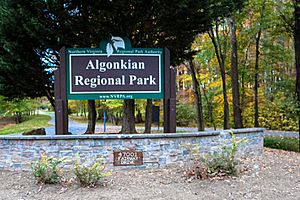
- Algonkian Regional Park
- Dulles Golf Center & Sports Park
- Sterling Golf Club
Public Services in Sterling
Fire protection services in Sterling are provided by the Sterling Volunteer Fire Company. Emergency Medical Services (EMS) are provided by the Sterling Volunteer Rescue Squad. Both are non-profit groups that work with the Loudoun County Combined Fire and Rescue System. They operate from three stations in the area.
Law enforcement is handled by the Loudoun County Sheriff's Office and the Virginia State Police.
Famous People from Sterling
Many interesting people have lived in or were born in Sterling:
- United States President James Buchanan had a summer home near Sterling.
- Hilarie Burton, an actress known for One Tree Hill.
- Billy King, a former general manager for the Brooklyn Nets basketball team.
- Patton Oswalt, a stand-up comedian.
- Austin St. John, an actor from Mighty Morphin Power Rangers. He later became a paramedic.
- Jalen Coker, an NFL Wide Receiver.
- Dondrea Tillman, an NFL Outside Linebacker.
Sterling's Climate
Sterling has a climate with hot, humid summers. The winters are generally mild to cool. This type of climate is called a humid subtropical climate.
See also
 In Spanish: Sterling (Virginia) para niños
 | Isaac Myers |
 | D. Hamilton Jackson |
 | A. Philip Randolph |


