Sunland-Tujunga, Los Angeles facts for kids
Quick facts for kids
Sunland-Tujunga
|
|
|---|---|
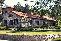
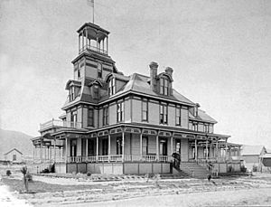
Historic Bolton Hall in Tujunga, 2008
|
|
| Country | United States |
| State | California |
| County | Los Angeles |
| City | Los Angeles |
| Population
(2008)
|
59,087 |
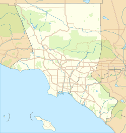
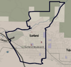
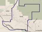
Sunland-Tujunga is a neighborhood in Los Angeles, California. It's located between the Crescenta Valley and the Verdugo Mountains. Sunland and Tujunga started as two separate towns. Today, they share many things like a police station, library, and high school. They officially became one community with a hyphenated name around 1928. This area is also home to Mount Lukens, which is the highest point in Los Angeles.
History of Sunland-Tujunga
Early Days with the Tongva People
Long ago, the land where Sunland and Tujunga now stand was home to the Tongva people. In 1840, this area was part of a large Mexican land grant called Rancho Tujunga. Later, people started to divide the land into smaller plots.
The name Tujunga is thought to mean "old woman's place" in the Tongva language. "Tuhu" meant "old woman," which was a term for Mother Earth in their stories.
Sunland's Beginnings: 1885–1925
Sunland began as a place called Monte Vista in 1885. About 2,200 acres of land were divided into smaller lots. One of the first big projects was planting 40 acres of olive trees. This became the largest olive orchard in Los Angeles County.
By 1906, people started calling the area "Sunland." In 1907, it was known as the first supply store about seven miles from the railroad. Getting to Sunland in 1908 was tough. It was 1,500 feet high and only reachable by rough mountain roads. A car trip from Los Angeles took a whole day.
By 1923, Sunland had about 2,000 people. The hills were covered with vineyards growing grapes. The town's only factory canned olives from local trees. Monte Vista Park was a popular spot for picnics. There was also a home for children in need, supported by women's groups.
In 1925, Tujunga became its own city. Some people in Sunland wanted to join Tujunga, but they voted against it. Instead, they focused on building a new school.
Tujunga's Beginnings: 1907–1929
In 1907, a social thinker named William Ellsworth Smythe and a land seller named M.V. Hartranft teamed up. They wanted to create a special community, a kind of perfect place. Their motto was "A Little Land and a Lot of Living." They divided the land into small 1.5-acre lots.
Bolton Hall, a community center made from local river rocks, was built in 1913. It's still a historical building and museum today.
An old advertisement for Tujunga said, "Move to Tujunga with a trowel and a bag of cement, and build your own." After World War I, many people from Los Angeles moved there. They built their homes using the many stones and boulders found in the area. By 1927, Tujunga had about 4,000 residents, more than Sunland. Many people had small farms with gardens and animals.
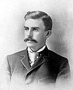
Tujunga was home to John Steven McGroarty, a writer and politician. He built his own home, Rancho Chupa Rosa, in 1923. It's now a historic landmark and an arts center.
In 1925, Tujunga officially became a city. Bolton Hall served as the City Hall until Tujunga joined Los Angeles in 1932.
Tujunga's high elevation and distance from the main city meant it had cleaner air. Because of this, many people with asthma moved there. In 1929, the city even made plans for places where people with lung conditions could get care.
Joining Los Angeles: 1926–1932
Most of Sunland became part of Los Angeles in 1926. La Tuna Canyon joined in 1927. Los Angeles also wanted to annex some of the same land Tujunga claimed. This led to a legal disagreement that had to be settled in court.
Tujunga voted twice against joining Los Angeles in 1927 and 1930. John Steven McGroarty was part of a group that wanted Tujunga to stay independent. However, in January 1932, the third vote was in favor of joining Los Angeles. Tujunga officially became part of the city on March 8, 1932.
Tuna Canyon Detention Station: 1941–1943
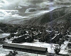
During World War II, a temporary holding place called the Tuna Canyon Detention Station was used in Tujunga. It held Japanese Americans, and some Italian Americans and German Americans. People held here were later moved to larger internment camps.
Gravel Pit Debates: 1950s and 1960s
In the 1950s, there was a big debate about a gravel pit in the Big Tujunga Wash. Local people fought against it for years. They said the dust from the pit was bad for the area's reputation as a place with clean air for people with asthma. In 1962, the California Supreme Court agreed with the community and allowed the city to ban the pit.
City Council Changes: 1986–2002
In 1986, the city council district for Sunland-Tujunga changed. This happened because Los Angeles needed to create new districts to better represent different groups of people. Sunland-Tujunga became part of a new district. The council member, Joel Wachs, served the area for 15 years. Later, Wendy Greuel took over and reopened the local office.
Helping the Homeless: 2010 and After
Starting in 2010, there were more news stories about people experiencing homelessness in the Big Tujunga Wash. The community and city workers have since organized major cleanups. They have removed tons of trash from these areas.
Geography and Nature
Location and Landscape
Sunland-Tujunga is located between the Verdugo Mountains and the San Gabriel Mountains. To the east, it borders La Crescenta-Montrose. Sunland and Tujunga are separated by Mount Gleason Avenue, with Sunland to the west and Tujunga to the east. Mount Lukens in Tujunga is the highest point in Los Angeles, standing at 5,074 feet.
Roads and Paths
In 1925, Tujunga didn't have sidewalks or paved roads. But by 1927, half of the streets were paved. A state highway also ran through the town.
In 1929, many streets in Sunland and Tuna Canyon were renamed. The main east-west road, once called Michigan Avenue, became Foothill Boulevard. Other streets were also given new names, like McGroarty Avenue, named after the writer John Steven McGroarty.
In the 1960s, the local Chamber of Commerce fought against building the Foothill Freeway through Shadow Hills. They worried it would ruin the area's "rural atmosphere." The final part of the freeway through Sunland-Tujunga was completed in 1981. Today, Foothill Boulevard is the main road with most businesses. The Interstate 210 freeway also serves the community.
Weather and Climate
Sunland-Tujunga has a hot-summer Mediterranean climate. This means it has hot, dry summers and mild, wet winters.
| Climate data for Tujunga, California | |||||||||||||
|---|---|---|---|---|---|---|---|---|---|---|---|---|---|
| Month | Jan | Feb | Mar | Apr | May | Jun | Jul | Aug | Sep | Oct | Nov | Dec | Year |
| Mean daily maximum °F (°C) | 64 (18) |
66 (19) |
68 (20) |
74 (23) |
79 (26) |
88 (31) |
94 (34) |
95 (35) |
91 (33) |
82 (28) |
72 (22) |
65 (18) |
78 (26) |
| Mean daily minimum °F (°C) | 36 (2) |
37 (3) |
38 (3) |
41 (5) |
45 (7) |
50 (10) |
54 (12) |
55 (13) |
52 (11) |
46 (8) |
39 (4) |
36 (2) |
44 (7) |
| Average precipitation inches (mm) | 2.99 (76) |
3.50 (89) |
3.03 (77) |
0.63 (16) |
0.22 (5.6) |
0.01 (0.25) |
0.01 (0.25) |
0.11 (2.8) |
0.27 (6.9) |
0.36 (9.1) |
1.22 (31) |
1.61 (41) |
13.96 (354.9) |
Community and People
Population Overview
In 2000, Sunland had about 28,414 people, and Tujunga had 26,527. The area has a higher percentage of White residents compared to the rest of Los Angeles County. Many residents are 25 or older and have a high school diploma or some college education. The median household income in Sunland was $68,720, which is high for Los Angeles.
Changing Reputation
Sunland-Tujunga's reputation has changed over time.
Fresh Air Haven
From the 1950s to the 1970s, the area was known for its clean air. It was seen as a great place for people with asthma or those looking for a healthy environment. In 1957, Coronet magazine even called Tujunga "the most healthy place in the world."
Community Vibe
By 1990, Tujunga had a reputation as a strong community. In 2001, Sunland-Tujunga was described as a mix of a middle-class suburb, a unique mountain hideaway, and a commercial area.
Education and Schools
About 22% of adults in Sunland and Tujunga (25 and older) had a four-year college degree by 2000. This is about average for the city and county.
Local Schools in Sunland-Tujunga
Here are some of the schools in the Sunland-Tujunga area:
Public Schools
- Mount Gleason Middle School, Sunland
- Sunland Elementary School, Sunland
- Apperson Street Elementary School, Sunland
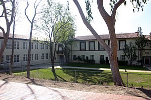
- Verdugo Hills High School, Tujunga
- Plainview Avenue Elementary School, Tujunga
- Mt. Lukens Continuation School, Tujunga
- Pinewood Avenue Elementary School, Tujunga
- Mountain View Elementary School, Tujunga
Private Schools
- Trinity Christian School, Sunland
- Fairhaven Christian Academy, Sunland
- Canyon View Academy, Sunland
- Our Lady of Lourdes School, Sunland
- Smart Academy / Christian, Tujunga
School History
Joining the LAUSD
In its early years, both Sunland and Tujunga had their own school districts. In 1926, Tujunga voters approved a plan for a new high school. By 1927, Tujunga had two schools for 400 students. In 1929, Tujunga joined the Los Angeles School District.
School Boundaries and Changes
In the 1960s, there was a plan to move students from Shadow Hills to a different junior high school. This caused some debate among parents. In 1966, the Los Angeles school board approved the change. Parents protested, saying they wanted their children to attend local neighborhood schools.
Busing for Desegregation: 1977–1981
Sunland-Tujunga residents were very active in protesting against mandatory busing to mix students from different areas in Los Angeles schools. In 1977, thousands of students stayed home from school to protest. Parents organized groups to fight the busing program.
In 1980, some elementary students from Sunland-Tujunga were bused to schools in other areas. Parents organized a "Yellow Flu" campaign to keep kids home. However, mandatory busing ended in 1981. Most Sunland-Tujunga students returned to their local schools.
"Parent Trigger" at Mount Gleason: 2010
By 2010, Mount Gleason Middle School had been on a list of under-performing schools for many years. A group of parents used a new state law, called the "parent trigger," to try and make big changes at the school. They wanted to improve the school and make it safer.
Parks and Fun Places
Sunland Park was originally known as Monte Vista Park.
Haines Canyon Park in Tujunga is a natural park area. It's open from dawn to dusk, but it's mainly used for keeping the area clear of brush.
The Sunland Recreation Center is a busy place. It has a gym, baseball field, basketball courts, a playground, and tennis courts. It hosts fun events like the Easter Carnival and the Watermelon Carnival. Verdugo Mountain Park is also nearby.
Howard Finn Park, named after a city council member, opened in 1990. Fehlhaber-Houk Park was built on land donated by a family in 1975.
Local News
The Sunland-Tujunga area has several local newspapers. These include the Voice, the Foothill Record, the North Valley Reporter, and the Crescenta Valley Weekly.
Cool Historical Spots
- Bolton Hall is an old stone building in Tujunga. Built in 1913, it was a community center for a special group called Los Terrenitos. Over the years, it was a library, city hall, and even a jail. Since 1980, it's been a local history museum. You can see old photos and items from Sunland-Tujunga's past.
- McGroarty Arts Center is a historic landmark. John Steven McGroarty, a famous writer and politician, built it in 1923. Today, it's a place where you can learn about art, music, and enjoy cultural events.
- Angeles National Golf Club is an 18-hole golf course at the base of the Angeles National Forest. It's the only golf course in Los Angeles County designed by the famous golfer Jack Nicklaus.
Filming Locations
Many movies and TV shows have been filmed in Sunland-Tujunga!
- Parts of the movie E.T. the Extra-Terrestrial were filmed in Tujunga, including the house where Elliot lived.
- Scenes from Corvette Summer starring Mark Hamill were filmed at Verdugo Hills High School.
- Long ago, Ben-Hur raced his chariot in Big Tujunga Canyon.
- Other famous movies filmed here include Mildred Pierce, The Birth of a Nation, Meet John Doe, The Craft, Ernest Goes to Camp, and River's Edge (with Keanu Reeves).
- Parts of Teen Wolf and Sons of Anarchy were also shot here.
- The Travel Inn in Tujunga was used in Seven Pounds and Memento.
- An episode of the TV show CHiPs was filmed at the Foothill Blvd and Mather Avenue intersection.
Famous People from Sunland-Tujunga
Residents
- Alan Alda (born 1936), American actor
- Robert Alda (1914–1986), American actor
- Teri Hatcher, actress
- Jaye P. Morgan (born 1931), singer and actress
- Giancarlo Stanton (born 1989), Major League Baseball player
- Ryan Starr, rock singer and finalist on American Idol
- The Smothers Brothers, television actors
- Patrick Swayze (1952–2009), American actor
- Paul Walker (1973–2013), actor
Verdugo Hills High School Students
- Jan Brewer (born 1944), former governor of Arizona
- Howard McKeon (born 1938), former member of the House of Representatives
- Jaye P. Morgan (born 1931), singer
 | James B. Knighten |
 | Azellia White |
 | Willa Brown |


