Texas barrier islands facts for kids
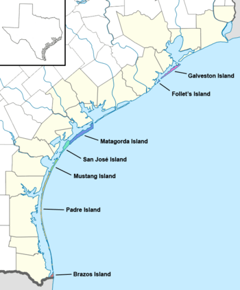
Map of the barrier islands along the Gulf Coast of Texas
|
|
| Geography | |
|---|---|
| Location | Gulf of Mexico |
| Coordinates | 28°N 97°W / 28°N 97°W |
| Total islands | 7 |
| Major islands | Galveston Island, Follet's Island, Matagorda Island, San José Island, Mustang Island, Padre Island, Brazos Island |
| Administration | |
| State | Texas |
The Texas barrier islands are a chain of barrier islands in the Gulf of Mexico along the coast of Texas. These amazing islands act like natural walls, protecting the Texas mainland from strong ocean waves and storms. They also create calm, shallow waters behind them called estuaries, which are super important homes for many different plants and animals. People love to visit these islands for fun activities like fishing and watching dolphins play in the water. There are seven main barrier islands in Texas, stretching from the northeast to the southwest: Galveston Island, Follet's Island, Matagorda Island, San José Island, Mustang Island, Padre Island, and Brazos Island.
Padre Island is extra special because it's the longest barrier island in the whole world! It stretches for about 113 miles (182 kilometers). Since 1962, Padre Island has been split into two parts by a dug-out channel called the Port Mansfield Channel. This channel is about 30 miles (48 kilometers) north of the island's southern end, creating South Padre Island and North Padre Island.
Contents
Texas Barrier Islands: Nature's Protectors
Texas is home to a unique chain of islands that play a huge role in protecting its coast. These are called barrier islands. They are long, narrow islands that form offshore, parallel to the mainland. Think of them as natural shields!
What Are Barrier Islands?
Barrier islands are made mostly of sand. They are formed by ocean currents, waves, and winds that move sand around over thousands of years. These islands are always changing shape because of the powerful forces of the ocean. They can grow, shrink, or even move over time.
How Barrier Islands Protect the Coast
The main job of a barrier island is to protect the mainland from strong ocean waves, storm surges, and hurricanes. When a big storm hits, the barrier island takes the first hit, reducing the impact on the land behind it. This helps prevent flooding and erosion on the coast where people live and work.
Estuaries: Important Water Homes
Behind the barrier islands, you'll find calm, sheltered bodies of water called estuaries. An estuary is where fresh water from rivers mixes with salty ocean water. These areas are incredibly important for nature. Many different types of fish, crabs, birds, and other wildlife use estuaries as nurseries, feeding grounds, and safe places to live. They are like busy underwater cities!
Fun Things to Do on Texas Barrier Islands
The Texas barrier islands are popular spots for tourists and locals alike. There are lots of fun activities to enjoy:
- Fishing: The waters around the islands and in the estuaries are full of fish. You can fish from the shore, a pier, or a boat.
- Dolphin Watching: Many people enjoy taking boat tours to see playful dolphins swimming in the Gulf waters.
- Beach Fun: Of course, the beaches are perfect for swimming, sunbathing, building sandcastles, and collecting seashells.
- Bird Watching: The islands and estuaries are home to many different bird species, making them great places for bird watchers.
Meet the Texas Barrier Islands
There are seven main barrier islands along the Texas coast. They stretch from the top (northeast) to the bottom (southwest) of the state. Each island has its own unique features and plays an important part in the Texas ecosystem.
Galveston Island
Located at the northern end of the chain, Galveston Island is a well-known tourist spot. It protects the large Galveston Bay, which is fed by the Trinity and San Jacinto Rivers.
Padre Island: The World's Longest
Padre Island is truly special because it holds the record for the longest barrier island in the world! It's so long that it's divided into two parts: North Padre Island and South Padre Island. This island protects the Laguna Madre Estuary, a very shallow and salty body of water.
List of Texas Barrier Islands
Here is a list of the main barrier islands in Texas, from north to south, along with their lengths and the estuaries they protect:
| Latitude | Name | Length | Estuary | Map |
|---|---|---|---|---|
| 29°13' N | Galveston Island | 27 miles (43 km) | Trinity–San Jacinto Estuary (Galveston Bay) | 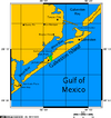 |
| 29°2' N | Follet's Island | 13 miles (21 km) | Christmas Bay Estuary |  |
| 28°14' N | Matagorda Island | 38 miles (61 km) | Guadalupe Estuary (San Antonio Bay) |  |
| 27°59' N | San José Island | 21 miles (34 km) | Mission–Aransas Estuary (Aransas Bay) | 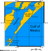 |
| 27°44' N | Mustang Island | 18 miles (29 km) | Nueces Estuary (Corpus Christi Bay) | 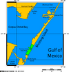 |
| 26°50' N | Padre Island | 113 miles (182 km) | Laguna Madre Estuary | 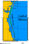 |
| 26°2' N | Brazos Island | 4.0 miles (6.4 km) | Laguna Madre Estuary |  |
 | Lonnie Johnson |
 | Granville Woods |
 | Lewis Howard Latimer |
 | James West |

