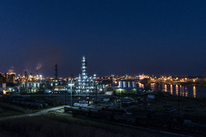
Estuaries of Texas facts for kids
Texas has many special places where rivers meet the sea. These areas are called estuaries. An estuary is a coastal body of water where freshwater from rivers mixes with saltwater from the ocean. Most of Texas's estuaries are protected from the open Gulf of Mexico by long, narrow strips of land called barrier islands.
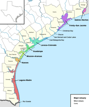
Texas has seven major estuaries and five smaller ones. They stretch all along the coast, from the Rio Grande in the south to the Sabine River near Louisiana. Each estuary is usually named after the main rivers that flow into it. Some, like Laguna Madre and East Matagorda Bay, don't have big rivers feeding them. These estuaries are super important for both nature and people in Texas. They are home to many animals and plants, and they help support industries like fishing and tourism. Many are also protected areas, like National Wildlife Refuges and state parks.
Contents
What Are Estuaries?
Estuaries are like nature's mixing bowls! They are where freshwater from rivers and streams meets saltwater from the ocean. This mix creates a unique environment. The Texas coast has 21 river systems that flow into the Gulf of Mexico, forming these special watery areas.
Most of the big estuaries in Texas are sheltered bays, protected by barrier islands. Some smaller estuaries are just the lower parts of rivers that flow straight into the Gulf. The Texas coastline has changed a lot over thousands of years due to changes in sea level. The barrier islands we see today formed between 5,000 and 8,000 years ago. Texas estuaries are full of life, supporting many different kinds of plants and animals. They also help the state's economy by supporting fishing and tourism. Plus, they act like natural filters for water and help protect the shoreline.
Laguna Madre Estuary
The Laguna Madre Estuary is found along the southern Texas coast. It stretches almost to the border with Mexico. This estuary is a long, shallow lagoon. It doesn't have any major rivers flowing into it. Padre Island and Brazos Island separate it from the Gulf of Mexico.
Laguna Madre is the second largest Texas estuary. It's about 130 miles (209 km) long and 4 to 6 miles (6.4 to 9.7 km) wide. It covers a huge area of about 280,910 acres (113,670 ha). A 20-mile (32 km) stretch of sand flats, called the Saltillo Flats, divides the lagoon into two parts. The water here is usually very salty because not much freshwater flows in, and a lot of water evaporates.
Not many people live right on the shores of Laguna Madre. The main towns are Port Isabel, Port Mansfield, and South Padre Island. Fishing and tourism are big industries here. Many parts of the lagoon are protected, like the Laguna Atascosa National Wildlife Refuge and Padre Island National Seashore.
Nueces Estuary
The Nueces Estuary is located in the Texas Coastal Bend area, right next to the city of Corpus Christi. The Nueces River and Oso Creek feed this estuary. Mustang Island separates it from the Gulf of Mexico.
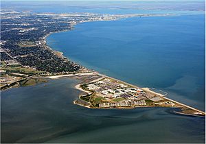
This estuary is the sixth largest in Texas, covering about 106,990 acres (43,300 ha). It includes Corpus Christi Bay and its smaller bays, Nueces Bay and Oso Bay. The natural parts of the bay can be up to 13 feet (4.0 m) deep. Smaller towns around the bay include Portland and Ingleside.
Corpus Christi Bay is a natural deep-water harbor. This means big ships can easily come and go. The Port of Corpus Christi is very important for the area's growth. Other important activities include shipping, tourism, and fishing. The Nueces Estuary is recognized as an important estuary for the whole country.
Mission–Aransas Estuary
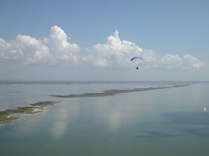
The Mission–Aransas Estuary is also on the Texas Coastal Bend. The Mission and Aransas Rivers flow into it. San José Island separates it from the Gulf of Mexico. It connects to the Gulf through Aransas Pass and Cedar Bayou.
This estuary is the fifth largest in Texas, covering about 111,780 acres (45,230 ha). It includes Aransas Bay and other bays like Redfish Bay, Copano Bay, and Saint Charles Bay. The natural parts of the bay are usually about 5.5 feet (1.7 m) deep.
The towns around this estuary are small, including Aransas Pass, Port Aransas, and Rockport. Today, fishing and tourism are the main ways people make a living here. The Mission–Aransas Estuary is home to a special research reserve, the only one of its kind in Texas. It's also a very important place for the endangered whooping crane, which spends its winters here.
Guadalupe Estuary
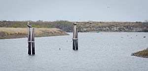
The Guadalupe Estuary is located in the middle part of the Texas coast. The Guadalupe River flows into it. Matagorda Island separates it from the Gulf of Mexico.
This estuary is the fourth largest in Texas, covering about 143,000 acres (57,870 ha). It includes San Antonio Bay and its nearby bays, Mesquite Bay and Espiritu Santo Bay. The natural parts of the bay are quite shallow, averaging about 2.5 feet (0.76 m) deep.
This estuary is pretty remote, meaning it's hard for ships to get to. There are very few people living on its shores, with only small towns like Seadrift and Austwell. Important activities in this area include oyster farming and fish processing. A large part of the southwestern shore and Matagorda Island are protected within the Aransas National Wildlife Refuge.
Colorado–Lavaca Estuary
The Colorado–Lavaca Estuary is on the upper-middle Texas coast. The Colorado, Lavaca, and Tres Palacios Rivers flow into it. The Matagorda Peninsula separates it from the Gulf of Mexico. It connects to the Gulf through the Matagorda Ship Channel and Pass Cavallo.
This estuary is the third largest in Texas, covering about 244,490 acres (98,940 ha). It includes Matagorda Bay and its extensions like Lavaca Bay. The natural parts of the bay range from 6 to 13 feet (1.8 to 4.0 m) deep.
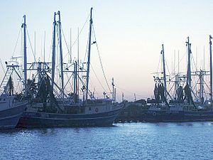
The towns around this estuary are small, including Port Lavaca, Palacios, and Port O'Connor. Matagorda Bay is a major hub for commercial fishing, especially for shrimp. The Port of Port Lavaca is a big part of the local economy. Tourism is also important here. This bay was also the site of a failed French colony led by La Salle. One of his ships, La Belle, was found and explored here in the 1990s.
Trinity–San Jacinto Estuary
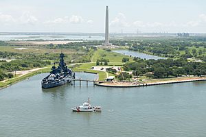
The Trinity–San Jacinto Estuary is on the northeastern Texas coast, right next to the city of Houston. It's formed where the Trinity and San Jacinto Rivers meet. Galveston Island and Bolivar Peninsula separate it from the Gulf of Mexico. It connects to the Gulf through several passes like Bolivar Roads.
This is the largest estuary in Texas, covering about 345,280 acres (139,730 ha). It includes Galveston Bay and its extensions like East Bay, Trinity Bay, and West Bay. The natural parts of the estuary are usually 6 to 10 feet (1.8 to 3.0 m) deep.
This estuary is surrounded by the large Greater Houston area. Its shores are busy with cities and industries. Other important towns here include Baytown, Texas City, and Galveston. This estuary is a major shipping center, home to the Houston Ship Channel. The Port of Houston is one of the busiest ports in the world. Many industries are located along the western shore. This estuary also supports Texas's largest commercial fishery. Parts of the northeastern shore are protected within the Anahuac National Wildlife Refuge. You can also visit the museum ship USS Texas here, right next to the San Jacinto Monument.
Sabine–Neches Estuary
The Sabine–Neches Estuary is located right on the border with Louisiana, near the city of Port Arthur. It's mostly an enclosed lake, formed by the Neches and Sabine Rivers. It connects to the Gulf of Mexico through Sabine Pass.
This is the smallest of the seven major estuaries, covering about 45,320 acres (18,340 ha). Because it's smaller and gets a lot of freshwater, it's the least salty of the major estuaries. The natural parts of the estuary are usually up to 10 feet (3.0 m) deep.
The Sabine–Neches Estuary is a very important waterway for industry. The three ports it connects to the Gulf of Mexico (Port Arthur, Beaumont, and Orange) are a major hub for shipping and industries that use oil and gas. This area is sometimes called the "Golden Triangle of Texas" because of its economic importance. Besides shipping, farming is also a big part of the local economy, especially growing rice and soybeans, raising livestock, and fishing for shellfish.
Minor Estuaries
Texas also has five smaller estuaries mixed in with the big ones. These are not as large or complex, and they don't play as big a role in the state's water systems or economy. Some of these are simply the lower parts of rivers that are affected by the tides, flowing directly into the Gulf without barrier islands.
Rio Grande Estuary
The Rio Grande Estuary is located right on the Texas–Mexico border. It's south of Laguna Madre, at the very southern tip of the Texas coast. This estuary is just the lower part of the Rio Grande river, with no big bay connected to it.
East Matagorda Bay Estuary
East Matagorda Bay is a smaller estuary located on the upper-middle Texas coast, just northeast of the big Matagorda Bay. It doesn't have any major rivers flowing into it. The Matagorda Peninsula separates it from the Gulf of Mexico. It only connects to the Gulf sometimes through a small opening called Brown Cedar Cut. This estuary covers about 37,810 acres (15,300 ha) and is about 3.4 feet (1.0 m) deep on average.
San Bernard River and Cedar Lakes Estuary
The San Bernard River and Cedar Lakes Estuary is one of three smaller estuaries located on the upper-middle Texas coast, between Matagorda Bay and Galveston Bay. It includes Cedar Lakes, Cowtrap Lake, and the lower parts of the San Bernard River. It covers about 3,760 acres (1,520 ha) and is about 2.1 feet (0.64 m) deep on average.
Brazos River Estuary
The Brazos River Estuary is another small estuary on the upper-middle Texas coast, also between Matagorda Bay and Galveston Bay. It's just the lower part of the Brazos River, with no large bay connected to it.
Christmas Bay Estuary
Christmas Bay is a small estuary located on the upper-middle Texas coast, just southwest of the big Galveston Bay. Bastrop Bayou flows into it. Follet's Island separates it from the Gulf of Mexico. It connects to the Gulf through San Luis Pass and Cold Pass. Its smaller parts include Bastrop Bay and Drum Bay. This estuary covers about 4,173 acres (1,689 ha). Much of its shoreline is protected within the Brazoria National Wildlife Refuge.
 | Stephanie Wilson |
 | Charles Bolden |
 | Ronald McNair |
 | Frederick D. Gregory |


