
Kincardineshire facts for kids
Quick facts for kids
Kincardineshire
A' Mhaoirne
|
|
|---|---|
 |
|
| Country | Scotland |
| County town | Stonehaven |
| Area | |
| • Total | 380 sq mi (984 km2) |
| Ranked 22nd of 34 | |
| Chapman code |
KCD
|
| Website | https://www.kincardineshirelieutenancy.co.uk/ |
Kincardineshire or the County of Kincardine is a historic area in northeast Scotland. It is also known as the Mearns. This name comes from the Scottish Gaelic words A' Mhaoirne, which means "the Stewartry."
Kincardineshire is located on the coast. It shares borders with Aberdeenshire to the north and west, and with Angus to the south. Today, the name "Kincardine" is still used in Kincardine and Mearns, which is a part of the Aberdeenshire Council area. This modern area is smaller than the historic county.
Contents
History of Kincardineshire
.PNG)
Long ago, this area was known as the Province of Mearns. It was bordered by Marr to the north and Angus to the west. The name Mearns simply meant it was an area managed by a "steward" (Maer). More important areas were managed by a "great steward" (Mormaer).
The area included towns like Stonehaven, Banchory, Inverbervie, and Laurencekirk. Other smaller places were Drumoak, Muchalls, Newtonhill, and Portlethen. The Mearns used to reach north of the River Dee to the Hill of Fare. However, in 1891, the town of Torry (which was south of the Dee) became part of Aberdeenshire.
Around the 11th century, officials called sheriffs were introduced. They had authority over the area from the town of Kincardine. This Kincardine was not Kincardine O'Neil or Kincardine-on-Forth. It was a town that disappeared during the Middle Ages. All that remains is the ruin of Kincardine Castle, located near Fettercairn.
In 1296, King John Balliol surrendered to Edward I of England from Kincardine Castle. This event marked the start of the Wars of Scottish Independence. Later, in 1600, the Scottish Parliament decided that the sheriff's work for Kincardineshire should be done at the Stonehaven Tolbooth.
In the mid-1800s, local government changed. The old provinces were replaced by new "Counties" or "shires," which followed the sheriff's areas. This is how Mearns became Kincardineshire. In 1890, the Local Government (Scotland) Act 1889 created county councils across Scotland. The Kincardineshire County Council met at the County Buildings in Stonehaven.
Kincardineshire lost its administrative role in 1975. The northern part, Nigg, joined the City of Aberdeen. The rest became part of the Kincardine and Deeside district within the Grampian region. In 1996, the Grampian region was divided into new council areas. Kincardine and Deeside then became part of the Aberdeenshire council area.
Geography


Kincardineshire is roughly shaped like a triangle. It has a mostly flat area called Strathmore near the coast. Further inland, the country becomes hillier and more forested. These hills are part of the Grampian Mountains. The highest point in the area is Mount Battock, which is 778 meters (2,552 feet) tall. It sits on the border with Angus.
Rivers
Several rivers flow through Kincardineshire. These include Cowie Water, Carron Water, Luther Water, Burn of Muchalls, Burn of Pheppie, Burn of Elsick, Burn of Monboys, Bervie Water, and the lower parts of the River Dee.
Structures and Sites to Explore
Kincardineshire is home to many interesting places, including:
- Allardice Castle
- Cowie Castle (ruins)
- Catterline
- Dunnottar Castle
- Fetteresso Castle
- Fowlsheugh Nature Reserve
- Lewis Grassic Gibbon Centre, Arbuthnott
- Muchalls Castle
- Portlethen Moss
- Stonehaven Tolbooth
- Ury House
Coat of Arms
The county's coat of arms tells a story about its history. It shows the Honours of Scotland (the Scottish crown jewels). These important items were kept safe at Dunnottar Castle and later at Kinneff, both within Kincardineshire, during the Wars of the Three Kingdoms.
The coat of arms features a red background. On it, you can see the Sceptre and Sword of Scotland crossed over each other. Above them is the Crown of Scotland, and below is a ruined castle on a hill, all in gold. The motto is LAUS DEO, which is Latin for "Praise God." This motto originally belonged to the Viscount of Arbuthnott, whose family home is in the county.
Representing Kincardineshire
From 1708 to 1918, Kincardineshire had its own representative in the House of Commons (part of the UK Parliament). This area included most of the county, but not the town of Inverbervie. Inverbervie was part of other groups of towns that sent representatives.
In 1918, the Kincardineshire area was combined with part of Aberdeenshire to form a new area called Kincardine and Western Aberdeenshire. Then, in 1950, this area was split again. Kincardineshire became part of the North Angus and Mearns area. This new area covered all of Kincardineshire, including Inverbervie, and part of Angus.
In 1983, new areas were created, and North Angus and Mearns was replaced. Today, Kincardineshire is part of the West Aberdeenshire and Kincardine area in the House of Commons.
Transport and Travel
Railways

The main railway line connecting Edinburgh and Aberdeen runs along the coast of Kincardineshire. It passes through towns like Laurencekirk, Stonehaven, and Portlethen.
Historic Routes
The Causey Mounth was an ancient road built on high ground. This was the only way to travel from coastal areas south of Aberdeen to the city in medieval times. It connected the Bridge of Dee to places like Muchalls Castle and Cowie Castle. In 1639, a large army used this route during the Bishops' Wars.
Another old path is the Elsick Mounth. This prehistoric trackway was used by the ancient Caledonian tribes. The Roman army also used it when they marched north into the Scottish Highlands.
Towns and Villages
- Altens
- Arbuthnott
- Auchenblae
- Balnagask
- Banchory
- Bridge of Muchalls
- Cammachmore
- Catterline
- Chapelton of Elsick
- Cookney
- Cove Bay
- Crawton
- Downies
- Drumlithie
- Edzell Woods
- Fettercairn
- Findon
- Fordoun
- Glenbervie
- Gourdon
- Inverbervie
- Johnshaven
- Kincorth
- Kinneff
- Kirkton of Durris
- Laurencekirk
- Luthermuir
- Maryculter
- Marykirk
- Muchalls
- Netherley
- Newtonhill
- Nigg
- Old Portlethen
- Portlethen
- St Cyrus
- Stonehaven
- Tewel
- Torry
- Tullos
Images for kids
-
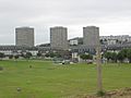
Balnagask
-
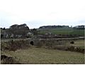
Bridge of Muchalls
-
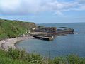
Catterline
-
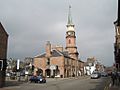
Stonehaven


Notable People from Kincardineshire
One famous person from this area is the author Lewis Grassic Gibbon. His real name was James Leslie Mitchell. His book Sunset Song is one of the most well-known Scottish novels of the 20th century. In 2005, it was voted Scotland's favorite book! The story is set in a made-up village in the Mearns and is inspired by Mitchell's own childhood in Arbuthnott. He used a mix of local Doric Scots and standard English in his writing, making it easy for everyone to enjoy.
Other notable people connected to Kincardineshire include:
- Richard Henry Brunton, born in Kincardine
- Cosmo Innes born in Durris Castle
- Hercules Linton (1837–1900), born in Inverbervie, who designed the famous ship Cutty Sark
- James Murdoch, born in Stonehaven
- James Taylor (tea planter) born on the Monboddo estate, Laurencekirk
- Robert William Thomson born in Stonehaven
- See also Category:People from Kincardine and Mearns
