
Vance County, North Carolina facts for kids
Quick facts for kids
Vance County
|
|||
|---|---|---|---|
_03_(cropped).jpg)
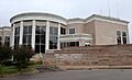
Vance County Courthouse
|
|||
|
|||

Location within the U.S. state of North Carolina
|
|||
 North Carolina's location within the U.S. |
|||
| Country | |||
| State | |||
| Founded | 1881 | ||
| Named for | Zebulon Baird Vance | ||
| Seat | Henderson | ||
| Largest community | Henderson | ||
| Area | |||
| • Total | 268.69 sq mi (695.9 km2) | ||
| • Land | 252.40 sq mi (653.7 km2) | ||
| • Water | 16.29 sq mi (42.2 km2) 6.06% | ||
| Population
(2020)
|
|||
| • Total | 42,578 | ||
| • Estimate
(2023)
|
42,301 | ||
| • Density | 168.69/sq mi (65.13/km2) | ||
| Time zone | UTC−5 (Eastern) | ||
| • Summer (DST) | UTC−4 (EDT) | ||
| Congressional district | 1st | ||


Vance County is a county in North Carolina, a state in the United States. In 2020, about 42,578 people lived here. The main town and county seat is Henderson.
Vance County is part of the Henderson, NC Micropolitan Area. This area is also included in the larger Raleigh-Durham-Cary, NC Combined Statistical Area. This bigger area had about 2.3 million people in 2023.
Contents
History of Vance County
The first people to live in the area that is now Vance County were the Occaneechi Native Americans. The first European explorer, John Lederer, visited with a Native American guide in 1670.
This land was first part of the Virginia colony. But in 1665, King Charles of England changed the borders. So, the area became part of the Province of Carolina. Later, in 1725, it became part of the Province of North Carolina.
In 1826, the Bingham School was built in Williamsborough, North Carolina. It was the first military training school in the area. Captain D. H. Bingham started it to train military officers.
A hotel called the "Glass House" opened near Kittrell in 1871. It was famous for its glass porches. Hunters and people needing to recover from illnesses often stayed there. The hotel burned down in 1895.
Vance County was officially created in 1881. It was formed from parts of Franklin, Granville, and Warren counties. The county is named after Zebulon Baird Vance. He was a Governor of North Carolina and a U.S. Senator.
The creation of Vance County was a political decision. In 1881, many African Americans voted for the Republican Party. By combining areas with many Republican voters into one new county, the Democratic Party hoped to keep control in other counties. Senator Vance, a Democrat, was happy to have the new county named after him. He jokingly called Vance County "Zeb's Black Baby."
In 1890, over 63% of Vance County's population was African American. Later, in 1894, a group of Populists and Republicans elected George Henry White, an African American, to the U.S. Congress. They also gained control of the state government. To prevent this from happening again, North Carolina lawmakers passed new laws. These laws made it harder for many African Americans to vote. This situation continued until the Voting Rights Act of 1965 was passed.
Geography of Vance County
Vance County covers about 268.69 square miles. Most of this is land (252.40 square miles). The rest is water (16.29 square miles), which is about 6% of the total area.

Protected Natural Areas
- Kerr Lake State Recreation Area (part of it)
- Vance Game Land
Main Water Bodies
Vance County has several important creeks and a large lake:
- Buffalo Creek
- Fishing Creek
- Flat Creek
- Island Creek Reservoir
- John H. Kerr Reservoir
- Little Nutbush Creek
- Martin Creek
- Nutbush Creek
- Roanoke River
- Ruin Creek
- Sandy Creek
- Tabbs Creek
- Tar River
Neighboring Counties
Vance County shares borders with these counties:
- Mecklenburg County, Virginia – to the north
- Warren County – to the east
- Franklin County – to the south
- Granville County – to the west
Major Roads
These are the main highways that run through Vance County:
 I-85
I-85 US 1
US 1
US 1 Bus. US 158

US 158 Bus. NC 39
NC 39
People of Vance County
| Historical population | |||
|---|---|---|---|
| Census | Pop. | %± | |
| 1890 | 17,581 | — | |
| 1900 | 16,684 | −5.1% | |
| 1910 | 19,425 | 16.4% | |
| 1920 | 22,799 | 17.4% | |
| 1930 | 27,294 | 19.7% | |
| 1940 | 29,961 | 9.8% | |
| 1950 | 32,101 | 7.1% | |
| 1960 | 32,002 | −0.3% | |
| 1970 | 32,691 | 2.2% | |
| 1980 | 36,748 | 12.4% | |
| 1990 | 38,892 | 5.8% | |
| 2000 | 42,954 | 10.4% | |
| 2010 | 45,422 | 5.7% | |
| 2020 | 42,578 | −6.3% | |
| 2023 (est.) | 42,301 | −6.9% | |
| U.S. Decennial Census 1790–1960 1900–1990 1990–2000 2010 2020 |
|||
When Vance County was formed in 1881, about 9,000 people lived there. From the 1930s to the 1970s, the population grew slowly. Many African Americans moved to northern states for better jobs. This was part of the Great Migration. Because of this, the county's large African-American majority changed. Today, the number of white and black residents is almost equal.
Population Changes (2010/2020)
The table below shows the different groups of people living in Vance County.
| Race / Ethnicity (NH = Non-Hispanic) | Pop 2000 | Pop 2010 | Pop 2020 | % 2010 | % 2010 | % 2020 |
|---|---|---|---|---|---|---|
| White alone (NH) | 19,894 | 19,101 | 16,243 | 46.31% | 42.05% | 38.15% |
| Black or African American alone (NH) | 20,604 | 22,477 | 21,081 | 47.97% | 49.48% | 49.51% |
| Native American or Alaska Native alone (NH) | 76 | 79 | 91 | 0.18% | 0.17% | 0.21% |
| Asian alone (NH) | 163 | 199 | 284 | 0.38% | 0.44% | 0.67% |
| Pacific Islander alone (NH) | 9 | 7 | 9 | 0.02% | 0.02% | 0.02% |
| Other race alone (NH) | 19 | 41 | 110 | 0.04% | 0.09% | 0.26% |
| Mixed race or Multiracial (NH) | 232 | 467 | 1,043 | 0.54% | 1.03% | 2.45% |
| Hispanic or Latino (any race) | 1,957 | 3,051 | 3,717 | 4.56% | 6.72% | 8.73% |
| Total | 42,954 | 45,422 | 42,578 | 100.00% | 100.00% | 100.00% |
In 2020, Vance County had 42,578 people. There were 16,875 households and 11,163 families living in the county.
Education in Vance County
Vance County has several schools and colleges:
- Vance County Schools (public schools)
- Henderson Collegiate (a public charter school that opened in 2010)
- Vance Charter School
- Kerr-Vance Academy (founded in 1968)
- Crossroads Christian School
- Victory Christian Academy
- Vance-Granville Community College (a college for higher education)
Historical Schools
Some schools from the past include:
- Henderson Male Academy (for white students only)
- Henderson Female Academy (for white students only)
- Kittrell College: This school was first for black males. It opened in 1787. It closed and reopened a few times before closing permanently in 1975.
- Middleburg Male Academy (also called Middleburg School, for white students only)
- Townesville School (for white students only)
- West End School
Communities in Vance County

City
- Henderson: This is the largest community and the county seat. It was first settled in the early 1700s.
Towns
- Kittrell: Founded in 1885.
- Middleburg: Formerly known as Middleburgh.
Townships
North Carolina counties are divided into smaller areas called townships. These are used for local administration. Vance County has these townships:
- Dabney
- Henderson
- Kittrell
- Middleburg
- Sandy Creek
- Townsville
- Watkins
- Williamsboro
Census-Designated Place
Unincorporated Communities
These are smaller communities that are not officially towns or cities:
- Adcock Crossroads
- Bullocksville
- Drewry
- Faulkner Crossroads
- Flint Hill
- Floytan Crossroads
- Gill
- Greenway
- Harris Crossroads
- Hicks Crossroads
- Knotts Crossroads
- Mobile
- Weldons Mill
- West End
- Vicksboro
Former Communities
Some communities in Vance County no longer exist or have changed names:
- Bearpond
- Bobbitt
- Brookston
- Carlton
- Cokesbury
- Dabney
- Epsom
- Gillburg
- Greystone
- Steedsville
- Townsville
- Tungsten
- Watkins
- Williamsboro
- Woodworths
Notable People from Vance County
- Henry P. Cheatham (1857–1935): An African American who was elected to the U.S. Congress.
- Ben E. King (1938–2015): A famous singer and musician.
Images for kids
-
Vance County Courthouse
-
Seal of Vance County
-

Flag of Vance County
See also
 In Spanish: Condado de Vance para niños
