
Villefranche-de-Rouergue facts for kids
Quick facts for kids
Villefranche-de-Rouergue
|
||
|---|---|---|
|
Subprefecture and commune
|
||

Villefranche from St-Jean d'Aigremont
|
||
|
||

Villefranche-de-Rouergue
Location in France

Villefranche-de-Rouergue
Location in Occitanie
|
||
| Country | France | |
| Region | Occitanie | |
| Department | Aveyron | |
| Arrondissement | Villefranche-de-Rouergue | |
| Canton | Villefranche-de-Rouergue | |
| Intercommunality | Le Grand Villefranchois | |
| Area
1
|
45.85 km2 (17.70 sq mi) | |
| Population
(2014)
|
11,822 | |
| • Density | 257.84/km2 (667.80/sq mi) | |
| Demonym(s) | Villefranchois | |
| Time zone | UTC+01:00 (CET) | |
| • Summer (DST) | UTC+02:00 (CEST) | |
| INSEE/Postal code |
12300 /12200
|
|
| Elevation | 237–544 m (778–1,785 ft) (avg. 391 m or 1,283 ft) |
|
| Website | www.villefranchederouergue.fr | |
| 1 French Land Register data, which excludes lakes, ponds, glaciers > 1 km2 (0.386 sq mi or 247 acres) and river estuaries. | ||
.svg)
Villefranche-de-Rouergue (which is Vilafranca de Roergue in the local Occitan language) is a town in southern France. It is located in the Aveyron department, which is part of the Occitanie region. This town is the main city, or sous-prefecture, of its own area called an arrondissement.
Contents
History of Villefranche-de-Rouergue
In the year 1252, a powerful leader named Alphonse de Poitiers, who was the Count of Toulouse, decided to build a new city. He sent Jean d'Arcis, who was a high-ranking official called a Seneschal (like a governor), to create this city.
The new city was built along the Aveyron River. It was meant to be the new capital for an old French region known as Rouergue. This new city was named Villefranche-de-Rouergue. From 1369 until the French Revolution, Villefranche-de-Rouergue served as the capital of Rouergue.
Geography and Landscape
Villefranche-de-Rouergue is found in the valley of the Aveyron River. This area is where two different types of land meet. On one side are the Causses, which are limestone plateaus (flat areas of high land). On the other side is the Ségala region, known for its different kind of soil.
Natural Resources
The area around Villefranche-de-Rouergue is rich in natural resources. There are mines where people have found valuable metals. These include copper, lead, tin, iron, and silver.
Rivers and Altitude
The Alzou River flows into the Aveyron River right in the city. The Alzou joins the Aveyron from the right side.
The town of Villefranche-de-Rouergue covers an area of about 45.9 square kilometers (about 17.7 square miles). The average height of the city above sea level is 391 meters (about 1,283 feet). At the city hall, the height is 323 meters (about 1,060 feet).

Surrounding Towns
Villefranche-de-Rouergue is surrounded by several other towns. These include Saint-Rémy, Maleville, La Bastide-l'Évêque, Morlhon-le-Haut, Sanvensa, La Rouquette, Savignac, and Toulonjac.
 |
Toulonjac | Saint-Rémy | Maleville | |
| Savignac | La Bastide-l'Évêque | |||
| La Rouquette | Sanvensa | Morlhon-le-Haut |
Local Climate
The climate in Villefranche-de-Rouergue is classified as Cfb. This means it has an Oceanic climate with mild summers.
Population Information
People who live in Villefranche-de-Rouergue are called Villefranchois (for men) and Villefranchoises (for women) in French.
The town has a population of 11,822 people. This means there are about 258 inhabitants for every square kilometer (about 668 inhabitants per square mile).
The population of Villefranche-de-Rouergue has changed over the years:
- In 1968, there were 10,709 people.
- By 1975, the population grew to 12,284.
- It reached its highest point in 1982 with 12,693 people.
- The population then slightly decreased to 12,291 in 1990 and 11,919 in 1999.
- In 2006, it was 12,040, and by 2014, it was 11,822.
Villefranche-de-Rouergue and the nearby town of Toulonjac together form an urban area. In 2013, this urban area had 12,644 people and covered 53.1 square kilometers (about 20.5 square miles). This urban area is also the center of a larger metropolitan area. This bigger area includes 16 towns and has a population of 20,180 people, covering 357.8 square kilometers (about 138.1 square miles).
Town Administration
Villefranche-de-Rouergue is a subprefecture of the Aveyron department. This means it is an important administrative center. It is the capital of its own arrondissement (a type of district) and the main town of the canton (a smaller administrative area). In 2014, this canton had 13,282 inhabitants.
The town is also part of a group of towns that work together, called Le Grand Villefranchois. This is known in French as Communauté de communes du Grand Villefranchois.
Sister Cities
Villefranche-de-Rouergue has special friendships with other cities around the world. These are called sister cities:
 Bihać, in Bosnia and Herzegovina
 Pula, in Croatia
 Sarzana, in Italy
Gallery
-
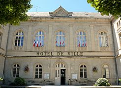
City Hall
-
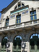
Municipal theatre
-
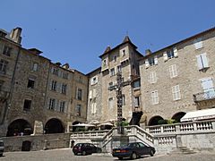
Notre-Dame square
-
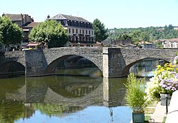
Pont des Consuls or Pont-Vieux (Old Bridge)


Related pages
See also
 In Spanish: Villefranche-de-Rouergue para niños
