
Wabash County, Illinois facts for kids
Quick facts for kids
Wabash County
|
|
|---|---|

Wabash County Courthouse in Mount Carmel
|
|

Location within the U.S. state of Illinois
|
|
 Illinois's location within the U.S. |
|
| Country | |
| State | |
| Founded | 1824 |
| Named for | Wabash River |
| Seat | Mount Carmel |
| Largest city | Mount Carmel |
| Area | |
| • Total | 228 sq mi (590 km2) |
| • Land | 223 sq mi (580 km2) |
| • Water | 4.3 sq mi (11 km2) 1.9% |
| Population
(2020)
|
|
| • Total | 11,361 |
| • Estimate
(2021)
|
11,202 |
| • Density | 49.83/sq mi (19.24/km2) |
| Time zone | UTC−6 (Central) |
| • Summer (DST) | UTC−5 (CDT) |
| Congressional district | 12th |

Wabash County is a county in the U.S. state of Illinois. In 2020, about 11,361 people lived there. Its main town, or county seat, is Mount Carmel. The county is in southern Illinois, in an area sometimes called "Little Egypt".
Contents
History of Wabash County
Wabash County was created in 1824. It was formed from parts of Edwards County. At first, there was a disagreement about where the county seat should be. This led to a small conflict between the towns of Albion and Mount Carmel. Mount Carmel became the county seat.
The county gets its name from the Wabash River. This river forms its eastern and southern borders. The name "Wabash" comes from the French word "Ouabache." The French traders got this name from the Miami Indian word "Wabashike." This word means "pure white." This is because much of the river's bottom is made of white limestone.
-
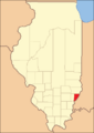
Wabash County when it was first created in 1824

A special part of the county is the Forest of the Wabash. It is found in Beall Woods State Park. This forest is a 329 acres (1.33 km2) piece of the original Eastern Woodlands ecosystem. It shows what the area looked like a long time ago.
In the 1920s, a famous hotel called the Grand Rapids Hotel was in Wabash County. It was near the Grand Rapids Dam on the Wabash River. People from all over the United States visited this hotel. It was open for nine years.
The 2008 Earthquake
On April 18, 2008, a large earthquake happened in Illinois. It struck at 4:37 AM. The center of the earthquake was in Lick Prairie Township, right in the middle of Wabash County. People felt the shaking very far away, even more than 400 miles away in Nebraska.
Geography of Wabash County

Wabash County covers about 228 square miles (590 km2) in total. Most of this area, 223 square miles (580 km2), is land. The rest, about 4.3 square miles (11 km2), is water. It is the fifth-smallest county in Illinois by size.
The Wabash River is on the east side of the county. The Bonpas Creek is on the west. These two waterways meet at the southern tip of the county. Bonpas Creek also separates Wabash County from Edwards County.
Climate and Weather
| Weather chart for Mount Carmel, Illinois | |||||||||||||||||||||||||||||||||||||||||||||||
|---|---|---|---|---|---|---|---|---|---|---|---|---|---|---|---|---|---|---|---|---|---|---|---|---|---|---|---|---|---|---|---|---|---|---|---|---|---|---|---|---|---|---|---|---|---|---|---|
| J | F | M | A | M | J | J | A | S | O | N | D | ||||||||||||||||||||||||||||||||||||
|
2.9
38
21
|
2.7
44
25
|
4.2
54
35
|
4.2
66
44
|
5.1
76
54
|
3.7
85
63
|
4.2
89
67
|
3.6
87
65
|
2.8
81
57
|
3
70
45
|
4.2
55
36
|
3.1
43
25
|
||||||||||||||||||||||||||||||||||||
| temperatures in °F precipitation totals in inches source: The Weather Channel |
|||||||||||||||||||||||||||||||||||||||||||||||
|
Metric conversion
|
|||||||||||||||||||||||||||||||||||||||||||||||
In Mount Carmel, the county seat, temperatures change throughout the year. In January, the average low is 21 °F (−6 °C). In July, the average high is 89 °F (32 °C). The coldest temperature ever recorded was −19 °F (−28 °C) in January 1985. The hottest was 102 °F (39 °C) in July 1988.
The amount of rain and snow also changes. February usually gets about 2.73 inches (69 mm) of precipitation. May gets the most, with about 5.12 inches (130 mm).
Transportation
- Rides Mass Transit District
Main Roads
 Illinois Route 1
 Illinois Route 15
Neighboring Counties
- Lawrence County - to the north
- Knox County, Indiana - to the northeast
- Gibson County, Indiana - to the south and mostly east
- Edwards County - to the west
- Richland County - to the northwest
Population of Wabash County
| Historical population | |||
|---|---|---|---|
| Census | Pop. | %± | |
| 1830 | 2,710 | — | |
| 1840 | 4,240 | 56.5% | |
| 1850 | 4,690 | 10.6% | |
| 1860 | 7,313 | 55.9% | |
| 1870 | 8,841 | 20.9% | |
| 1880 | 9,945 | 12.5% | |
| 1890 | 11,866 | 19.3% | |
| 1900 | 12,583 | 6.0% | |
| 1910 | 14,913 | 18.5% | |
| 1920 | 14,034 | −5.9% | |
| 1930 | 13,197 | −6.0% | |
| 1940 | 13,724 | 4.0% | |
| 1950 | 14,651 | 6.8% | |
| 1960 | 14,047 | −4.1% | |
| 1970 | 12,841 | −8.6% | |
| 1980 | 13,713 | 6.8% | |
| 1990 | 13,111 | −4.4% | |
| 2000 | 12,937 | −1.3% | |
| 2010 | 11,947 | −7.7% | |
| 2020 | 11,361 | −4.9% | |
| 2023 (est.) | 10,942 | −8.4% | |
| U.S. Decennial Census 1790-1960 1900-1990 1990-2000 2010-2013 |
|||
In 2010, there were 11,947 people living in Wabash County. Most people (96.9%) were white. About 0.6% were black or African American, and 0.6% were Asian. People of Hispanic or Latino origin made up 1.3% of the population.
Many people in the county have German (25.6%), English (12.3%), American (11.7%), or Irish (8.4%) family backgrounds.
The average age of people in the county was 42 years old. About 29% of households had children under 18 living with them.
Towns and Villages
Cities
- Mount Carmel (This is the county seat)
Villages
Small Communities (Unincorporated)
Precincts
Wabash County uses the term "precinct" instead of "township." There are 17 counties in Illinois that do this.

- Bellmont (Bellmont)
- Coffee (Keensburg)
- Compton (East Grayville)
- Friendsville (Friendsville)
- Lancaster (Lancaster)
- Lick Prairie (Lick Prairie)
- Mount Carmel (Mount Carmel)
- Wabash (Allendale)
You can find more information about Wabash County precincts and their borders here.
Education in Wabash County
The county has several school districts:
- Allendale Community Consolidated School District 17
- Edwards County Community Unit School District 1
- Grayville Community Unit School District 1
- Wabash Community Unit School District 348
See also
 In Spanish: Condado de Wabash (Illinois) para niños
