
Washington Island (Wisconsin) facts for kids

Washington Island
Location in Wisconsin

Washington Island
Location in the United States
|
|
| Geography | |
|---|---|
| Location | Door County, Wisconsin |
| Coordinates | 45°22′37″N 86°53′47″W / 45.376991°N 86.896362°W |
| Area | 23.51 sq mi (60.9 km2) |
| Length | 6 mi (10 km) |
| Width | 5 mi (8 km) |
| Highest elevation | 705 ft (214.9 m) |
| Administration | |
| State | Wisconsin |
| County | Door County |
| Town | Washington Island |
| Demographics | |
| Population | 708 (2010) |

Washington Island is a cool island in Lake Michigan, located in the state of Wisconsin. It's about 7 miles (11 km) northeast of the tip of the Door Peninsula. This island is part of Door County, Wisconsin.
About 708 people live on Washington Island all year round, based on the 2010 census. The island covers about 23.51 square miles (60.9 km²). It makes up most of the land area and all the people of the town of Washington. The small community of Detroit Harbor is also on the island.
Washington Island is the biggest in a group of islands. This group includes Plum, Detroit, Hog, Pilot, Fish, and Rock Islands. All these islands together form the Town of Washington. The Detroit Harbor bay is on the island's south side. A big part of Washington Island's economy, or how it makes money, comes from tourism.
The island is about 5 miles (8 km) wide and 6 miles (10 km) long. Washington Island and the Door Peninsula create a tricky waterway. This waterway connects Green Bay to the rest of Lake Michigan. Long ago, French explorers called this area Porte des Morts, which means "Door of the Dead" or "Death's Door." This name came from the many shipwrecks found there. It's also how Door County and the Door Peninsula got their names!
Contents
Island History
Washington Island is one of many islands that stretch across the entrance of Green Bay. These islands are actually part of the Niagara Escarpment, a long cliff formation. The island's oldest known name was "Wassekiganeso." This Ojibwa name means "his breast is shining." It likely referred to the sun's sparkle off the island's limestone cliffs.
Early Names of the Islands
The first written records and maps from the French explorers didn't name each island separately. Instead, they called them all a group. The names changed depending on which Native American group was living on the islands at the time. After 1650, the most common name was the Potawatomi Islands. The Potawatomi people likely first came to the southern islands around 1641. The French often used a shorter version of the tribe's name, calling them l'Isle des Poux.
Before 1800, other names were used too. Some records called them the Huron Islands. Others called them the Noquet Islands, named after a small group of Ojibwa people. A traveler named Jonathan Carver simply called them the Islands of the Grand Traverse.
How Washington Island Got Its Name
In July 1816, a military leader named Col. John Miller was heading to a new fort. His fleet of ships, including a large schooner named Washington, sailed from Mackinac. The Washington anchored in what is now Washington Harbor to wait for the other ships.
While waiting, the crew explored the island. The officers thought their ship was the first to anchor there. So, they named the harbor after their ship, Washington, to honor President Washington. They also started naming other islands after important people in their group. For example, the largest island was named Millers Island after Col. John Miller. Today, Chambers Island still keeps its original name. Other islands, like Keans Island and Fallons Island, are now called Rock and Detroit Islands.
Not everyone knew or used these new names right away. For many years, maps still showed names like Potawatomi and Louse Islands. Sometimes, Potawatomi was used for the main island, and sometimes for what is now Rock Island. When a lighthouse was built on Rock Island, it was called Potawatomi Light, and it still is today.
Settlers began to arrive on Washington Island in the 1830s. Many of these early settlers were from Iceland and Ireland. They often called the whole island by the name of their harbor, "Washington Harbor." By the 1850 census, the name "Washington Island" appeared. After that, the older names like Potawatomi Islands slowly stopped being used.
Most of the people who settled on the island were immigrants from Scandinavia, especially Icelanders. Today, Washington Island is one of the oldest Icelandic communities in the United States. It's also one of the largest Icelandic communities outside of Iceland itself.
Island Culture
As mentioned, many people who settled on Washington Island were Scandinavian immigrants, especially from Iceland. Because of this, Washington Island is one of the oldest and largest Icelandic communities in the United States.
Local Traditions
There's a unique tradition on the island involving Angostura Bitters. During a time called Prohibition, when alcohol was banned, the owner of Nelsen's Hall (a bar) found a way around the rules. He served shots of Angostura Bitters. Because of this, taking shots of bitters became a local tradition. In fact, people on Washington Island drink more bitters than anyone else in the world!
Famous Visitors
From 1896 to 1926, a famous economist named Thorstein Veblen spent his summers on Washington Island. He had a study cabin there. On the island, he learned Icelandic. This helped him write articles for an Icelandic newspaper. He also translated an old Icelandic story called the Laxdæla saga into English.
In 1914, Washington Island was the setting for a children's book. The novel was written by Harry Lincoln Sayler using the pen name "Gordon Stuart."
Modern Day Island Life
Washington Island is home to the Midwest region's largest lavender farm. They even have a special festival for it every other summer. The island has two town parks, one county park, and two town beaches. There's also a public boat ramp and three State Natural Areas.
The Sievers School of Fiber Arts, a fine arts school, is also located on the island. You can still find one commercial fisherman working on the island today.
Island Climate
| Climate data for Washington Island | |||||||||||||
|---|---|---|---|---|---|---|---|---|---|---|---|---|---|
| Month | Jan | Feb | Mar | Apr | May | Jun | Jul | Aug | Sep | Oct | Nov | Dec | Year |
| Record high °F (°C) | 48.9 (9.4) |
52.0 (11.1) |
71.1 (21.7) |
77.0 (25.0) |
87.1 (30.6) |
91.9 (33.3) |
93.9 (34.4) |
98.1 (36.7) |
93.9 (34.4) |
84.0 (28.9) |
71.1 (21.7) |
57.9 (14.4) |
98.1 (36.7) |
| Mean daily maximum °F (°C) | 25.9 (−3.4) |
28 (−2) |
36.9 (2.7) |
48.7 (9.3) |
59.9 (15.5) |
69.6 (20.9) |
76.3 (24.6) |
75.4 (24.1) |
67.3 (19.6) |
55.8 (13.2) |
42.6 (5.9) |
31.1 (−0.5) |
51.5 (10.8) |
| Daily mean °F (°C) | 18.7 (−7.4) |
20.1 (−6.6) |
28.8 (−1.8) |
39.9 (4.4) |
50.0 (10.0) |
59.9 (15.5) |
66.7 (19.3) |
66.4 (19.1) |
58.8 (14.9) |
48.4 (9.1) |
36.3 (2.4) |
25.2 (−3.8) |
43.3 (6.3) |
| Mean daily minimum °F (°C) | 11.1 (−11.6) |
11.8 (−11.2) |
20.5 (−6.4) |
31.1 (−0.5) |
40.1 (4.5) |
50.2 (10.1) |
57.0 (13.9) |
57.2 (14.0) |
50.4 (10.2) |
40.8 (4.9) |
30.4 (−0.9) |
19.2 (−7.1) |
35.0 (1.7) |
| Record low °F (°C) | −27.0 (−32.8) |
−26.0 (−32.2) |
−26.0 (−32.2) |
1.9 (−16.7) |
19.9 (−6.7) |
24.1 (−4.4) |
35.1 (1.7) |
32.0 (0.0) |
26.1 (−3.3) |
18.0 (−7.8) |
1.0 (−17.2) |
−20.9 (−29.4) |
−27.0 (−32.8) |
| Average precipitation inches (mm) | 1.4 (36) |
0.9 (24) |
1.6 (40) |
2.4 (61) |
3.0 (75) |
3.2 (81) |
3.1 (78) |
3.2 (82) |
3.2 (82) |
2.6 (67) |
2.3 (59) |
1.5 (37) |
28.4 (721) |
| Average snowfall inches (cm) | 13.2 (33.5) |
9.6 (24.4) |
8.0 (20.3) |
2.8 (7.1) |
0.2 (0.5) |
0.0 (0.0) |
0.0 (0.0) |
0.0 (0.0) |
0.0 (0.0) |
0.1 (0.2) |
3.0 (7.6) |
10.5 (26.7) |
47.4 (120.4) |
| Average precipitation days | 7.7 | 5.5 | 6.5 | 8.3 | 9.0 | 9.2 | 8.9 | 9.0 | 9.6 | 8.2 | 9.1 | 8.2 | 99.3 |
| Source: Weatherbase | |||||||||||||
Getting to Washington Island
You can reach Washington Island by taking one of two ferry routes.
Ferry Routes
- From Northport Pier: One way is a 30-minute ferry ride from the Door Peninsula to Detroit Harbor on the island. This ferry carries cars, freight, and passengers. It leaves daily from the Northport Pier, which is at the end of Wisconsin Highway 42.
- From Gills Rock: The second way is a passenger-only ferry. It leaves from the community of Gills Rock and takes about 20 minutes. This trip can also include a fun narrated train tour when you arrive on Washington Island.
Island Airport
The Washington Island Airport is also on the island. It's a small public airport with two grass runways.
-
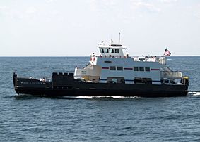
Arni J. Richter car ferry
-
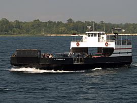
Eyrarbakki car ferry.
-
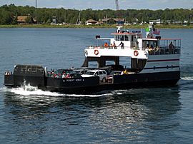
Robert Noble car ferry
-
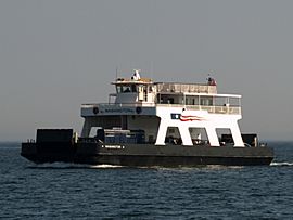
Washington car ferry
-
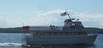
Island Clipper passenger ferry


More Island Pictures
-
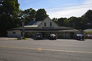
Nelsen's Hall
-
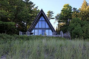
Building at Sand Dunes Park
-
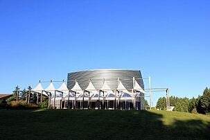
Performing Arts Center
-
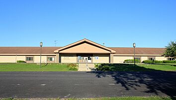
School
-
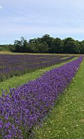
Lavender in July
-
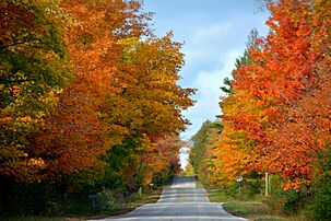
Fall color, October 20


