West Siberian Plain facts for kids
Quick facts for kids West Siberian Plain |
|
|---|---|
| Западно-Сибирская равнина | |
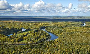
View of the Vasyugan River
|
|
| Location | Russia Kazakhstan |
| Coordinates | 62°00′N 76°00′E / 62.000°N 76.000°E |
| Part of | Siberia |
| Length | 2,500 kilometers (1,600 mi) |
| Width | 1,500 kilometers (930 mi) |
| Area | 2,600,000 km2 (1,000,000 sq mi) |
| Geology | Plain |
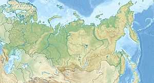
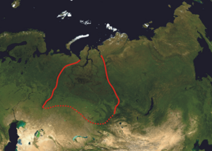
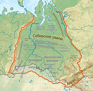
The West Siberian Plain is a huge flat area of land in western Siberia. It sits between the Ural Mountains in the west and the Yenisei River in the east. To the southeast, you'll find the Altai Mountains.
A lot of this plain is very wet. It has some of the world's biggest swamps and areas that often flood. Important cities in this region include Novosibirsk, Omsk, and Tomsk.
Winters here are very cold and last a long time. The climate is either subarctic (like near the Arctic) or continental (with big differences between summer and winter). The plain also has huge amounts of petroleum (oil) and natural gas hidden underground. Much of Russia's oil and gas came from this area in the 1970s and 80s.
Contents
What is the West Siberian Plain?
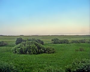
The West Siberian Plain is mostly in Russia, east of the Ural Mountains. It is known as the world's largest unbroken lowland. This means more than half of it is less than 100 meters (about 328 feet) above sea level.
The plain covers a massive area, about 2.6 to 2.7 million square kilometers. This is roughly one-third of all of Siberia! It stretches for about 2,500 kilometers (1,550 miles) from north to south. At its widest, in the south, it is about 1,500 kilometers (930 miles) across.
Rivers and Water
Many important rivers flow through the West Siberian Plain. These include the Ob River, Irtysh River, Nadym River, Pur River, and Taz River. The mighty Yenisei River flows from south to north, all the way to the Arctic Ocean. It is about 3,530 kilometers (2,190 miles) long.
The Yenisei River valley helps divide the West Siberian Plain from the Central Siberian Plateau. Because the plain is so flat, it has many lakes and swamps. Large parts of it get flooded every spring when the snow melts.
The Siberian Uvaly is a low, hilly area that crosses the plain from east to west. There are also some low hills and ridges formed by ancient glaciers. The Ob Plateau in the south is one example.
Farming Areas
Even though much of the plain is wet, some parts are great for farming. The Ishim Plain and the Baraba Lowland in the south are important agricultural areas. There are also salt lakes in the Kulunda Plain, which stretches into Kazakhstan.
Swamps and Peatlands
The West Siberian Plain is very swampy. Its soils are often made of peat, which is partly decayed plant material. It is one of the biggest areas of peatlands in the world. These areas have many "raised bogs," which are like spongy hills of peat.
The Vasyugan Swamp is one of the largest raised bogs on Earth. It covers an enormous area of about 51,600 square kilometers (19,900 square miles). That's bigger than some countries!
Plants and Animals
The plain has eight different types of plant regions. These range from cold tundra in the north to steppe (grasslands) in the south.
- Tundra: Cold, treeless plains with mosses and lichens.
- Forest-tundra: A mix of tundra and sparse forests.
- Taiga: Dense forests of conifer trees (like pine and spruce). This is further divided into northern, middle, and southern taiga.
- Sub-taiga forest: A transition zone between taiga and forest-steppe.
- Forest-steppe: Areas with patches of forest mixed with grasslands.
- Steppe: Large, treeless grasslands.
The number of animal species changes depending on the region. The tundra has fewer types of animals (at least 107 species). The forest-steppe region in the south has many more, with 278 or more different species. In the very south, where the ground doesn't stay frozen, there used to be rich grasslands. These were an extension of the Kazakh Steppe, but most of them have been used for farming.
How the Plain Formed
The West Siberian Plain is incredibly flat. It is mostly made of alluvium, which is sand, silt, and clay carried and deposited by rivers. This material has built up over millions of years, starting about 65 million years ago.
Imagine how flat it is: if the sea level rose by just 50 meters (about 164 feet), all the land between the Arctic Ocean and the Ob-Irtysh rivers would be underwater!
Many of the deposits on this plain came from "ice dams." These were huge blocks of ice that blocked the flow of the Ob and Yenisei rivers. This caused the rivers to reverse direction and flow into the Caspian Sea (and maybe the Aral Sea) instead of the Arctic Ocean. Over time, these redirected rivers deposited a lot of sediment, helping to create the flat plain we see today.
See also
 In Spanish: Llanura de Siberia Occidental para niños
- East European Plain, another major plain in Russia
- Eurasian steppe
- South Siberian Mountains
- West Siberian petroleum basin
 | John T. Biggers |
 | Thomas Blackshear |
 | Mark Bradford |
 | Beverly Buchanan |


