Altai Mountains facts for kids
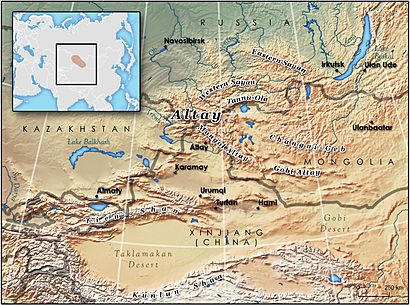
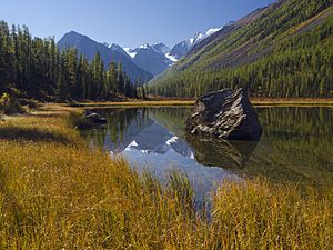
The Altai Mountains, also called Altay Mountains, are a huge mountain range in Central Asia. They are found where Russia, China, Mongolia, and Kazakhstan meet. Important rivers like the Irtysh and Ob start here. These mountains connect with the Sayan Mountains in the northeast. They slowly get lower in the southeast, joining the high Gobi Desert plateau. The Altai Mountains stretch across a large area, from about 45° to 52° North and 84° to 99° East.
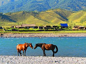
Many different groups of people live in this region. These include Russians, Kazakhs, Altais, Tuvans, Mongols, and Volga Germans. Most of the people are indigenous ethnic minorities who live a semi-nomadic life. This means they move with their animals. The local economy relies on raising animals like cattle, sheep, and horses. People also do hunting, farming, logging, and mining.
ᠨᠢᠷᠤᠭᠤ
Contents
What's in a Name?
The name Altai comes from an old word meaning "gold" or "golden." For example, in Old Turkic, the word for gold was altun. This golden name fits the mountains well!
People in different countries call these mountains by various names:
- In Khalkha Mongolian, they are Altain nuruu (Алтайн нуруу).
- In Altay, they are Altay tuular (Алтай туулар).
- In Kazakh, they are Altaı taýlary (Altaı taýlary).
- In Russian, they are Altajskije gory (Алтайские горы).
- In Chinese, they are ā'ěrtài shānmài (阿尔泰山脉).
Exploring the Geography
The Altai Mountains are a huge system of mountains in central Asia. They cover an area of 845,000 km2 (326,000 sq mi). These mountains stretch for 2,525 km (1,569 mi) from the northwest to the southeast.
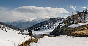
In the northern part of the region are the Sailughem Mountains. These mountains have an average height of 1,500–1,750 m (4,920–5,740 ft). The line where snow stays all year (the snow-line) is around 2,000 m (6,600 ft) on the north side. It is about 2,400 m (7,900 ft) on the south side. Above this line, the rugged peaks rise even higher. Crossing these mountains is tough, with only a few difficult mountain passes.
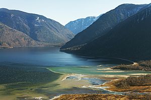
This area has many large lakes. Some of these include Uvs (720 m (2,360 ft) above sea level) and Khar (1,170 m (3,840 ft)). Several other mountain ranges also cross this region.
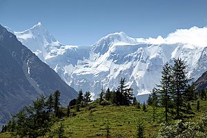
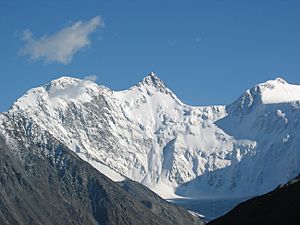
The highest peak in the Altai Mountains is Belukha. It has two tops, reaching 4,506 m (14,783 ft) and 4,400 m (14,400 ft). Many glaciers start from Belukha. The local people call it Kadyn Bazhy or Uch-Sumer. The second highest peak is Khüiten Peak in Mongolia, which is 4,374 m (14,350 ft) tall.
Rivers and Valleys
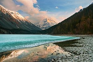
The Katun River starts as a wild gorge on the side of Belukha mountain. This river is 600 km (370 mi) long. It flows through a wide valley before joining the Biya River. Together, the Katun and Biya rivers form the mighty Ob River.
Another important valley is the Charysh valley. It is very fertile and offers beautiful views. One special spot is the deep Kolyvan Lake, surrounded by amazing granite domes.
Further west, the valleys of the Uba, Ulba, and Bukhtarma rivers lead towards the Irtysh River. The Bukhtarma valley is 320 km (200 mi) long. It starts near Belukha and has stunning changes in landscape and plants. Its upper parts have many glaciers. The Berel glacier, which comes from Belukha, is well-known.
In the 18th century, parts of the Bukhtarma valley were settled by Russian peasants. They were looking for new homes and religious freedom. Later, in 1869, this area became part of Russia.
The Altai highlands continue north into the Kuznetsk district. The Abakan River also flows through this region. The Ek-tagh, or Mongolian Altai, is a border range. It separates the Khovd basin from the Irtysh basin. This range has steep cliffs on one side and gentler slopes on the other. Nomadic Kyrgyz people mainly live on these slopes.
Highest Peaks
Here are the five highest mountains in the Altai range:
- Belukha Mountain (Russia), 4,506 m (14,783 ft)
- Khüiten Peak (Mongolia), 4,374 m (14,350 ft)
- Mönkhkhairkhan Mountain (Mongolia), 4,204 m (13,793 ft)
- Sutai Mountain (Mongolia), 4,220 m (13,850 ft)
- Tsambagarav Mountain (Mongolia), 4,195 m (13,763 ft)
Amazing Animals of the Altai
The Altai Mountains are home to many different animals. This is because the region has various habitats, like grassy plains (steppes), northern forests (taigas), and high mountain areas.
Mountain Dwellers
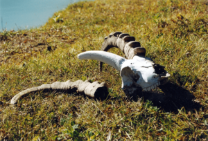
On the steep slopes, you can find the Siberian ibex. The rare argali, a type of wild sheep, lives on gentler slopes. Five types of deer live here:
Moose and reindeer mostly live in the northern parts of the mountains. Wild boars are found in the lower hills.
Predators and Other Wildlife
Large predators in the Altai include snow leopards, wolves, Eurasian lynx, and brown bears. The wolverine also lives in the northern areas. The Tien Shan dhole, a type of wild dog, used to live here too. Many of the animal species in this region originally came from Mongolia. The western Siberian eagle-owl can be seen in the western mountains.
Long ago, the Caspian tiger lived in the southern Altai Mountains. It was found near Lake Zaisan and the Black Irtysh. This tiger is closely related to the Amur tiger we know today.
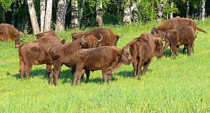
The wisent, a type of European bison, also lived in the Altai until the Middle Ages. Today, a small herd lives in a special nursery in the Altai Republic. You can also find Moor frogs near water bodies high up in the mountains.
A Look Back in Time
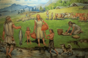
The Altai Mountains have had a very stable climate since the last ice age. This means the mix of animals has stayed mostly the same. It's one of the few places on Earth that still has animals from the ice age, except for extinct ones like mammoths.
Ancient Humans
The Altai Mountains were home to a group of ancient humans called Denisovans. They lived at the same time as Neanderthals and Homo sapiens (modern humans). In 2008, scientists found a Denisovan bone in the Denisova Cave in the Altai Mountains. This bone was about 40,000 years old. DNA from the Denisovans has been very well preserved in the cold caves. What's amazing is that Neanderthal bones and tools made by Homo sapiens have also been found in the same cave. This makes it the only place where all three groups of ancient humans are known to have lived!
Scientists also found the remains of a dog-like animal from 33,000 years ago in the Razboinichya Cave. DNA tests showed it was more like modern dogs than wolves.

Early Cultures
The Afanasievans were some of the first herders in East Asia. They helped start the long tradition of raising animals in Mongolia. Later, other groups like the Andronovo culture arrived. Many remains of Eastern Scythians have been found in the Altai Mountains. These remains are very well preserved, even showing skin and hair.
The Altai Mountains might also be where a big cultural change began during the Bronze Age. This event, called the Seima-Turbino Phenomenon, led to many people moving across Europe and Asia.
Empires and Skiing
Over time, the Altai region was part of several large empires. These included the Xiongnu Empire, the First Turkic Khaganate, and the Uyghur Empire. During these times, the local people adopted the culture and languages of the Turkic groups.
Some historians think that skiing might have started in the Altai Mountains. Cave paintings in the Altai show people on skis chasing animals. A study in 2016 suggested these paintings could be 4,000 to 5,250 years old. This might make them as old as, or even older than, ancient skiing finds in Scandinavia. The oldest known written record about skiing is from a Chinese text from the Western Han dynasty (206 BC to 24 AD). It also talks about skiers in the Altai Mountains.
A Special Place: World Heritage Site
A huge area of 16,178 km2 (6,246 sq mi) in the Altai Mountains is a World Heritage Site. This means it's a very special place recognized by UNESCO (United Nations Educational, Scientific and Cultural Organization). This protected area is called the Golden Mountains of Altai. It includes the Altai and Katun Natural Reserves, Lake Teletskoye, Mount Belukha, and the Ukok Plateau.
UNESCO chose this site because it has a complete range of plant life zones in central Siberia. You can find everything from steppes (grassy plains) to forests and high alpine plants. The Russian Altai is also important for protecting endangered animals. These include the Snow leopard, Altai argali, and Siberian ibex. The Uvs Nuur basin is another protected area nearby.
Concerns have been raised about protecting these animals, highlighting the importance of following conservation rules.
Earth's Movements: Geology
The Altai Mountains are in a region where the Earth's plates are still moving. This is because the Indian plate is slowly pushing into the Asian plate. Many fault lines run through the area. These are cracks in the Earth's crust where rocks move. Some of these faults are still active, meaning they can cause earthquakes. The rocks in the mountains are mostly granite and metamorphic schist.
A geologist named Victor R. Baker discovered signs of huge floods in the Altai Mountains in the past. These floods came from a massive glacial lake, even bigger than what was once thought to be the largest ice-dammed lake in the world.
Earthquakes in the Altai
While big earthquakes are not very common here, a large one happened on September 27, 2003. It measured 7.3 on the Moment magnitude scale. This earthquake and its smaller aftershocks caused a lot of damage in the Chuya Basin area. It even destroyed the village of Beltir.
See Also
 In Spanish: Macizo de Altái para niños
- Altai Republic
- Altai Krai
- Altay Prefecture
- Govi-Altai Province
- Altaic languages
- Altay language
- Altai-Sayan region
- List of Altai mountains
 | Charles R. Drew |
 | Benjamin Banneker |
 | Jane C. Wright |
 | Roger Arliner Young |


