Woonasquatucket River facts for kids
Quick facts for kids Woonasquatucket River |
|
|---|---|
| Country | United States |
| State | Rhode Island |
| County | Providence |
| Physical characteristics | |
| Main source | North Smithfield, Rhode Island |
| River mouth | Providence River 41°49′36″N 71°24′36″W / 41.8267°N 71.4100°W |
| Length | 15.8 mi (25.4 km) |
| Basin features | |
| Basin size | 130 km2 (50 sq mi) |
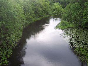
The Woonasquatucket River is a river in the U.S. state of Rhode Island. Its name comes from an Algonquian word meaning "where the salt water ends." This river is about 15.8 miles (25.4 km) long. It drains an area of about 130 square kilometers (50 square miles). This area is called a watershed, which means all the land where water flows into this river.
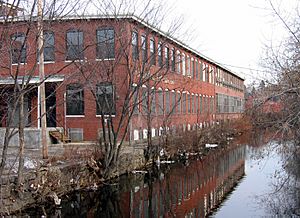
In 1998, the Woonasquatucket River was named an American Heritage River. It shares this special title with the Blackstone River nearby. Both rivers were very important during the Industrial Revolution in the 1800s. This was a time when many factories were built. You can still see signs of this history today. There are 18 dams along the river, which were used to power the old factories.
Contents
Where the River Flows
The Woonasquatucket River begins in the swampy areas west of Primrose Pond in North Smithfield. It then flows southeast, passing Primrose Pond and going into Stillwater Reservoir.
After the reservoir, the river continues its journey southeast. It feeds many smaller ponds along the way. Eventually, it flows under the Providence Place mall. In downtown Providence, it meets the Moshassuck River in front of the One Citizens Plaza building. Together, they form the Providence River.
River Changes in Providence
The lower part of the river, especially below the Rising Sun Dam in Olneyville, is tidal. This means its water level changes with the ocean tides.
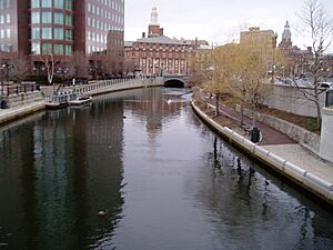
East of Interstate 95, the river's original path has changed. It now flows through a channel made by people. This channel goes under the Providence Place Mall and through Waterplace Park. In Waterplace Park, the Woonasquatucket River is even used for the famous WaterFire art event.
River History
The Woonasquatucket River was a very important travel route for Native American tribes. It helped connect different groups of the Algonquian nation to the Providence River and the Atlantic Ocean.
A place now called Federal Hill in Providence was a key meeting spot along the river. Here, tribes like the Narragansett and Wampanoag gathered. This spot was known as Nocabulabet. It was likely a place for trading and harvest festivals. Some people think it was also used to watch for other tribes coming from Narragansett Bay.
Smaller Streams that Join the River
Many smaller streams and brooks flow into the Woonasquatucket River. These are called tributaries. They add water to the main river.
Here are some of the named streams that join the Woonasquatucket:
- Latham Brook
- Stillwater River
- Harris Brook
- Hawkins Brook
- Assapumpset Brook
 | Roy Wilkins |
 | John Lewis |
 | Linda Carol Brown |


