
Yankton County, South Dakota facts for kids
Quick facts for kids
Yankton County
|
|
|---|---|
_from_E_1.JPG)
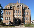
Scottish Rite Masonic Center in Yankton.
|
|

Location within the U.S. state of South Dakota
|
|
 South Dakota's location within the U.S. |
|
| Country | |
| State | |
| Founded | April 10, 1862 |
| Named for | Yankton Sioux |
| Seat | Yankton |
| Largest city | Yankton |
| Area | |
| • Total | 532 sq mi (1,380 km2) |
| • Land | 521 sq mi (1,350 km2) |
| • Water | 11 sq mi (30 km2) 2.1% |
| Population
(2020)
|
|
| • Total | 23,310 |
| • Estimate
(2023)
|
23,517 |
| • Density | 43.82/sq mi (16.917/km2) |
| Time zone | UTC−6 (Central) |
| • Summer (DST) | UTC−5 (CDT) |
| Congressional district | At-large |

Yankton County is a county located in the state of South Dakota in the United States. It's a great place with a mix of nature and communities. In 2020, about 23,310 people lived here. This makes it the 9th largest county in South Dakota by population. The main town and county seat is Yankton. Yankton County is also part of the Yankton Micropolitan Statistical Area, which means it's a smaller city area with close ties to nearby communities.
Contents
Exploring Yankton County's Geography


Yankton County is located in the southern part of South Dakota. Its southern border touches the state of Nebraska, with the Missouri River flowing between them. The Missouri River travels eastward along the county's southern edge. Another important river, the James River, flows through the western-central part of the county. It joins the Missouri River near the middle of the county's southern border.
The land in Yankton County has rolling hills, with many small creeks and lakes. Much of the area is used for farming. The land generally slopes down towards the south and east. The highest point in the county is about 1,473 feet (449 meters) above sea level. This high point is found on the eastern part of its northern border. The county covers a total area of 532 square miles. About 521 square miles of this is land, and 11 square miles (2.1%) is water.
Lewis and Clark Lake is a very popular spot for tourists and fun activities. You can find it in the southwestern part of the county.
Main Roads in Yankton County
These are the major highways that help people travel through Yankton County:
 U.S. Highway 81
 South Dakota Highway 46
 South Dakota Highway 50
 South Dakota Highway 52
 South Dakota Highway 153
 South Dakota Highway 314
Airports in the Area
- Chan Gurney Municipal Airport
Neighboring Counties
Yankton County shares its borders with several other counties:
- Turner County - to the northeast
- Clay County - to the east
- Cedar County, Nebraska - to the southeast
- Knox County, Nebraska - to the southwest
- Bon Homme County - to the west
- Hutchinson County - to the northwest
Protected Natural Areas
Yankton County has several special areas set aside for nature and recreation:
- Chief White Crane State Recreation Area
- Dakota Territorial Capitol Building/Riverside Park
- Diede Waterfowl Production Area
- Edelman Waterfowl Production Area
- Gavins Point National Fish Hatchery
- Hansen Waterfowl Production Area
- Lewis & Clark State Recreation Area
- Missouri National Recreational River (part)
- Pierson Ranch State Recreation Area
Lakes and Reservoirs
Here are some of the lakes and water bodies you can find in Yankton County:
- Beaver Lake
- Guthmiller Lake
- Lake Yankton
- Lewis and Clark Lake (part)
- Marindahl Lake
Population and People of Yankton County
| Historical population | |||
|---|---|---|---|
| Census | Pop. | %± | |
| 1870 | 2,097 | — | |
| 1880 | 8,390 | 300.1% | |
| 1890 | 10,414 | 24.1% | |
| 1900 | 12,649 | 21.5% | |
| 1910 | 13,135 | 3.8% | |
| 1920 | 15,233 | 16.0% | |
| 1930 | 16,589 | 8.9% | |
| 1940 | 16,725 | 0.8% | |
| 1950 | 16,804 | 0.5% | |
| 1960 | 17,551 | 4.4% | |
| 1970 | 19,039 | 8.5% | |
| 1980 | 18,952 | −0.5% | |
| 1990 | 19,252 | 1.6% | |
| 2000 | 21,652 | 12.5% | |
| 2010 | 22,438 | 3.6% | |
| 2020 | 23,310 | 3.9% | |
| 2023 (est.) | 23,517 | 4.8% | |
| U.S. Decennial Census 1790-1960 1900-1990 1990-2000 2010-2020 |
|||
What the 2020 Census Showed
The 2020 census counted 23,310 people living in Yankton County. There were 9,435 households and 5,693 families. On average, there were about 44.7 people per square mile. The county also had 10,372 housing units.
What the 2010 Census Showed
In the 2010 census, there were 22,438 people in the county. There were 8,770 households and 5,476 families. The population density was about 43.1 people per square mile. There were 9,652 housing units.
Most people in the county were white (92.8%). There were also American Indian (2.5%), Black or African American (1.5%), and Asian (0.5%) residents. About 2.7% of the population was of Hispanic or Latino origin.
About 29.2% of households had children under 18 living with them. The average household had 2.30 people, and the average family had 2.90 people. The average age of people in the county was 41.3 years old.
The average income for a household was $47,124. For families, the average income was $62,070. About 11.2% of the population lived below the poverty line. This included 10.7% of those under 18 and 13.5% of those 65 or older.
Communities in Yankton County
Yankton County is home to several cities, towns, and other communities.
Cities
- Irene (part of this city is in Yankton County)
- Yankton (This is the main town, also called the county seat)
Towns
Census-Designated Place
- Jamesville Colony (This is a special type of community defined by the census)
Townships
These are smaller local government areas within the county:
- Gayville
- Jamesville
- Marindahl
- Mayfield
- Mission Hill
- Turkey Valley
- Utica
- Volin
- Walshtown
Unorganized Territories
These are areas that are not part of a city or township:
- Southeast Yankton
- West Yankton
Fun Things to Do: Recreation and Tourism
Lewis and Clark Lake is a big attraction in southwestern Yankton County. It's about 4 miles (6 km) west of Yankton. This area is super popular for tourists and for having fun outdoors! You'll find parks, walking trails, campgrounds, places to launch boats, and marinas.
Gavins Point Dam, which creates Lewis & Clark Lake, is a favorite spot for fishing on the Missouri River. The South Dakota Department of Game, Fish, and Parks manages the Lewis & Clark State Recreation Area on the north side of the lake.
Below Gavins Point Dam, you'll find the Missouri National Recreational River. This part of the "Big Muddy" (as the Missouri River is sometimes called) is special because it hasn't been changed by human-made channels. It's a great place for watching birds, hunting, canoeing, and kayaking.
Images for kids
-
Scottish Rite Masonic Center in Yankton.
See also
 In Spanish: Condado de Yankton para niños
