2004–2008 volcanic activity of Mount St. Helens facts for kids
Quick facts for kids 2004–2008 volcanic activity of Mount St. Helens |
|
|---|---|
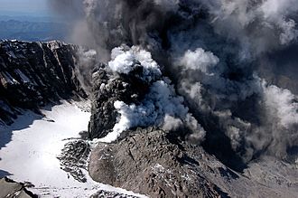
Mount St. Helens sent a plume of volcanic ash and steam to 10,000 feet (3,000 m) above sea level in its October 1, 2004 eruption.
|
|
| Volcano | Mount St. Helens |
| Location | Skamania County, Washington, U.S. 46°11′45″N 122°11′20″W / 46.19583°N 122.18889°W |
| VEI | 2 |
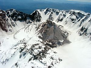
From 2004 to 2008, Mount St. Helens in Washington, United States, was very active. It had a continuous eruption where new magma slowly pushed out. This activity built a new lava dome inside the volcano's crater. This new dome did not grow taller than the edge of the crater that was formed during the big 1980 eruption of Mount St. Helens.
Contents
Mount St. Helens Awakens: 2004 Activity
In September 2004, Mount St. Helens started to rumble. On September 23, around 2:00 a.m. PDT, many small earthquakes happened. About 200 quakes, all less than magnitude 1, occurred deep below the volcano.
Earthquake Swarm and Warnings
The earthquakes kept increasing. By September 26, the U.S. Geological Survey (USGS) and the Pacific Northwest Seismograph Network issued a "notice of volcanic unrest." This meant a dangerous event was possible. The U.S. Forest Service then closed the mountain to climbers. They also closed some trails because of the risk of debris flows. These flows could happen if the Crater Glacier melted.
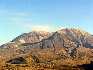
The earthquakes grew stronger, reaching magnitude 2.5. By September 29, they were happening about four times a minute. The USGS raised the "alert level" to the second of three levels. They warned that a steam explosion or eruption from the lava dome was likely soon. Scientists thought this event would be small and only affect the area near the mountain. However, the earthquakes continued to get stronger, with the largest reaching magnitude 3.3.
First Eruptions and Ash Plumes
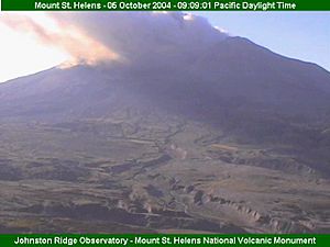
At 12:02 p.m. PDT on October 1, 2004, the mountain erupted. It sent a plume of steam and volcanic ash about 9,700 feet (about 3 kilometers) into the air. This came from a vent in the Crater Glacier. The ash cloud drifted south, reaching Vancouver, Washington, and Wood Village, Oregon. It left a thin layer of black ash on cars.
Mount St. Helens released another steam plume the next day at 12:14 p.m. PDT. This one was even stronger. After the steam, a low-frequency harmonic tremor began. This made seismologists raise the "alert level" to the highest level. This meant there was a potential danger to people and property. Because of this, the Johnston Ridge Observatory was evacuated. Tourists moved to safer spots several miles away.
On October 3, more low-frequency harmonic tremors started around 3:00 a.m. PDT. They lasted for about 90 minutes. This might have meant that magma was moving deep inside the mountain. A steam release followed this at around 10:40 a.m.
The volcano kept erupting steam in the following days. Steam releases happened on October 4 and again on the morning of October 5. The October 5 eruption sent an ash plume that dusted towns like Randle, Morton, and Packwood, Washington. These towns are about 30 miles (48 km) from the volcano. Between these steam releases, strong earthquakes continued, some near magnitude 3.0.
On October 6, the U.S. Geological Survey announced that the alert level was lowered. They said an eruption was no longer expected in minutes or hours.
New Lava Dome Forms
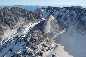
Around October 11, magma reached the surface of the volcano. This led to the growth of a new lava dome on the south side of the existing dome. The dome continued to grow. By early November 2004, the USGS reported that magma was pushing out at a rate of 7 to 10 cubic meters per second. If this rate continued, the crater would be full in about eleven years. The Mount St. Helens VolcanoCam at Johnston Ridge could even show the new dome glowing at night.
Part of the new dome was a feature called the "Whaleback." It looked like the back of a whale. This was a lava spine, a long piece of hardened magma pushed up by pressure from below. The Whaleback was very hot but also fragile. Its edges crumbled quickly, creating loose rock around the new dome. The crumbling and growth rates soon matched, so the Whaleback stayed about the same size.
Mount St. Helens in 2005
By February 1, 2005, the new lava dome on Mount St. Helens was 7,642 feet (2,329 m) high. This was 1,363 feet (415 m) above the 1980 crater floor. It was about 2,000 feet (610 m) above the Glacier and 721 feet (220 m) below the volcano's highest point. The Whaleback was about 1,550 feet (470 m) long and 500 feet (150 m) wide. The new dome was about 1,700 feet (520 m) across. It contained about 50 million cubic yards (40 million cubic meters) of material.
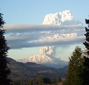
Mount St. Helens had more activity on March 8, 2005, around 5:30 p.m. PST. A huge plume of steam and ash, 36,000-foot (11 km) high, shot from the volcano. This was with a tremor of about magnitude 2.5. The plume was seen from Seattle, Washington, to Salem, Oregon. It only lasted about 20–30 minutes. Ash fell in Yakima, Washington, and nearby areas. Scientists thought this was a small release of pressure, normal for dome building. It was likely caused by a small part of the lava dome collapsing. There were no more earthquakes before this event.
By May 5, 2005, the new dome's highest point was 7,675 feet (2,339 m). This was 688 feet (210 m) below the volcano's highest point. It held about 58 million cubic yards (45 million cubic meters) of material. The new dome kept growing steadily. Small earthquakes continued every few minutes. The Whaleback slowly broke apart but kept being pushed up as new hardened lava came from below.
On July 2, 2005, the top of the Whaleback broke off. This caused a rockfall that sent ash and dust hundreds of meters into the air.
Mount St. Helens in 2006
After the dome and Whaleback collapsed, a new feature called the "slab" began to grow. This large, cooled volcanic rock was about the size of a football field. It was forced upward as fast as 6 feet (2 m) per day. However, the top part of the slab often collapsed each day due to its own weight.
On July 21, 2006, the crater rim was reopened for hikers.
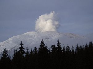
On December 19, 2006, an eruption sent a steam plume over Washington.
Mount St. Helens in 2008
After a fairly quiet 2007, Mount St. Helens showed activity again on January 16, 2008. A USGS geologist saw steam coming from the lava dome. At the same time, a magnitude 2.9 earthquake was recorded. This was followed by a small tremor lasting almost ninety minutes, and another magnitude 2.7 earthquake. But by the end of January, the lava dome stopped growing. On July 10, 2008, after five months of no activity, it was officially announced that the eruption that started in 2004 had ended.
 | William Lucy |
 | Charles Hayes |
 | Cleveland Robinson |


