Angus facts for kids
Quick facts for kids
Angus
Aonghas |
|||
|---|---|---|---|
|
|||

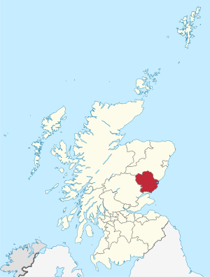
Angus within Scotland
|
|||
| Admin HQ | Forfar | ||
| Government | |||
| • Body | Angus Council | ||
| Area | |||
| • Total | 842 sq mi (2,182 km2) | ||
| Population
(2020)
|
|||
| • Total | 116,040 | ||
| • Density | 137.74/sq mi (53.181/km2) | ||
| ONS code | S12000041 | ||
| ISO 3166 code | GB-ANS | ||
Angus (in Scottish Gaelic: Aonghas) is one of the 32 local government areas in Scotland. It's also a registration county and a lieutenancy area. Angus shares its borders with Aberdeenshire, Dundee City, and Perth and Kinross.
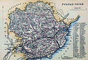
Historically, Angus was known as Forfarshire from the 1700s until 1928. It's famous for its rich history, from ancient times to the signing of the Declaration of Arbroath in 1320. This important document helped establish Scotland as an independent nation. Today, main industries in Angus include agriculture (farming) and fishing. A big global company, GSK, also has a large office in Montrose.
Contents
History of Angus
Ancient Times
People have lived in the area that is now Angus for a very long time, since at least the New Stone Age (around 3500 BC). Scientists have found evidence from this time, like postholes from an old enclosure. We don't know exactly what this enclosure was for, but it might have been used for farming or special ceremonies.
There are also many discoveries from the Bronze Age in Angus. For example, ancient burials have been found with pottery, silver discs, and a gold armlet. From the Iron Age, archaeologists have found underground passages called souterrains at places like Warddykes and West Grange of Conan.
Medieval Period
Angus is traditionally linked to the Picts, an ancient people of Scotland. Their kingdom, called Circinn, is thought to have included Angus. The most amazing things left by the Picts are their many sculpted stones. You can see great collections of these stones at places like Aberlemno, St Vigeans, and Kirriemuir. These stones have unique symbols and carvings.
A very important event in Scottish history happened in Angus: the signing of the Declaration of Arbroath at Arbroath Abbey in 1320. This declaration was a letter sent to the Pope, stating Scotland's independence. It's a huge part of Scotland's story!
Other famous historic sites in Angus include Glamis Castle, the Arbroath Signal Tower museum, and the Bell Rock Light House.
People and Language
Population of Angus
In 2011, the population of Angus was about 116,000 people. This number has changed a lot over the years, growing from around 65,000 in 1801.
| Historical Angus population | ||
|---|---|---|
| Year | Pop. | ±% |
| 1801 | 65,068 | — |
| 1811 | 69,376 | +6.6% |
| 1821 | 74,436 | +7.3% |
| 1831 | 84,630 | +13.7% |
| 1841 | 106,890 | +26.3% |
| 1851 | 119,357 | +11.7% |
| 1911 | 118,748 | −0.5% |
| 1921 | 101,767 | −14.3% |
| 1931 | 93,803 | −7.8% |
| 1941 | 95,290 | +1.6% |
| 1951 | 96,777 | +1.6% |
| 1961 | 93,666 | −3.2% |
| 1971 | 90,554 | −3.3% |
| 1981 | 98,685 | +9.0% |
| 1991 | 107,866 | +9.3% |
| 2001 | 108,400 | +0.5% |
| 2011 | 116,000 | +7.0% |
| Source: , |
||
Languages Spoken
While Scottish English is the main language spoken today, Angus has a rich language history. The ancient Pictish language was once spoken here. Later, Gaelic became common, especially in the highland glens. Over time, Scots (a language related to English) became more widely used in the lowland areas.
Today, a small number of people in Angus speak Gaelic. The Angus Council is working to support the Gaelic language. They plan to use Gaelic more often, for example, on road signs and in their communications.
Geography of Angus
Angus has three main types of landscapes:
- Mountains and Glens: To the north and west, you'll find mountains and the famous Angus Glens. This area has fewer people, and hill-farming is the main activity.
- Rolling Hills and Coast: To the south and east, the land has rolling hills that meet the sea. This is where most of the larger towns are located.
- Strathmore (The Great Valley): In the middle, there's a very fertile farming area called Strathmore. It's known for growing potatoes, soft fruits, and for raising Angus cattle.
Montrose in the northeast is special because of its tidal basin, which is a unique natural harbor.
Towns and Villages
Main Towns
- Arbroath, the biggest town
- Brechin
- Carnoustie
- Forfar, the main administrative center
- Kirriemuir
- Monifieth
- Montrose
Villages in Angus
- Aberlemno
- Arbirlot
- Auchmithie
- Auchterhouse
- Birkhill
- Bridge of Craigisla
- Carmyllie
- Dunnichen
- East Haven
- Edzell
- Farnell
- Finavon
- Friockheim
- Glamis
- Guthrie
- Hillside
- Inverkeilor
- Kingsmuir
- Letham
- Liff
- Memus
- Menmuir
- Monikie
- Muirhead
- Murroes
- Newbigging
- Newtyle
- Noranside
- St Vigeans
- Tannadice
- Tarfside
- Tealing
- Unthank
Places to Visit
Angus has many interesting places to visit:
- Aberlemno Sculptured Stones (ancient Pictish carvings)
- Angus Folk Museum, in Glamis
- Arbroath Abbey, where the Declaration of Arbroath was signed
- Barry Mill
- Brechin Cathedral
- Brechin Castle
- Brechin Round Tower
- Caledonian Railway (Brechin) (a heritage railway)
- Cairngorms National Park (part of it is in Angus)
- Corrie Fee, a National Nature Reserve
- Eassie Stone
- Edzell Castle
- Glamis Castle
- Glenesk Folk Museum
- House of Dun
- Loch of Kinnordy Nature Reserve
- Meffan Institute, a museum and art gallery in Forfar
- Monboddo House
- Montrose Air Station Heritage Centre, the site of Britain's first military airfield
- Montrose Basin Nature Reserve
- Montrose Museum
Sister Areas
Angus has a "sister area" in China:
See also
 In Spanish: Angus para niños
 | Emma Amos |
 | Edward Mitchell Bannister |
 | Larry D. Alexander |
 | Ernie Barnes |


