
Archbald Pothole State Park facts for kids
Quick facts for kids Archbald Pothole State Park |
|
|---|---|
|
IUCN Category III (Natural Monument)
|
|

The pothole
|
|

Archbald Pothole State Park
Location in Pennsylvania
|
|
| Location | Archbald, Lackawanna, Pennsylvania, United States |
| Area | 149.16 acres (60.36 ha) |
| Elevation | 1,211 ft (369 m) |
| Established | 1964 |
| Named for | Archbald Pothole |
| Governing body | Pennsylvania Department of Conservation and Natural Resources |
Archbald Pothole State Park is a cool place to visit in Archbald, Lackawanna County, Pennsylvania. It's a state park that covers about 149 acres. The most important part of the park is the amazing Archbald Pothole. This giant hole was made by a glacier during the Wisconsin Glacial Period. It's about 38 feet deep. At its widest, it's 42 feet across and 24 feet wide. People have been visiting this unique spot since it was found in 1884. You can find Archbald Pothole State Park right on U.S. Route 6 Business in Archbald.
Contents
History of Archbald Pothole State Park
How the Pothole Was Discovered
A coal miner named Patrick Mahon found Archbald Pothole in 1884. He was digging a mine shaft deeper. When he set off some explosives, water and stones suddenly rushed into the mine. Patrick and the other miners quickly ran away, scared for their lives.
The mining company's manager, Edward Jones, came to see what happened. He told his workers to clear away the rocks and dirt. They removed almost 1,000 tons of small, round stones. Jones soon realized that the deep, vertical tunnel they found was a huge pothole.
From Mine Shaft to Tourist Spot
After its discovery, the pothole was used to help air flow in the mine. Later, Colonel Hackley, who owned the land, put a fence around it. He wanted people to come and see this amazing natural wonder. The pothole quickly became a famous tourist attraction. Edward Jones, the manager, even gave tours to local people and well-known geologists.
Becoming a State Park
In 1914, Archbald Pothole became public property. Colonel Hackley's wife gave one acre of land around the pothole to the Lackawanna Historical Society. Then, in 1940, Lackawanna County took over the pothole and about 150 acres around it.
Archbald Pothole was a county park until 1961. That's when the land was given to the Commonwealth of Pennsylvania. Finally, Archbald Pothole State Park officially opened in 1964.
In the 1990s, fewer people were visiting the park. The park needed some repairs. So, it closed for a while for a big update. When it reopened in 1997, it had new paved paths and fresh landscaping. Even with these improvements, the park still faced challenges. Sometimes, people would throw trash into the pothole.
Geology: Understanding the Pothole
What is a Pothole?
Archbald Pothole is 38 feet deep. It is 42 feet wide at its largest point. This giant hole cuts through layers of sandstone, shale, and coal.
In geology, a pothole is a hole worn into the solid rock of a stream. This happens in strong rapids or at the bottom of a waterfall. The powerful force of the water spins small rocks, sand, and gravel. These spinning bits slowly grind a hole into the bedrock. After many years, they carve out a smooth, round or oval hole.
How Archbald Pothole Was Formed
Archbald Pothole was created during the Wisconsin Glacial Period. Imagine a huge glacier melting. A stream of water might have flowed on top of the glacier. This water could have fallen into a crack in the ice. Then, it plunged all the way down to the bedrock below.
The force of this falling water was incredibly strong. It carved out the pothole, much like a waterfall does. As the glacier melted and moved back, it left behind sand, rocks, and gravel. These materials filled the pothole. Archbald Pothole stayed hidden underground for almost 13,000 years until it was found by Patrick Mahon. The park is located at an elevation of about 1,211 feet.
Other Glacial Formations Nearby
- Hickory Run State Park: This park is in the nearby Pocono Mountains. It has 14 acres of jumbled rocks. These rocks were left behind by glaciers during the last ice age. A glacial moraine (a pile of rocks and dirt left by a glacier) crosses through the park.
- Seven Tubs Natural Area: This area is about four miles southeast of Wilkes-Barre. It's also called Whirlpool Valley. Seven Tubs has a series of potholes carved into the bedrock. A hiking trail lets you see these seven tub-shaped potholes. It's owned by Luzerne County.
- Tannersville Cranberry Bog: This bog is in Pocono Township, Monroe County. It's owned by The Nature Conservancy. This bog is special because it's the southernmost low-altitude hemiboreal bog. It's home to rare orchids and some cool carnivorous plants like sundew and the pitcher plant.
Fun Things to Do at the Park

You can enjoy a small loop trail at Archbald Pothole State Park. This trail follows an old coal mine road. It's great for hiking! The path goes along a rocky ledge and through a peaceful forest.
Hunting is allowed on over 100 acres of the park. The most common animals to hunt are squirrels, turkeys, and white-tailed deer. However, hunting groundhogs is not allowed. Hunters must always follow the rules set by the Pennsylvania State Game Commission.
Some parts of the park were once used for strip mining. This land is now being restored. There are plans to use these reclaimed areas for fun activities. They might even build athletic fields there in the future!
Nearby State Parks to Explore
If you're looking for more outdoor adventures, here are some state parks close to Archbald Pothole State Park (within 30 miles):
- Frances Slocum State Park (Luzerne County)
- Gouldsboro State Park (Monroe and Wayne Counties)
- Lackawanna State Park (Lackawanna County)
- Promised Land State Park (Pike County)
- Prompton State Park (Wayne County)
- Tobyhanna State Park (Monroe County)
- Varden Conservation Area (Wayne County)
Images for kids
-
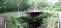
Panoramic view of the pothole at Archbald Pothole State Park

