
Baotou facts for kids
Quick facts for kids
Baotou
包头市 • ᠪᠤᠭᠤᠲᠤᠬᠣᠲᠠ
Paotow
|
|
|---|---|
|
Prefecture-level city
|
|
|
|
.svg)
Location of Baotou City jurisdiction in Inner Mongolia
|
|

Baotou
Location in Inner Mongolia

Baotou
Location in China
|
|
| Country | |
| Autonomous region | Inner Mongolia |
| County-level divisions | 10 Banners |
| Municipal seat | Jiuyuan District |
| Area | |
| • Prefecture-level city | 27,768 km2 (10,721 sq mi) |
| • Urban | 247.14 km2 (95.42 sq mi) |
| • Metro | 953.5 km2 (368.1 sq mi) |
| Elevation | 1,065 m (3,494 ft) |
| Population
(2023 census)
|
|
| • Prefecture-level city | 2,761,700 |
| • Density | 99.456/km2 (257.590/sq mi) |
| • Urban | 2,283,700 |
| • Urban density | 9,240.5/km2 (23,932.8/sq mi) |
| • Metro | 2,418,200 |
| • Metro density | 2,536.13/km2 (6,568.5/sq mi) |
| • Major ethnic groups | Han - 94% |
| GDP | |
| • Prefecture-level city | CN¥ 426.3 billion US$ 60.5 billion PPP$ 106.8 billion |
| • Per capita | CN¥ 155,050 US$ 22,003 PPP$ 38,859 |
| Time zone | UTC+08:00 (China Standard) |
| Postal code |
014000
|
| Area code(s) | 472 |
| ISO 3166 code | CN-NM-02 |
| License plate prefixes | 蒙B |
| Local Dialect | Jin (Baotou dialect); Northeastern Mandarin; Southern Mongolian |


.jpg)


| Baotou | |||||||||||||
|---|---|---|---|---|---|---|---|---|---|---|---|---|---|
| Chinese name | |||||||||||||
| Simplified Chinese | 包头 | ||||||||||||
| Traditional Chinese | 包頭 | ||||||||||||
| Postal | Paotow | ||||||||||||
|
|||||||||||||
| Mongolian name | |||||||||||||
| Mongolian Cyrillic | Бугaт хот | ||||||||||||
| Mongolian script | ᠪᠤᠭᠤᠲᠤ ᠬᠣᠲᠠ | ||||||||||||
Baotou is a large city in Inner Mongolia, China. It is the biggest city in Inner Mongolia based on the number of people living in its main urban area. Over 2.2 million people live in its city center, and about 2.7 million people live in the wider Baotou region.
Its name, Baotou, means "place with deer" in the Mongolic language. It is also called "City of Deer" in Chinese. Another nickname for Baotou is "City of Steel in the Grasslands". For a long time, making steel was a huge industry here. Today, Baotou processes more than half of the world's rare-earth minerals. These are special metals used in phones, computers, and wind turbines. However, this has caused some pollution around the factories.
Contents
Baotou's Past: A Quick Look

Ancient Times: Nomads and Warriors
Long ago, nomadic people lived in the area where Baotou is now. Some of their descendants are known today as Mongols. A famous warrior named Lü Bu was born here during the Han Dynasty (206 BC–220 AD).
How the City Started
Baotou became a town in 1809, which was later than Hohhot, the capital of Inner Mongolia. The city was built in a good spot near the Yellow River. This area had fertile land for farming.
Early 1900s: Growth and Changes
In 1923, a railway from Beijing was built to Baotou. This helped the city grow and start new industries. In 1934, a German-Chinese company built the Baotou Airport. It offered weekly flights connecting Baotou with other cities like Ningxia and Lanzhou.
When a young explorer named Owen Lattimore visited Baotou in 1925, it was a small trading town. It was an important place for trains. Wool and animal hides from Qinghai and Gansu were brought down the Yellow River to Baotou. From there, they were sent by train to places like Tianjin for export.
World War II and Civil War
Baotou was controlled by Japan from 1937 to 1945 during the Second Sino-Japanese War. After that, during the Chinese civil war, Baotou came under Communist control on September 19, 1949. The new government was formed in February 1950.
Late 1900s: Steel City and an Earthquake
In the early years of Communist China, Baotou became a major industrial center. A large part of its economy came from making steel. The Baotou Iron and Steel Base was one of many projects built with help from the Soviet Union. These projects helped China develop its economy in the 1950s and 1960s. Baotou kept its reputation as a steel city for many years.
The 1996 Baotou Earthquake
On May 3, 1996, a strong earthquake hit Baotou. It killed 26 people and injured 453. Nearly 200,000 people lost their homes. The city's power system was also damaged.
This earthquake destroyed many old buildings. This led to a big rebuilding effort in Baotou. In 2002, the city government received an award from the UN for improving homes and urban areas.
21st Century: Economic Changes
In the early 2000s, Baotou's economy grew very fast. It increased about tenfold between 2000 and 2010. The city's total economic output reached its highest point in 2016. Since then, it has become a bit smaller.
Baotou's Economy
Baotou has the largest economy in the Inner Mongolia Autonomous Region. In 2012, it made up about 21.3% of Inner Mongolia's total economic output. In 2018, the city's economy was worth 295.18 billion renminbi (RMB). This was an increase from the year before, but lower than its peak in 2016.
Making things (the secondary sector) is very important to Baotou's economy. In 2016, this sector contributed 182.215 billion RMB to the city's economy. This was almost half of the city's total economic output. However, this part of the economy has also shrunk since then.
Baotou Xingsheng Economic & Technological Development Zone is an industrial area in the city.
As mentioned, Baotou was a major industrial center in the past. Its economy relied heavily on metal industries, especially steel. The Baotou Iron and Steel Base was one of the "156 Projects" built with help from the Soviet Union. These projects helped China develop its economy in the 1950s and 1960s.
Baotou is also a big center for rare-earth metals. These special minerals come from the Bayan Obo Mining District, which is about 120 kilometers from Baotou. They are processed in the city. Rare-earth metals are used in many electronic devices. These include smartphones, TVs, wind turbines, and electric car motors. The waste products from these factories are stored in the Baotou Tailings Dam. There have been reports of environmental concerns around this dam.
People of Baotou

In 2020, about 2,709,400 people lived in Baotou. This was an increase of about 59,000 people since 2010. The average household in Baotou has 2.27 people.
Ethnic Groups in Baotou
Most people in Baotou are Han Chinese. There are also many Mongol people and other groups.
| Ethnicity | 2000 | 2020 | ||
|---|---|---|---|---|
| Population | Percentage | Population | Percentage | |
| Han Chinese | 2,122,737 | 94.16% | 2,525,500 | 93.21% |
| Mongol | 67,209 | 2.98% | 113,200 | 4.18% |
| Hui Chinese | 36,234 | 1.61% | N/A | N/A |
| Manchu | 22,826 | 1.01% | N/A | N/A |
| Korean Chinese | 848 | 0.04% | N/A | N/A |
| Other | N/A | N/A | 70,700 | 2.61% |
| Total | N/A | 100.00% | 2,709,400 | 100.00% |
People Who Move to Baotou
In 2020, about 1,026,400 people lived in Baotou but were officially registered elsewhere. This group of people has increased by about 144,100 since 2010.
City Living vs. Country Living
In 2020, most of Baotou's population, about 2,334,400 people (86.16%), lived in urban areas. The remaining 375,000 people (13.84%) lived in rural areas.
Places to See in Baotou
- The Baotou Olympic Sports Centre Stadium is the main sports venue in the city. It can hold 39,000 people and is mostly used for football games.

- Saihantalah Grasslands Park is a very large park in central Baotou. It covers 5.5 square kilometers. This park is home to many wild animals and birds. It is thought to be one of the biggest urban parks in China. It is a popular place for fun and gets 2 million visitors each year.
- The largest Tibetan Buddhist monastery in Inner Mongolia, Badekar Monastery, is located in Shiguai District.
- The Baotou Tailings Dam is about 20 kilometers outside the city. It holds the waste from rare-earth mineral factories. There have been reports of serious environmental concerns around this dam.
Getting Around Baotou
- Baotou is the end point for two major railways: the Baolan Railway (going west to Lanzhou) and the Jingbao Railway (going east to Beijing). The city has two main train stations.
- Baotou Donghe Airport serves the city. It has regular flights to big cities like Beijing, Shanghai, and Hong Kong.
- The city is connected to Hohhot, Inner Mongolia's capital, by the Hubao Expressway.
- China National Highway 210 also passes through Baotou.
- The city is also planning a Baotou Metro system.
Baotou's Location and Weather
Baotou is in the western part of Inner Mongolia. It sits where two important economic zones meet. The Yellow River flows for 214 kilometers through the Baotou area, south of the city. The Tumochuan Plateau, Hetao Plateau, and Yin Mountains are also found in and around the city.
Baotou has a cold, dry climate. Winters are long, cold, and very dry. Summers are hot and a bit humid. Strong winds are common, especially in spring. Temperatures can drop below -15°C (5°F) in winter and rise above 30°C (86°F) in summer.
The city gets about 300 millimeters (12 inches) of rain each year. More than half of this rain falls in July and August. Because it is dry and high up, the temperature can change a lot between day and night. Dust storms can also happen, especially in spring.
| Climate data for Baotou, elevation 1,005 m (3,297 ft), (1991–2020 normals, extremes 1971–2010) | |||||||||||||
|---|---|---|---|---|---|---|---|---|---|---|---|---|---|
| Month | Jan | Feb | Mar | Apr | May | Jun | Jul | Aug | Sep | Oct | Nov | Dec | Year |
| Record high °C (°F) | 7.4 (45.3) |
16.3 (61.3) |
23.9 (75.0) |
34.4 (93.9) |
35.9 (96.6) |
40.4 (104.7) |
40.1 (104.2) |
37.6 (99.7) |
35.0 (95.0) |
27.5 (81.5) |
19.3 (66.7) |
10.1 (50.2) |
40.4 (104.7) |
| Mean daily maximum °C (°F) | −3.7 (25.3) |
1.7 (35.1) |
9.3 (48.7) |
18.1 (64.6) |
24.4 (75.9) |
28.8 (83.8) |
30.2 (86.4) |
27.9 (82.2) |
22.9 (73.2) |
15.5 (59.9) |
5.8 (42.4) |
−2.2 (28.0) |
14.9 (58.8) |
| Daily mean °C (°F) | −10.6 (12.9) |
−5.5 (22.1) |
2.1 (35.8) |
10.8 (51.4) |
17.3 (63.1) |
22.2 (72.0) |
24.0 (75.2) |
21.8 (71.2) |
15.9 (60.6) |
7.9 (46.2) |
−0.9 (30.4) |
−8.5 (16.7) |
8.0 (46.4) |
| Mean daily minimum °C (°F) | −16.0 (3.2) |
−11.5 (11.3) |
−4.2 (24.4) |
3.4 (38.1) |
9.7 (49.5) |
15.2 (59.4) |
18.2 (64.8) |
16.1 (61.0) |
10.0 (50.0) |
2.0 (35.6) |
−6.1 (21.0) |
−13.6 (7.5) |
1.9 (35.5) |
| Record low °C (°F) | −31.4 (−24.5) |
−28.8 (−19.8) |
−20.4 (−4.7) |
−10.4 (13.3) |
−3.0 (26.6) |
3.2 (37.8) |
10.5 (50.9) |
4.9 (40.8) |
−2.0 (28.4) |
−11.8 (10.8) |
−20.8 (−5.4) |
−27.6 (−17.7) |
−31.4 (−24.5) |
| Average precipitation mm (inches) | 1.8 (0.07) |
4.3 (0.17) |
7.4 (0.29) |
10.7 (0.42) |
24.3 (0.96) |
36.5 (1.44) |
69.8 (2.75) |
79.1 (3.11) |
49.4 (1.94) |
15.6 (0.61) |
6.2 (0.24) |
2.1 (0.08) |
307.2 (12.08) |
| Average precipitation days (≥ 0.1 mm) | 1.6 | 2.1 | 2.9 | 3.1 | 5.0 | 7.4 | 10.1 | 9.6 | 7.8 | 3.9 | 2.2 | 1.6 | 57.3 |
| Average snowy days | 3.3 | 3.2 | 2.8 | 0.9 | 0.1 | 0 | 0 | 0 | 0 | 0.9 | 2.3 | 3.5 | 17 |
| Average relative humidity (%) | 59 | 50 | 43 | 35 | 37 | 45 | 57 | 62 | 60 | 57 | 58 | 58 | 52 |
| Mean monthly sunshine hours | 199.0 | 207.2 | 248.2 | 270.6 | 292.1 | 270.7 | 261.2 | 253.6 | 231.3 | 234.5 | 197.1 | 189.3 | 2,854.8 |
| Percent possible sunshine | 66 | 68 | 67 | 67 | 65 | 60 | 58 | 60 | 63 | 69 | 67 | 66 | 65 |
| Source 1: China Meteorological Administration | |||||||||||||
| Source 2: Weather China | |||||||||||||
Baotou's Local Areas
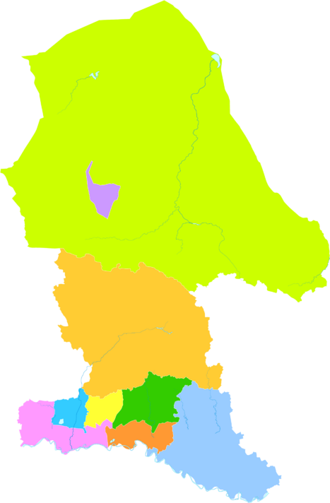
Baotou is divided into 10 smaller areas. These include 7 districts, 1 county, and 2 banners.
| Map | |||||||
|---|---|---|---|---|---|---|---|
Donghe
Hondlon
Qingshan
Shiguai
Bayan'obo
Jiuyuan
Tumed Right
Banner Guyang
County Darhan'muminggan
United Banner |
|||||||
| # | Name | Mongolian | Hanzi | Hanyu Pinyin | Population (2010 Census) |
Area (km2) | Density (/km2) |
| 1 | Hondlon District | ᠬᠥᠨᠳᠡᠯᠡᠨ ᠲᠣᠭᠣᠷᠢᠭ (Köndelen toɣoriɣ) |
昆都仑区 | Kūndūlún Qū | 726,838 | 301 | 2,415 |
| 2 | Donghe District | ᠳᠦᠩᠾᠧ ᠲᠣᠭᠣᠷᠢᠭ (Düŋhė toɣoriɣ) |
东河区 | Dōnghé Qū | 512,045 | 470 | 1,089 |
| 3 | Qingshan District | ᠴᠢᠩᠱᠠᠨ ᠲᠣᠭᠣᠷᠢᠭ (Čiŋšan toɣoriɣ) |
青山区 | Qīngshān Qū | 600,284 | 396 | 1,516 |
| 4 | Shiguai District | ᠰᠢᠭᠤᠶᠢᠲᠤ ᠲᠣᠭᠣᠷᠢᠭ (Siɣuyitu toɣoriɣ) |
石拐区 | Shíguǎi Qū | 35,803 | 761 | 47 |
| 5 | Bayan'obo Mining District | ᠪᠠᠶᠠᠨ ᠣᠪᠣᠭ᠋ᠠ ᠠᠭᠤᠷᠬᠠᠢ ᠶᠢᠨ ᠲᠣᠭᠣᠷᠢᠭ (Bayan Oboɣ-a Aɣurqai-yin toɣoriɣ) |
白云鄂博矿区 | Báiyún Èbó Kuàngqū | 26,050 | 303 | 86 |
| 6 | Jiuyuan District | ᠵᠢᠦᠶᠤᠸᠠᠨ ᠲᠣᠭᠣᠷᠢᠭ (Jiü yuvan toɣoriɣ) |
九原区 | Jiǔyuán Qū | 195,831 | 734 | 267 |
| 8 | Guyang County | ᠭᠦᠶᠠᠩ ᠰᠢᠶᠠᠨ (Güyaŋ siyan) |
固阳县 | Gùyáng Xiàn | 175,574 | 5,025 | 35 |
| 9 | Tumed Right Banner (Tumed Barun Banner) |
ᠲᠦᠮᠡᠳ ᠪᠠᠷᠠᠭᠤᠨ ᠬᠣᠰᠢᠭᠤ (Tümed Baraɣun qosiɣu) |
土默特右旗 | Tǔmòtè Yòu Qí | 276,453 | 2,368 | 116.7 |
| 10 | Darhan Muminggan United Banner (Darhan Muminggan Holbot Banner) |
ᠳᠠᠷᠬᠠᠨ ᠮᠤᠤᠮᠢᠩᠭᠠᠨ ᠬᠣᠯᠪᠣᠭᠠᠲᠤ ᠬᠣᠰᠢᠭᠤ (Darqan Muumiŋɣan Qolboɣatu qosiɣu) |
达尔罕茂明安 联合旗 |
Dá'ěrhǎn Màomíng'ān Liánhé Qí |
101,486 | 17,410 | 5.8 |
Images for kids
-
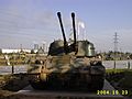
Northern Weapons Park
-
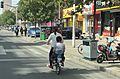
Trip home for lunch, area rebuilt after the earthquake
-

Aobao Shrine
-
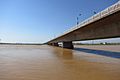
Bridge over the Yellow River
-
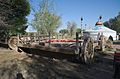
Baotou chariot and Yurt
-
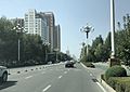
Main airport road, Baotou
-
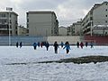
Students at Baotou Foreign Languages School playing soccer in the snow


See also
 In Spanish: Baotou para niños
