Baugh Fell facts for kids
Quick facts for kids Baugh Fell |
|
|---|---|

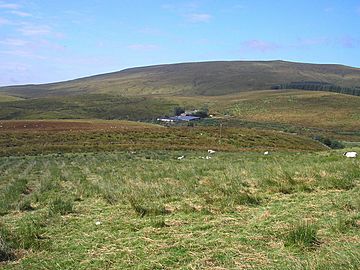
The slopes of Baugh Fell from Grisedale
|
|
| Highest point | |
| Elevation | 678 m (2,224 ft) |
| Prominence | c. 260 m |
| Parent peak | Wild Boar Fell |
| Listing | Marilyn, Hewitt, Nuttall |
| Geography | |
| Parent range | Pennines |
| OS grid | SD740916 |
| Topo map | OS Landranger 98, Explorer OL19 |
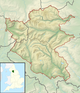
Baugh Fell is a big, flat-topped hill in northern England. It's part of the Pennines mountain range. You can find it in the northwest corner of the Yorkshire Dales National Park. It's near the Howgill Fells and north of Whernside, which is one of the tallest hills in the Yorkshire Three Peaks area. Before 1974, Baugh Fell was in a place called the West Riding of Yorkshire. Now, it's part of the county of Cumbria.
Contents
Exploring Baugh Fell's Shape
Baugh Fell is a really spread-out area, covering about 45 square kilometers (17 square miles). It has some steep sides, especially towards Garsdale in the south. The western slopes are a bit gentler.
Rivers and Streams
The River Rawthey starts high up on Baugh Fell's flat top. At first, it flows north, but then it turns south. This river forms the western edge of the hill. On the eastern side, Grisedale Beck marks the boundary. This beck is a main stream that flows into the Clough River, which runs through Garsdale.
The Flat Top of Baugh Fell
The very top of Baugh Fell is mostly flat, like a big table. This flat area is shaped a bit like the letter 'L' and is about 4 kilometers (2.5 miles) long. The rock on this flat top is called millstone grit. This is a type of hard sandstone. You can also find other kinds of sandstone and limestone on the sides of the hill.
Highest Points and Views
The very highest point on Baugh Fell is called Tarn Rigg Hill, which is 678 meters (2,224 feet) high. Even though it's the highest, the trig point on Knoutberry Haw is almost as tall, at 676 meters (2,218 feet). A trig point is a special marker used by mapmakers. From Knoutberry Haw, you can see amazing views! On a clear day, you might spot the Yorkshire Three Peaks, the Howgill Fells, and even parts of the Lake District. You might even see as far as Blackpool Tower!
If you want to see Wensleydale and the Eden valley, head to Grisedale Pike. This is a slightly raised area on the eastern side of Baugh Fell, about a mile from the main summit.
Lakes on the Top
There are a few small lakes, called tarns, on the flat top of Baugh Fell.
- The East Tarns are a group of five small lakes. They are on the eastern part of the plateau, just north of Tarn Rigg Hill.
- The West Tarn is on the northwest end of the plateau. It can be a bit tricky to find because it sits in a small dip. But if you follow the western edge of the plateau, looking towards Sedbergh, you'll see two piles of stones (called cairns) that point the way to it.
Getting Around Baugh Fell
Even though there aren't many official paths to the very top of Baugh Fell, most of the hill is open moorland. This means that walkers are allowed to explore freely under a law called the Countryside and Rights of Way Act 2000.
Paths and Trails
You can get onto the open parts of Baugh Fell from several places:
- There are paths for horses (called bridleways) that lead up from the River Rawthey valley on the west side.
- A public walking path from Uldale to Grisedale forms the northern edge of Baugh Fell.
- You can also access the open moor from places like Garsdale Foot and West Hind Keld on the southwest slopes.
- From Grisedale on the northeast slopes, and parts of Fell End on the northwest slopes, you can also get onto the open fell.
Finding Your Way
Once you are on the open moor, there are no set paths to the summit. The slopes are generally gentle, so it's not too hard to walk around. Baugh Fell is not as busy as popular places like the Lake District or the Yorkshire Three Peaks. Even on long holiday weekends, you'll often find it quiet and peaceful.
 | William Lucy |
 | Charles Hayes |
 | Cleveland Robinson |


