Bethania, Queensland facts for kids
Quick facts for kids BethaniaLogan City, Queensland |
|||||||||||||||
|---|---|---|---|---|---|---|---|---|---|---|---|---|---|---|---|

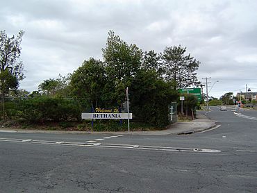
Albert Street, 2014
|
|||||||||||||||
| Population | 6,333 (2021 census) | ||||||||||||||
| • Density | 1,092/km2 (2,830/sq mi) | ||||||||||||||
| Postcode(s) | 4205 | ||||||||||||||
| Elevation | 15 m (49 ft) | ||||||||||||||
| Area | 5.8 km2 (2.2 sq mi) | ||||||||||||||
| Time zone | AEST (UTC+10:00) | ||||||||||||||
| Location |
|
||||||||||||||
| LGA(s) | Logan City | ||||||||||||||
| State electorate(s) | Waterford | ||||||||||||||
| Federal Division(s) | Forde | ||||||||||||||
|
|||||||||||||||
Bethania is a suburb found in the City of Logan, Queensland, Australia. It is a friendly community located not too far from major cities. In 2021, Bethania was home to 6,333 people.
Contents
Exploring Bethania's Location
Bethania is located south of the Logan River. Sometimes, the lower areas near the river can experience floods.
Getting Around by Train
The suburb is on the main Beenleigh railway line. You can catch a train at the Bethania railway station. This station connects Bethania to places like Brisbane and Beenleigh.
Another railway line, the Beaudesert railway line, starts just south of Bethania station. It used to go to Beaudesert, but it hasn't been used since 2004.
A Look at Bethania's Past
Bethania was settled by German people in the 1860s. Over time, many different nationalities have made Bethania their home. By 1866, a small town had already started to grow. The name "Bethania" is thought to come from "Bethany," a village mentioned in the Bible.
Early Buildings and Floods
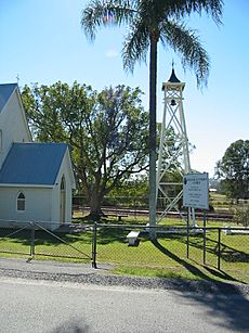
A Lutheran church was built in 1864. It was made of wooden slabs and stood where the railway line is now. A cemetery was also started next to the church in 1866. The current church building was built in 1872, very close to the first one. The road leading to it became known as Church Road.
The first railway bridge in Bethania was destroyed by a flood in 1887. A new bridge was built, which lasted until 1972. Then, an even newer, stronger bridge was put in place.
Bethania was also heavily affected by a big flood in Brisbane in 1974. After this flood, an area called Duck Island became part of the suburb because the river changed its path. In recent years, sand and gravel have been dug up from the river's old deposits.
Schools in Bethania
Bethania Lutheran Primary School opened its doors on January 27, 1976.
Who Lives in Bethania?
In 2021, Bethania had a population of 6,333 people. More than half of the residents were female (55.3%), and 44.7% were male. The average age of people in Bethania was 48 years old.
Most people living in Bethania (65.5%) were born in Australia. Other common birthplaces included New Zealand (7.6%) and England (6.0%).
When it comes to languages, 82.1% of people spoke only English at home. Other languages spoken included Mandarin, Samoan, Spanish, Cantonese, and Hindi.
Important Places in Bethania
Bethania has some places that are important for their history. These are called heritage-listed sites.
Heritage-Listed Sites
- Bethania Lutheran Church, located on Church Road, is one of these special historical sites.
Learning in Bethania
Bethania Lutheran Primary School is a private school for students from Prep to Year 6. It is located at 66 Glastonbury Drive. In 2018, the school had 287 students.
Community and Services
Palm Lake Christian Fellowship holds its services at the Palm Lake Resort. This group is part of the Wesleyan Methodist Church.
Getting Around Bethania
The Bethania railway station is a key transport hub. It offers regular train services on the Queensland Rail City network to Brisbane and Beenleigh.
 | Sharif Bey |
 | Hale Woodruff |
 | Richmond Barthé |
 | Purvis Young |


