Bethlehem, New York facts for kids
Quick facts for kids
Bethlehem
|
|
|---|---|

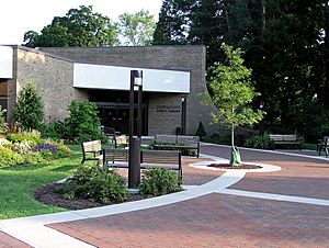
Bethlehem Public Library
|
|

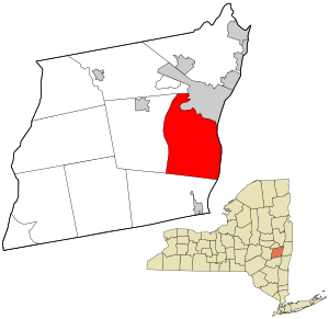
Location in Albany County in the state of New York.
|
|
| Country | United States |
| State | New York |
| County | Albany |
| Incorporated | 1793 |
| Government | |
| • Type | Town council |
| Area | |
| • Total | 49.86 sq mi (129.15 km2) |
| • Land | 49.03 sq mi (126.99 km2) |
| • Water | 0.83 sq mi (2.16 km2) |
| Elevation | 197 ft (60 m) |
| Population
(2020)
|
|
| • Total | 35,034 |
| • Density | 714.54/sq mi (275.88/km2) |
| Time zone | UTC-5 (Eastern (EST)) |
| • Summer (DST) | UTC-4 (EDT) |
| ZIP code |
No Bethlehem addresses. Some hamlets have ZIP codes (Delmar 12054; Glenmont, 12077; Selkirk, 12158; Slingerlands, 12159; South Bethlehem, 12161) and some areas use Albany (12203, 12208) ZIP codes.
|
| Area code(s) | 518 |
| FIPS code | 36-001-06354 |
| GNIS feature ID | 0978731 |
| Website | Town of Bethlehem |
Bethlehem is a town in Albany County, New York, United States. It is located just south of the city of Albany. In 2020, about 35,034 people lived here.
The town includes several smaller communities called hamlets. These are Delmar, Elsmere, Glenmont, North Bethlehem, Selkirk, Slingerlands, and South Bethlehem. A major road, U.S. Route 9W, goes through the town. Bethlehem is named after the famous biblical town. A well-known person from Bethlehem is YouTuber James Charles.
Contents
History of Bethlehem
Early Days and Founding
It is believed that Henry Hudson landed in what is now Bethlehem when he sailed up the river named after him. There is a park, Henry Hudson Park, that remembers this event.
The town of Bethlehem was officially created on March 12, 1793. It was formed from a larger area called the town of Watervliet. Later, in 1832, a part of Bethlehem was used to create the town of New Scotland.
Growth and Development
The town first started to grow in a place called Normansville. This area was named for its location along the Normans Kill, a creek that forms the border with Albany. Normansville still exists today, but it's a bit hidden.
In the mid-1800s, the Delaware and Hudson railroad started train service. It connected Albany to Binghamton. The railroad passed through a hamlet then called Adamsville and renamed it Delmar.
Delmar: A Central Hub
Today, Delmar is the largest hamlet in Bethlehem. The town hall, police station, court, and public library are all located on Delaware Avenue in Delmar. Many businesses are also found there.
The Delaware and Hudson railroad stopped passenger service in 1963. Its tracks were removed between 2000 and 2005. Now, the old railway path is the Albany County Rail Trail. This is a popular path for biking and walking. It goes from downtown Albany to Voorheesville. Bethlehem has continued to grow and is now a well-off suburb of Albany.
Exploring Local Landmarks
Bethlehem has several interesting historic buildings and places.
- Four Corners: This is a busy intersection in Delmar where Delaware and Kenwood avenues meet. It's like the main center of town. You'll find stores, banks, restaurants, and the post office here. Many Delmar residents can walk to it easily.
- Adams House: In 1838, Nathaniel Adams built a hotel here. This grand building later became the town hall. In 1980, the town hall moved to a bigger place. The volunteer fire department then used Adams House. Today, it is owned by the Bethlehem Chabad, a Jewish group. The fire station is still behind the building.
- Beckers Homestead: Albertus Becker built this house in 1800. His grandson, Albertus Becker II, became the town supervisor in 1863.
- Bethlehem House: This building is listed on the National Register of Historic Places (NRHP) since 1973.
- District School No. 1: This old school building is also listed on the NRHP since 1998.
- Memorial Park: This is a small park along Delaware Avenue. It honors the town's war veterans. You can also get to the old Delaware and Hudson railway path from here. This path is being turned into a bike trail.
- Elm Avenue Park: This is the biggest park in town and a popular spot in summer. It has three outdoor swimming pools, a splash area for toddlers, and courts for basketball and tennis. In winter, you can go ice skating, hockey, cross-country skiing, sledding, and snowmobiling. Only town residents and their guests can use the pool area, and there is a fee.
- Bethlehem Central Middle School: This building was first built as the high school. It has been added to over the years. It has outdoor tennis courts, basketball courts, softball fields, a running track, and soccer fields. These are open to the public when school is not in session. The high school moved to a new building, and this one became the middle school.
- Delaware Plaza: This is a shopping center built in the 1950s. It's on Delaware Avenue in Elsmere. Delaware Plaza has a large supermarket (Hannaford) and about 30 other shops and restaurants.
- Delmar post office: This post office was built in the late 1930s during the Depression. It has a special design called Colonial Revival.
- Albany County Helderberg-Hudson Rail Trail: This trail was made from the old Delaware and Hudson railroad path. The tracks are gone, and the path is now paved. It runs from New Scotland to the Port of Albany.
Education in Bethlehem
Most children in Bethlehem go to schools in the Bethlehem Central School District.
Elementary Schools
The district has five public elementary schools: Eagle, Elsmere, Glenmont, Hamagrael, and Slingerlands. These schools teach students up to grade 5. Another elementary school, Clarksville, closed in 2011 due to fewer students and money issues. The building is now leased to the Albany County Sheriff's Department.
Middle and High Schools
The Bethlehem Central Middle School teaches students in grades 6, 7, and 8. The Bethlehem Central High School is for grades 9 through 12.
Other Schools
There are also other schools in Bethlehem. The School of Saint Thomas the Apostle is a Catholic school for grades K-8. Bethlehem Children's School is an independent school for K-8 students. It focuses on creative, child-centered environmental education.
The school district also offers classes for adults who want to keep learning. They also provide busing and most textbooks for families who choose private schools.
Some parts of Bethlehem are in different school districts. Students in North Bethlehem go to the Guilderland Central School District. Those in Selkirk and South Bethlehem attend the Ravena-Coeymans-Selkirk Central School District. One of their elementary schools, Albertus W. Becker Elementary School, is in Selkirk.
Geography of Bethlehem
Bethlehem covers about 49.6 square miles (129.15 square kilometers). Most of this area is land, with a small part being water.
Location and Nearby Areas
The town is located in Albany County, New York. The eastern border of Bethlehem is the Hudson River, which also forms the border with Rensselaer County.
To the north, Bethlehem borders the city of Albany and the town of Guilderland. To the west is the town of New Scotland. To the south, it borders the town of Coeymans.
The New York State Thruway (Interstate 87) runs through the town. Bethlehem also has public bus service provided by the CDTA.
Population and People
| Historical population | |||
|---|---|---|---|
| Census | Pop. | %± | |
| 1810 | 4,430 | — | |
| 1820 | 5,114 | 15.4% | |
| 1830 | 6,082 | 18.9% | |
| 1840 | 3,238 | −46.8% | |
| 1850 | 4,102 | 26.7% | |
| 1860 | 5,644 | 37.6% | |
| 1870 | 6,950 | 23.1% | |
| 1880 | 3,752 | −46.0% | |
| 1890 | 4,187 | 11.6% | |
| 1900 | 4,226 | 0.9% | |
| 1910 | 4,413 | 4.4% | |
| 1920 | 4,430 | 0.4% | |
| 1930 | 7,160 | 61.6% | |
| 1940 | 9,782 | 36.6% | |
| 1950 | 13,065 | 33.6% | |
| 1960 | 18,936 | 44.9% | |
| 1970 | 23,427 | 23.7% | |
| 1980 | 24,296 | 3.7% | |
| 1990 | 27,552 | 13.4% | |
| 2000 | 31,304 | 13.6% | |
| 2010 | 33,656 | 7.5% | |
| 2020 | 35,034 | 4.1% | |
| U.S. Decennial Census | |||
In 2000, there were 31,304 people living in Bethlehem. About 12,112 households and 8,551 families were in the town. The population density was about 641 people per square mile.
Most people in Bethlehem are White (94.74%). There are also African American (2.26%), Asian (1.66%), Native American (0.15%), and Pacific Islander (0.04%) residents. About 1.74% of the population was Hispanic or Latino.
About 27.5% of the population was under 18 years old. The median age was 40 years. The average income for a household in Bethlehem was $63,169. For families, it was $77,211.
Notable People from Bethlehem
Many interesting people have connections to Bethlehem:
- E. G. Squier (1821–1888), an archaeologist and newspaper editor.
- Megyn Kelly, a former Fox News and NBC anchor, who graduated from Bethlehem Central.
- Eva Marie Saint, an American actress with a long career in movies, Broadway, and TV.
- James Charles, a makeup artist and the first male spokesmodel for CoverGirl. He also graduated from Bethlehem Central.
- Josh Eppard, the drummer for the band Coheed & Cambria.
- Frances S. Curry, a United States Medal of Honor recipient, lived in Selkirk.
- Matt Quatraro, the manager of the Kansas City Royals baseball team.
- Bill Karins, an NBC News meteorologist.
- Ed O'Keefe, a CBS News political correspondent.
Communities and Locations in Bethlehem
Official Hamlets
These are the main small communities within the town:
- Delmar: This hamlet is near the center of town and where the town government is located. It used to be called Adamsville.
- Elsmere: This hamlet is just east of Delmar.
- Glenmont: This hamlet is in the eastern part of the town.
- North Bethlehem: This hamlet is at the northern edge of the town, in the northeastern part.
- Selkirk: This hamlet is east of South Bethlehem.
- Slingerlands: This hamlet is right next to Delmar on its west side.
- South Bethlehem: This hamlet is in the southern part of the town.
Other Communities
These are smaller, less official communities or locations:
- Beckers Corners: A hamlet in the southern part of town, located on Route 9W.
- Bethlehem Center: A hamlet in the northeastern part of the town.
- Bethlehem Heights: A community east of South Bethlehem, often linked with it.
- Callahans Corners: A location at the southwestern corner of the town.
- Cedar Hill: A hamlet in the southeastern part of the town, east of the Thruway.
- Henry Hudson Park: A park east of Cedar Hill, by the Hudson River.
- Houcks Corners: A hamlet south of Delmar.
- Mallorys Corners: A location in the southern part of the town.
- Meyers Corners: A location in the southern section of the town.
- Normansville: A hamlet in the northern part of the town.
- Spawn Hollow: A community in the southwestern corner of the town, often linked with South Bethlehem.
- South Albany: A hamlet in the southern section of the town, north of South Bethlehem.
- Wemple: A hamlet in the southeastern part of the town.
Electric Power in Bethlehem
Bethlehem Energy Center
The Bethlehem Energy Center (BEC) is a power plant that produces electricity. It uses natural gas to create power. It started operating in 2005. The plant uses special turbines that create steam to make electricity. It also has a system to cool air, which helps reduce how much water it uses.
The BEC is located on a large piece of land that used to be an industrial area. In 2017, the plant produced a lot of electricity, enough to power many homes and businesses in the region.
As part of its building permit, the company that owns BEC created a special wetland area. This helps to balance out the industrial development of the plant and supports local wildlife.
In 2015, the plant was updated to produce even more electricity. This upgrade did not increase air pollution or make the plant bigger. The Bethlehem Energy Center also contributes to the town's budget through payments.
See also
 In Spanish: Bethlehem (Nueva York) para niños


