
Càrn Eige facts for kids
Quick facts for kids Càrn Eige |
|
|---|---|

Càrn Eige seen from the large cairn on Mam Sodhail.
|
|
| Highest point | |
| Elevation | 1,183 m (3,881 ft) |
| Prominence | c. 1148 m Ranked 2nd in British Isles |
| Parent peak | Ben Nevis |
| Listing | Marilyn, Munro, Hardy, County top (Ross and Cromarty) |
| Naming | |
| English translation | File hill or Notch hill |
| Language of name | Gaelic |
| Pronunciation | English approximation: karn-EK-yə |
| Geography | |
| Location | Glen Affric, Scotland |
| OS grid | NH123262 |
| Topo map | OS Landranger 25 |
Càrn Eige, sometimes spelled Càrn Eighe, is a huge mountain in the north of Scotland. It stands at 1,183 meters (3,881 feet) above sea level. This makes it the highest mountain in northern Scotland, which is the area north of the Great Glen.
It is also the twelfth-highest mountain in the entire British Isles. When you look at how much it rises from its base (its "relative height"), it's the second-tallest mountain in the British Isles, right after Ben Nevis. Càrn Eige is the highest point in the historic area of Ross and Cromarty. It has a "twin" mountain called Mam Sodhail, which is almost as tall at 1,181 meters (3,875 feet). They are on the same ridge.
Càrn Eige is located in the Highland region. It sits on the border between the historic areas of Inverness and Ross and Cromarty. Getting to the mountain can be tricky because it's about 10 kilometers (6 miles) from the nearest road.
Contents
What's in a Name?
The name "Càrn Eige" comes from the Scottish Gaelic language. It most likely means File Hill or Notch Hill.
Some people think it could also be spelled "Càrn Eigh." If it were, it would mean Hill of Ice. This would make it the only Scottish mountain with "ice" in its name!
Mountain Shape and Neighbors
The top of Càrn Eige looks like a pyramid. Three ridges meet at its peak, forming a triangle shape.
Its "twin" mountain, Mam Sodhail, is about 1 kilometer (0.6 miles) to the southwest. There are three other important peaks, called Munros, on the same mountain range. These include Beinn Fhionnlaidh to the north. There's also a long grassy ridge that goes east. After about 4.5 kilometers (2.8 miles), it reaches Tom a' Chòinich (1,112 meters or 3,648 feet). Then, after a similar distance, it ends at Toll Creagach (1,054 meters or 3,458 feet).
Besides these five main peaks, there are 10 smaller peaks nearby. These are known as "Munro Tops."
Lochs and Views
This mountain ridge is located between two large lochs (lakes). To the south, you'll find Loch Affric and Loch Beinn a' Mheadhoin. To the north is the bigger Loch Mullardoch.
Càrn Eige is the tallest mountain in this area. It stands out even when compared to other high peaks across Loch Mullardoch, like Sgùrr na Lapaich (1,150 meters or 3,773 feet). North of the summit, there's an impressive glacial corrie. This is a bowl-shaped valley that drops half a kilometer down to the shores of Corrie Lochan.
Mountain Rocks
Càrn Eige is in the northwest highlands of Scotland. It's located north of a major crack in the Earth's crust called the Great Glen Fault. You can find sheets of a type of rock called West Highland granite gneiss stretching from this fault through Glen Affric.
Summit Panorama

Mountain History
In 1848, a man named Colonel Winzer from the Ordnance Survey climbed Càrn Eige. He found a pile of stones at the top. He thought someone had climbed it before him. However, a local gamekeeper suggested the stones might have been a small shelter for people watching the area.
In 1891, Sir Hugh Munro, 4th Baronet included Càrn Eige in his famous Munro Tables. These tables list all the Scottish mountains over 3,000 feet (914.4 meters). Since then, people have completed climbing all the Munros at least 5,000 times!
Plants and Animals
Like many parts of the Scottish Highlands, the slopes of Càrn Eige don't have many trees, especially higher up. Instead, the mountain is covered in different kinds of grasses and mosses. Near the top, these are often covered by snow for part of the year. The lower slopes are described as "boggy, wet moorland."
At the bottom of the southern side of the mountain, near Loch Affric, there are woods. These woods have Scots pine trees mixed with others like oak, birch, and beech. These forests are home to special animals, including the crested tit and the Scottish crossbill.
Where is Càrn Eige?
Càrn Eige is located in northern Scotland. It sits on the border of two historic counties: Inverness and Ross and Cromarty. It is the highest point in Ross and Cromarty.
The mountain is very remote. It's more than 10 kilometers (6 miles) from the closest road in Glen Affric. However, there is a youth hostel called Alltbeithe in the same valley, which is closer. The summit's exact location is UK grid reference NH123261. You can find it on the OS Landranger 25 map.
How to Climb Càrn Eige
You can climb Càrn Eige from the south, starting at Loch Affric. You would go up the north side of Gleann nam Fiadh, crossing a stream. From there, you can reach the top of both Càrn Eige and then Mam Sodhail. You can do this route clockwise or anticlockwise. Some climbers also include Beinn Fhionnlaidh, as it's hard to reach otherwise.
The summit of Càrn Eige has an Ordnance Survey triangulation pillar (a trig point) and a cairn (a pile of stones). Climbing the three main peaks (Càrn Eige, Mam Sodhail, and Beinn Fhionnlaidh) can take about 9 to 10 hours.
There's also a way to climb to the top from the north, going through Beinn Fhionnlaidh. This route starts from a spot on Loch Mullardoch that you can reach by boat.
Images for kids
-
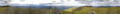
A wide panorama from the summit of Càrn Eige.
See also
 In Spanish: Càrn Eige para niños
