
Cape Sable facts for kids
Quick facts for kids Cape Sable |
|
|---|---|

Satellite image of Cape Sable
|
|
| Location | United States |
| Coordinates | 25°16′20″N 81°07′25″W / 25.272185°N 81.123638°W |
| Geology | Cape |
Cape Sable is the very southernmost tip of the United States mainland. It is located in southwestern Florida, in Monroe County. This special place is part of the amazing Everglades National Park.
The cape is like a long arm of land (a peninsula) that reaches out from the southeastern part of Florida. It curves west and then north, touching Ponce de Leon Bay near the Shark River. It also forms the southern and western edges of Whitewater Bay.
There are three main spots on the cape, and each has a special camping area:
- East Cape: This is the actual southernmost point of mainland Florida and the U.S. It's also where you'll find Lake Ingraham, the southernmost lake in the country.
- Middle Cape: This spot is also known as Palm Point.
- Northwest Cape.
These campsites are part of a water trail called the "Everglades Wilderness Waterway." If you want to stay overnight, you need a permit from the Flamingo Visitor Center. Cape Sable also has many beautiful lakes and sandy beaches.
Cape Sable is home to some unique animals. You can find the mangrove diamondback terrapin there. This is a type of turtle that lives in salty water. The Florida gopher tortoise (Gopherus polyphemus) also lives here. Before a big storm called Hurricane Donna in 1960, over 3,000 Cape Sable seaside sparrows lived on the cape. These sparrows are now an endangered bird.
Most of the cape facing Florida Bay and the Gulf of Mexico has a beautiful sandy beach. It stretches inland for less than 100 yards. Behind the beach, in the eastern and middle parts, there's a flat, grassy area called a marl prairie. This prairie goes from Flamingo to Northwest Point. Further inland, and in the northern part of the cape, you'll find a mix of marshes and land covered by mangrove trees. The biggest lake on the cape is Lake Ingraham. It's long and narrow, running just behind the beach from East Cape to past Middle Cape.
Contents
Exploring Cape Sable's Past
People haven't lived in large settlements on Cape Sable for a long time. Even though there's fresh water and some good land for farming, there's not much proof of big villages. We know there are a few small Indian shell mounds left by early people. The Spanish explorers once mentioned a Tequesta village on the cape. The native tribes of south Florida before the Seminoles didn't farm much. They probably used the cape as a good spot for fishing and hunting.
Sailors and fishermen often visited Cape Sable to get fresh water. Hunters also came here because the cape had more wildlife than the nearby Florida Keys.
How Wars Shaped the Cape
During the Second Seminole War, people living in the Florida Keys were worried. They thought Seminole warriors might use Cape Sable to attack them. In 1840, a group of Seminole warriors, believed to have traveled across Cape Sable, attacked a settlement on Indian Key. They destroyed it.
The United States government was concerned that Spanish officials in Cuba were helping the Seminole people. They knew that Cuban fishermen, including some Native Americans who had moved to Cuba, still fished along the Florida coast. To stop this and protect the Florida Keys, the United States Army built Fort Poinsett on East Cape in 1838. But this fort didn't stop the attack on Indian Key. Later, in 1856, during the Third Seminole War, the Army built another fort called Fort Cross on Middle Cape. You could see parts of Fort Poinsett until a powerful storm in 1935 destroyed it.
The Town of Flamingo
The only main town on Cape Sable was Flamingo. It started around 1892. By 1900, about 50 families lived there. In 1905, a wildlife warden named Guy Bradley was killed near the town while trying to stop people from hunting birds illegally for their feathers. His death, and two others, helped end the commercial feather trade. By 1910, only three homes were still lived in.
Building Roads and Resorts
In 1912, a man named Henry Flagler received a huge amount of land, including much of Cape Sable. His company, the Model Land Company, was set up to manage and sell this land. The company's president, James E. Ingraham, had a road built from Homestead to the Cape between 1914 and 1916. This road was later named the Ingraham Highway. It was extended to Flamingo in 1922. Along the road, he also built the Homestead Canal, which reaches the Gulf of Mexico.
In 1916, the Model Land Company built a "Club House" on East Cape. It was meant to be a sales office and a hotel for people interested in buying land, or for fishermen and hunters. The building was on tall stilts and had a porch for meals. There were also six tents, called "cottages," that people could rent. Each tent had a wooden floor, a bed, and other simple furniture. A swimming pool was built nearby, surrounded by coconut trees. They even built a small bridge to Middle Cape and some small ditches to make the land look nicer.
However, only a few pieces of land were ever sold. A hurricane destroyed the "Club House" around 1931. In 1948, the company sold their 135,000 acres to the NPS. You could still see the swimming pool as late as the 1950s!
Gallery
-
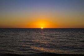
East Cape Sable Sunset
-
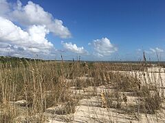
Middle Cape Sable 1/1/2019
-
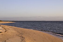
Northwest Cape overlooking Middle Cape in the distance


See also
 In Spanish: Cabo Sable para niños
