Catterick facts for kids
Quick facts for kids Catterick |
|
|---|---|
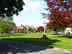
 Catterick Village Green |
|
| Population | 3,155 (2011) |
| OS grid reference | SE240980 |
| Civil parish |
|
| District |
|
| Shire county | |
| Region | |
| Country | England |
| Sovereign state | United Kingdom |
| Post town | RICHMOND |
| Postcode district | DL10 |
| Dialling code | 01748 |
| Police | North Yorkshire |
| Fire | North Yorkshire |
| Ambulance | Yorkshire |
| EU Parliament | Yorkshire and the Humber |
| UK Parliament |
|
Catterick is a village in North Yorkshire, England. It's also a civil parish and an electoral area. Historically, it was part of the North Riding of Yorkshire.
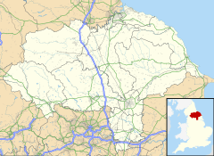
Catterick is about 8.5 miles (13.7 km) north-west of Northallerton. It sits just west of the River Swale. The village gives its name to the nearby Catterick Garrison, a large army base. It's also close to Catterick Bridge, which is home to Catterick Racecourse. The village is on the route of an old Roman road called Dere Street. It was once the site of a Roman fort called Cataractonium.
Contents
What Does Catterick Mean?
The name Catterick comes from the Latin name "Cataractonium." This name sounds like it means "place of a waterfall." However, it might have been the Romans' way of saying a Celtic name. That Celtic name was likely Catu-rātis, which means "battle ramparts." This idea is supported by how the name was spelled on an old map by Ptolemy.
Catterick's Past: A Look Back
Catterick has a very long history, going all the way back to Roman times.
Roman Times in Catterick
Around 150 AD, Catterick was mentioned in Ptolemy's Geographia. Back then, it was a Roman fort called Cataractonium. This fort was important for protecting the crossing of Dere Street over the River Swale.
Early Battles and Events
Catterick is thought to be where the Battle of Catraeth happened around 598 AD. This battle was fought between Celtic British kingdoms and the Anglo-Saxon kingdom of Bernicia. Later, Paulinus of York performed baptisms in the nearby River Swale.
Catterick in the Domesday Book
Catterick is also mentioned in the famous Domesday Book as Catrice. This book was a survey of England made in 1086. After the Norman invasion, the land was given to Count Alan of Brittany. Over the centuries, many important families owned the manor of Catterick.
Old Castles and Coaching Inns
Just north of the village church is Pallet Hill. This is where you can still see the remains of an old motte-and-bailey castle. It was probably built by King Stephen in the 1100s. Its purpose was to control the important Great North Road. This site is now a Scheduled Ancient Monument.
Catterick also became a busy "coaching town." This meant it was a place where travelers on the Great North Road would stop overnight. They would rest and refresh themselves and their horses. The Angel Inn, which is still there today, used to be one of these coaching inns.
Modern Military Connections
In 1914, Catterick Camp was set up about 4.7 miles (7.6 km) west of the village. This camp later became Catterick Garrison, which is a very large army base today. During the First World War, soldiers came to Catterick for their basic training.
RAF Catterick, an airfield south of the village, also opened in 1914. It was later taken over by the British Army and is now called Marne Barracks.
Catterick Today
In 1974, Catterick became part of the new county of North Yorkshire.
How Catterick is Governed
Catterick is part of the Richmond area for the UK Parliament. This means people in Catterick vote for a Member of Parliament (MP) who represents them in the government.
The village also has a Parish Council. This council helps manage local matters for the people living in Catterick.
Catterick's Location and Surroundings
The village is located along the A6136 road that goes to Richmond. The main A1 road used to go through Catterick, but now it bypasses the village. This bypass was opened in 1959.
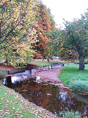
The River Swale flows south just north of the village at Catterick Bridge. It then runs along the east side of Catterick. A smaller stream called Brough Beck also flows through the village and joins the River Swale. There are also some small lakes in the area that were created from old quarries.
Nearby villages include Brompton-on-Swale, Catterick Bridge, Colburn, and Scorton.
Flooding and Flood Protection
The A1 road and the village have sometimes had problems with flooding from Brough Beck. For example, in 2012, a sudden flood caused the A1 to close for a whole day. This flood also affected many homes in Catterick.
To help prevent future flooding, a large flood reservoir was built. This project cost £6 million. The reservoir can hold a huge amount of water, over 91 million imperial gallons (410 million litres). It helps to control the water flow, especially when there's a lot of rain or melting snow. It's also hoped that wildlife will start to live in the reservoir area.


