Cedar Point, Kansas facts for kids
Quick facts for kids
Cedar Point, Kansas
|
|
|---|---|

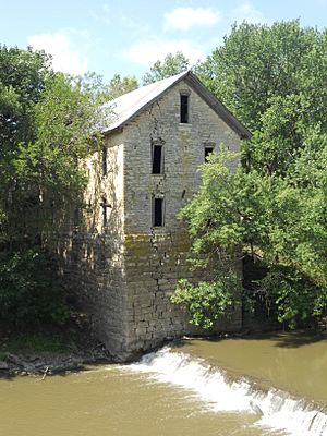
North side of 1875 Cedar Point Mill next to Cottonwood River (2012)
|
|

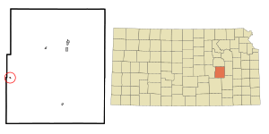
Location within Chase County and Kansas
|
|

|
|
| Country | United States |
| State | Kansas |
| County | Chase |
| Township | Cottonwood |
| Founded | 1862 |
| Incorporated | 1912 |
| Government | |
| • Type | Mayor–Council |
| Area | |
| • Total | 0.07 sq mi (0.18 km2) |
| • Land | 0.07 sq mi (0.17 km2) |
| • Water | 0.00 sq mi (0.00 km2) |
| Elevation | 1,247 ft (380 m) |
| Population
(2020)
|
|
| • Total | 22 |
| • Density | 314/sq mi (122/km2) |
| Time zone | UTC-6 (CST) |
| • Summer (DST) | UTC-5 (CDT) |
| ZIP code |
66843
|
| Area code | 620 |
| FIPS code | 20-11425 |
| GNIS ID | 477384 |
Cedar Point is a small city located in Chase County, Kansas, United States. It's a quiet place with a population of 22 people, according to the 2020 census. The city is about 5 miles east of Florence and very close to the U.S. Route 50 highway.
Contents
Exploring Cedar Point's Past
Early Days of Kansas
For thousands of years, the wide-open Great Plains of North America were home to nomadic (traveling) Native American tribes. In the 16th to 18th centuries, France claimed a large part of North America. Later, in 1762, France secretly gave this land to Spain after a war.
How Cedar Point Grew in the 1800s
In 1802, Spain gave most of the land back to France. Then, in 1803, the United States bought a huge area, including what is now Kansas, from France. This was called the Louisiana Purchase. It was a massive deal, costing only about 2.83 cents per acre!
In 1806, an explorer named Zebulon Pike led an expedition west from St Louis, Missouri. Part of their journey followed the Cottonwood River right through Chase County, close to where Cedar Point is today.
Kansas became a U.S. state in 1861. Just a year later, in 1862, the town of Cedar Point was officially founded. The first post office opened in Cedar Point that same year.
A few years later, in 1867, a wooden dam was built across the Cottonwood River. A mill was also built to saw lumber. The next year, in 1868, it was changed to grind flour and was called Cedar Point Mill. In 1870, its name changed to Drinkwater & Schriver Mill. The stone building you can see today was started in 1871 and finished in 1875. A stone dam replaced the old log dam in 1884.
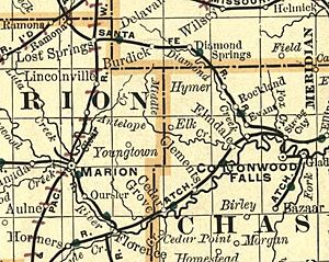
In 1871, the Atchison, Topeka and Santa Fe Railway built a main train line nearby. They built a station called Cedar Grove north of Cedar Point. This railroad is now known as the BNSF Railway, but many local people still call it the "Santa Fe."
Where is Cedar Point?
Cedar Point is located at 38°15′39″N 96°49′18″W / 38.260888°N 96.821662°W. It sits in the beautiful Flint Hills region of the Great Plains. The city covers a small area of about 0.08 square miles (0.21 square kilometers), and all of it is land.
Cool Places to Visit in Cedar Point
Cedar Point has two special places listed on the National Register of Historic Places (NRHP). This means they are important historical sites worth preserving.
- The 1875 Cedar Point Mill: This old mill is a key part of the city's history.
- The 1916 Cottonwood River Pratt Truss Bridge: This historic bridge is located just west of the city.
Who Lives in Cedar Point?
| Historical population | |||
|---|---|---|---|
| Census | Pop. | %± | |
| 1880 | 113 | — | |
| 1920 | 190 | — | |
| 1930 | 141 | −25.8% | |
| 1940 | 140 | −0.7% | |
| 1950 | 107 | −23.6% | |
| 1960 | 87 | −18.7% | |
| 1970 | 73 | −16.1% | |
| 1980 | 66 | −9.6% | |
| 1990 | 39 | −40.9% | |
| 2000 | 53 | 35.9% | |
| 2010 | 28 | −47.2% | |
| 2020 | 22 | −21.4% | |
| U.S. Decennial Census | |||
Cedar Point is part of the Emporia area. The number of people living in Cedar Point has changed over the years. In 1920, there were 190 residents, but by 2020, the population was 22.
A Look at the 2020 Population
The 2020 United States census found 22 people living in Cedar Point. Most residents were white. About half of the households had children under 18. The average age of people in Cedar Point was 26 years old.
A Look at the 2010 Population
In the census of 2010, there were 28 people living in the city. Most residents were white. About a quarter of the households had children under 18. The average age of people in Cedar Point was 51.5 years old.
Learning in Cedar Point
The local schools for Cedar Point are part of the Chase County USD 284 public school district. There are two schools in the district, both located in Cottonwood Falls:
- Chase County Junior/Senior High School
- Chase County Elementary School
Cedar Point used to have its own high school, and its mascot was the Cedar Point Bronchos!
News and Information
Local Newspapers
- Marion County Record: This is the official newspaper for Marion County.
- Hillsboro Free Press: A free newspaper for the wider Marion County area.
Getting Around and Services
How People Travel
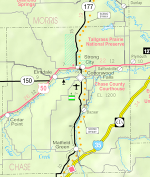
The U.S. Route 50 highway and the BNSF Railway (train tracks) both pass near Cedar Point, running from east to west.
City Services
- Internet: You can get internet service through satellites from companies like HughesNet, StarBand, and WildBlue.
- TV: Satellite TV is available from DirecTV and Dish Network. You can also get TV channels from regional digital TV stations.
- Electricity: Electricity for rural areas is provided by Butler REC.
- Trash: Trash collection services are handled by the City of Florence.
See also
 In Spanish: Cedar Point (Kansas) para niños
 | Tommie Smith |
 | Simone Manuel |
 | Shani Davis |
 | Simone Biles |
 | Alice Coachman |


