City Creek (Salt Lake County, Utah) facts for kids
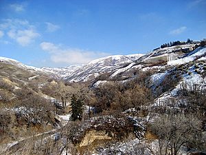
City Creek is a small but very important mountain stream in Salt Lake City, Utah. It flows from City Creek Canyon and goes through part of the city. Then it joins the Jordan River, which eventually flows into the Great Salt Lake.
The stream starts about 8 miles (13 km) northeast of Downtown Salt Lake City. The whole stream is only about 14.5 miles (23 km) long. Most of its water comes from melting snow in the nearby mountains. But natural springs at the start of the creek keep it flowing all year round.
For many years, until 1882, City Creek was the main source of water for Salt Lake City. It still provides drinking water to areas like The Avenues and other northern parts of the city today.
Contents
History of City Creek
Pioneers and Early Water Use
The first Mormon pioneers arrived in Utah and camped by City Creek Canyon on July 22, 1847. This area is now near State Street and North Temple in Salt Lake City. The stream originally split into two branches. One went south through what is now Washington Square. The other main branch flowed west towards Temple Square. Both branches eventually flowed into the Jordan River.
The pioneers, led by Orson Pratt, immediately used the stream. They diverted its water to soften the dry soil so they could plant crops. By July 24, when Brigham Young and his group arrived, five acres (20,000 m²) of potatoes were already planted!
On August 22, 1847, Brigham Young named the creeks in Salt Lake Valley. He called this one City Creek because it was right in the middle of the city the pioneers planned to build.
Managing the Water
Brigham Young declared that the rights to all rivers belonged to everyone. At first, local church leaders managed the water. In 1850, Brigham Young gained control of the water rights himself, but the local leaders still helped distribute it. When Salt Lake City became an official city in 1851, the city council took over the job of distributing water.
City Creek's western branch was channeled, and canals were dug on both sides of every street in Salt Lake City. Water was delivered to homes by opening gates to these street canals. This system, managed by special "water masters," brought drinking water and water for farming to ditches in front of every resident's property.
Modern Water System
A new system with pipes was built to serve downtown in 1876. It was finished by June 1877. However, some parts of the city, like The Avenues (then called "the dry bench"), still didn't have easy access to water. People there had to carry water uphill from City Creek.
In 1878, residents of The Avenues asked the city to expand the water system. A new diversion was made in 1884, piping water to residents on 6th Avenue and below. More diversions were built over time to reach higher parts of the city. By 1910, a diversion was finally built high enough to provide water to the entire city.
Water became harder to find in Salt Lake City in the 1860s, especially during dry years. The US Army took control of Red Butte Creek for Fort Douglas in 1862. Salt Lake City was also growing quickly. This led the city council to build a canal to bring more water from Utah Lake, which is 35 miles (56 km) south. The Jordan-Salt Lake Canal was finished in 1882. This gave Salt Lake City a reliable source of water for farming.
In 1909, the creek was placed in an underground pipe along North Temple Street. It flowed underground from Memory Grove to west of the State Fairpark, where it then entered the Jordan River.
The Great Flood of 1983
City Creek stayed underground for many years. But in the winter of 1982-1983, there was a huge amount of snow. When warmer weather arrived suddenly in May, the snow melted very fast. This caused the stream to swell to an enormous size.
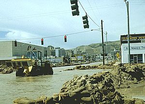
On Saturday night, May 28, the underground pipe on North Temple became blocked. The entire river overflowed into the streets! It rushed down Canyon Road and onto State Street. Volunteers worked quickly that Sunday morning, filling sandbags to protect buildings. They channeled the water down the east side of State Street to large storm sewers near the Salt Lake City and County Building. When those sewers overflowed, the "State Street River" extended all the way to 1300 South. There, the water joined other streams in pipes and flowed to the Jordan River. Temporary bridges were built over State Street so people could cross.
The stream returned to its normal path on June 11, but cleanup took several more weeks. The flood became a popular sight, and some people suggested bringing the stream permanently above ground. This attention led to improvements for City Creek.
The next year, students and Boy Scouts built the "Freedom Trail" in the lower part of City Creek Canyon. In 1986, Salt Lake City created the "City Creek Master Plan." Its goal was to protect the canyon around City Creek as an important area for water, recreation, and open space for the whole city.
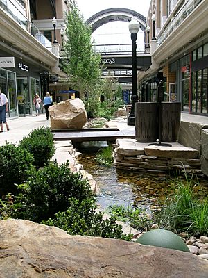
When The Church of Jesus Christ of Latter-day Saints finished the LDS Conference Center in 2000, part of the stream became visible again. City Creek now flows freely by the center in a rough stone bed, adding to the building's waterfall feature.
Canyon Fire
On July 29, 2008, a large grass fire started in a part of the canyon. By the next day, it had burned more than 180 acres (0.73 km²). It was determined that people caused the fire, as there was no lightning that day.
City Creek Canyon
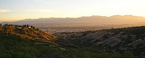
For a short time in 1873, people explored City Creek Canyon for minerals. They found silver, lead, and gold. A town called Modoc City was even built for the miners. However, the mining was not profitable, and it stopped in 1874.
In the early 1900s, Salt Lake City and the US government worked together to buy the watershed of City Creek. As of 2005, most of the area is owned and protected by the government forever. This was originally done to keep the water supply clean. But now, people who support open space also see it as a success for protecting wildlife.
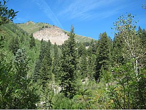
City Creek Canyon has almost no private buildings. It is less than one mile (1.6 km) from the Utah State Capitol and downtown Salt Lake City. A single road goes up the canyon. You can reach it by walking from Memory Grove Park or by using Bonneville Boulevard. This road circles the canyon, connecting The Avenues with Capitol Hill.
Bonneville Boulevard is a two-lane road, but cars can only use one lane. This lane is used as a single-lane road for cars. The other lane is shared by bicycles and people walking, who can travel in both directions. The canyon road is open to private cars for a small fee on even calendar days and holidays, from Memorial Day weekend to the end of September. Bicycles are allowed on odd calendar days during the summer, except holidays. You can reserve picnic sites. The canyon is closed to cars during the winter, but it is open to bicycles and people walking. Dogs are allowed in the canyon on a leash below the water treatment plant. The boundary for this area is clearly marked with signs near the four-mile marker.
Crossings
The only road that crosses the canyon north of Fourth Avenue (200 North) is the winding, one-way Bonneville Boulevard. However, there have been plans for a more direct crossing in the past. For example, in 1916, the Salt Lake City Commission asked for bids to build a bridge at 11th Avenue.
Later, during World War II, a 7-mile (11 km) northern bypass of downtown Salt Lake City was planned. It would have connected Fort Douglas with US-89 near North Salt Lake. The state legislature named it State Route 231 in 1941. It was planned to follow 11th Avenue from the fort to a canyon crossing, then curve north around Ensign Peak to North Salt Lake. But this road was never built and was removed from the state highway system in 1945.
|
 | Emma Amos |
 | Edward Mitchell Bannister |
 | Larry D. Alexander |
 | Ernie Barnes |


