Craigavon facts for kids
Quick facts for kids Craigavon
|
|
|---|---|
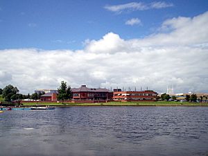 Craigavon Civic Centre from Craigavon Lakes |
|
| Population | (2021)
|
| Irish grid reference | J042562 |
| • Belfast | 21 miles (34 km) |
| District |
|
| County | |
| Country | Northern Ireland |
| Sovereign state | United Kingdom |
| Post town | CRAIGAVON |
| Postcode district | BT62–BT67 |
| Dialling code | 028 |
| Police | Northern Ireland |
| Fire | Northern Ireland |
| Ambulance | Northern Ireland |
| EU Parliament | Northern Ireland |
| UK Parliament |
|
| NI Assembly |
|
| Website | www.craigavon.gov.uk |
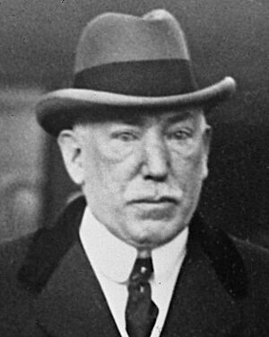
Craigavon (/kreɪˈɡævən/ kray-GAV-ən; Irish: Creag Abhann) is a town in northern County Armagh, Northern Ireland. Its building started in 1965. It was named after James Craig, 1st Viscount Craigavon, the first Prime Minister of Northern Ireland.
The original idea was for Craigavon to be the center of a new "linear city." This city would connect the towns of Lurgan and Portadown. However, this plan was mostly stopped. Today, "Craigavon" usually means the area between these two towns.
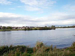
Craigavon is built next to two man-made lakes. It has a large residential area called Brownlow. There is also a smaller area called Mandeville. A central area, Highfield, has a big shopping center, a courthouse, and the local council offices. The area around the lakes is a public park with walking trails. It is also a safe place for wildlife. You can find a watersports center, a golf course, and a ski slope nearby. In most of Craigavon, cars are kept separate from people walking and cycling. Many roundabouts are used for traffic.
Craigavon sometimes refers to the larger Craigavon Urban Area. This name is used by the Northern Ireland Statistics and Research Agency. It includes Craigavon, Lurgan, Portadown, and Aghacommon.
Contents
History of Craigavon
Building a New City
Craigavon was planned as a 'new city' for Northern Ireland. It was similar to new towns built in Great Britain, like Cumbernauld. The idea was to link Lurgan and Portadown into one big urban area. This plan was made because experts thought the population would grow a lot. More homes would be needed in the future.
Building new towns had worked well in Great Britain. So, Craigavon was also a way to show that Northern Ireland was modern. It also showed it was part of the British mainstream. The Craigavon Development Commission started in October 1965. They bought about 6,000 acres of land for the new city.
The location was chosen for several reasons. It was near existing towns and industries. It was also close to Belfast. Planners hoped Craigavon would help spread development away from Belfast. They thought people from Belfast would like its suburban design. Businesses might also find it an interesting place. Some families were even offered money to move there. The M1 motorway was built to connect Craigavon with Belfast. A new hospital, Craigavon Area Hospital, was also built.
Modern Design and Green Spaces
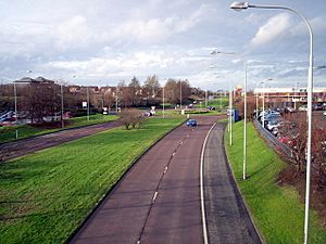
Craigavon's design was very modern. Planners wanted to keep cars, walkers, and cyclists separate. They built a network of paths. This allowed people to travel around Craigavon without meeting traffic. The roads for cars used roundabouts instead of traffic lights. This made it easier to add more lanes if needed. All electricity cables were placed underground. Street lighting was also put everywhere.
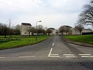
Homes were grouped around small 'village centers'. These centers had shops, leisure places, and schools. They also had post offices and community centers. All housing areas were built with safety in mind. They usually had only one way in and out for cars. Different types of land use were kept separate. For example, industrial areas were far from homes.
Craigavon was designed to be very child-friendly. Small playgrounds were placed in many residential areas. There was a focus on having green spaces in housing estates. Safe paths for cycling were also important. National Cycle Route 9 goes through the town. Craigavon also got many public facilities. These included a leisure center, library, and shopping center. There was a large park with artificial lakes. It also had playing fields, a petting zoo, and an artificial ski slope. The Craigavon Civic Centre cost £3 million to build. It opened in April 1983.
Challenges and Changes
Building Craigavon faced some problems. There was debate about where to build the new city. Some felt it should have been in Derry, a mainly Catholic city. Instead, it was built in a mainly Protestant area. There was also disagreement about naming it after James Craig, 1st Viscount Craigavon. He was a Protestant leader. Some people thought this name would not help bring communities together. When the name was announced in 1965, some people protested.
Problems also appeared with some of the new homes. They were built with new materials and methods. This meant they sometimes lacked good insulation or sound-proofing. Then, 'the Troubles' began in the late 1960s. This led to violence and separation between communities. Less money was invested in Northern Ireland. More people also moved away.
The Craigavon Development Commission closed in 1973. The Craigavon Borough Council was then created. A large factory, Goodyear, was a main employer. It made fan-belts and was Europe's biggest factory at the time. But it closed in 1983.
Because of these issues, about half of the planned city was never built. Some buildings that were built became empty and had to be torn down. The area meant to be Craigavon's 'city center' mostly had only council buildings, courts, and a shopping mall. It was surrounded by empty green land. Experts later said the plan for Craigavon was "flawed from the outset." They felt the cycle paths and mixed housing would not work.
The idea of a new "Craigavon city" never really became popular. Today, locals use 'Craigavon' to mean the area between Lurgan and Portadown. Many people from Lurgan and Portadown do not like being called part of Craigavon. The plan to bring communities together also largely failed. People who moved to Craigavon often chose to live near their original towns. For example, Catholics often moved closer to Lurgan. Protestants often moved closer to Portadown. This separation became worse during the Troubles.
Impact of the Troubles
During the Troubles, Craigavon saw many violent events. These events led to people being killed. The conflict caused serious problems for the area. It made it hard for communities to live together. It also affected the growth and development of the town.
Geography of Craigavon
Craigavon is on flat land near the southeastern shore of Lough Neagh. Nearby towns include Aghacommon to the north and Lurgan to the northeast. To the east is Corcreeny. Bleary is to the southeast, and Portadown is to the southwest. Fields mostly separate Craigavon from these places.
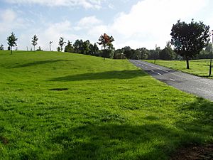
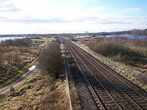
Craigavon is built next to two man-made lakes. These are called Craigavon Lakes. The railway line runs between the two lakes. Further north is the M1 motorway. This motorway runs parallel to the railway line. The area around Craigavon Lakes is a public park. It is also a safe place for wildlife. It has woodlands and walking trails. In 2017, it was named the best park in Northern Ireland. There are plans to build a college campus in the park. Some locals are against this because it would mean destroying woodland. This woodland is home to endangered wildlife.
Local Areas (Townlands)
Much of Craigavon is in the civil parish of Seagoe. Here are some of the local areas, called townlands, within Craigavon's urban area. Their names often come from old Irish words:
- Balteagh (meaning "Fiach's townlands")
- Clanrolla (meaning "meadow of the shaft")
- Crossmacahilly (meaning "McAughley's crossroads")
- Drumgask (meaning "Easter ridge")
- Drumgor (meaning "ridge of the herons")
- Drumnagoon (meaning "O'Doone's ridge")
- Knockmenagh (meaning "the middle hill")
- Legaghory or Legahory (meaning "hollow of the cauldron")
- Monbrief (perhaps meaning "plain of the rising ground" or "plain of wolves")
- Moyraverty or Moyraferty (meaning "Raifeartach's plain")
- Tamnafiglassan (meaning "grassy field of the finch")
- Tannaghmore West (meaning "big grassy field")
- Tullygally (meaning "white hills")
Population Information (Demography)
The NI Statistics and Research Agency (NISRA) does not count Craigavon as a separate town for census. Instead, it is grouped with Portadown, Lurgan, and Bleary. This group is called the "Craigavon Urban Area." This makes it hard to know the exact population of the area most people call Craigavon. This area is mainly between Portadown and Lurgan. In the late 1970s and early 1980s, Craigavon welcomed many families who were refugees from the Vietnam War.
2021 Census Data
| National Identity of Craigavon Urban Area residents (2021) | ||||
|---|---|---|---|---|
| Nationality | Per cent | |||
| British | 35.9% | |||
| Irish | 31.9% | |||
| Northern Irish | 26.9% | |||
| Religious background of Craigavon Urban Area residents (2021) | ||||
|---|---|---|---|---|
| Religion | Per cent | |||
| Roman Catholic | 52.3% | |||
| Protestant | 36.0% | |||
| No religion/Not stated | 10.1% | |||
| Other religions | 1.6% | |||
On 21 March 2021, the Craigavon Urban Area (including Aghacommon) had 72,301 people living there.
- About 52% of people were Catholic or grew up Catholic.
- About 36% of people were Protestant or grew up Protestant.
- About 36% said they had a British national identity.
- About 32% said they had an Irish national identity.
- About 27% said they had a Northern Irish national identity. People could choose more than one identity.
2011 Census Data
On 27 March 2011, the Craigavon Urban Area (including Aghacommon) had 64,323 people. This was about 3.55% of Northern Ireland's total population.
- About 97.5% of people were from the white ethnic group.
- About 51% were Catholic or grew up Catholic.
- About 42.5% were Protestant or grew up Protestant.
- About 43.8% said they had a British national identity.
- About 27.8% said they had an Irish national identity.
- About 28% said they had a Northern Irish national identity. People could choose more than one identity.
In the Craigavon District Electoral Area, for people aged 3 and over:
- About 11% knew some Irish.
- About 4.6% knew some Ulster-Scots.
- About 8% did not have English as their first language.
Education in Craigavon
Craigavon has several schools for different age groups.
Primary Schools
- Drumgor Primary School (Controlled)
- St Anthony's Primary School (Catholic Maintained)
- St Brendan's Primary School (Catholic Maintained)
- Tullygally Primary School (Controlled) - This is a mixed-religion school. It usually has about 100 students. It was built when Craigavon was first founded. Part of the school now has an adult learning center. There are many more primary schools in the wider Craigavon area, like in Lurgan and Portadown.
Post-primary Schools
- Brownlow Integrated College (Controlled) - This was one of the first integrated secondary schools in Northern Ireland. Integrated schools teach students from both Catholic and Protestant backgrounds together.
- Lismore Comprehensive School (Catholic Maintained)
There are also plans to build a Southern Regional College campus next to Craigavon Lake. Some local people are against these plans. They worry it would destroy woodland that is home to endangered wildlife.
Sports in Craigavon
Craigavon is home to several sports clubs:
- Éire Óg Gaelic Football Club – This club plays Gaelic football. They have won both Junior and Intermediate honors in the Armagh All County League.
- Craigavon United F.C. – This is a football (soccer) club. They won the Milk Cup in 1986.
- Craigavon City F.C. – This football club started in 2007. In their first season, they finished 4th in their league. They also won the John Magee Memorial Cup.
- Craigavon Cowboys – This is the only American football team in County Armagh. They won the IAFL DV8s league in 2009. They returned to the main IAFL league in 2010.
Twin Towns
Craigavon has sister cities, also known as twin towns:
 LaGrange, Georgia, United States
 Ballina, County Mayo, Republic of Ireland


