Lurgan facts for kids
Quick facts for kids Lurgan
|
|
|---|---|
Statue of linen-makers in Lurgan town centre |
|
| Population | 28,634 (2021 Census) |
| Irish grid reference | J080585 |
| • Belfast | 18 miles (29 km) |
| District |
|
| County | |
| Country | Northern Ireland |
| Sovereign state | United Kingdom |
| Post town | CRAIGAVON |
| Postcode district | BT66, BT67 |
| Dialling code | 028 |
| Police | Northern Ireland |
| Fire | Northern Ireland |
| Ambulance | Northern Ireland |
| EU Parliament | Northern Ireland |
| UK Parliament |
|
| NI Assembly |
|
Lurgan (from Irish: An Lorgain, meaning "the long low ridge") is a town in County Armagh, Northern Ireland. It's located near the southern shore of Lough Neagh. Lurgan is about 18 miles (29 km) southwest of Belfast. You can reach Belfast from Lurgan by the M1 motorway or the Belfast–Dublin railway line.
In 2021, Lurgan had a population of about 28,634 people. It is part of the Armagh, Banbridge and Craigavon district. Sometimes, Lurgan is seen as part of the "Craigavon Urban Area." This area also includes nearby Craigavon and Portadown.
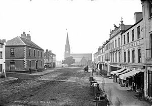
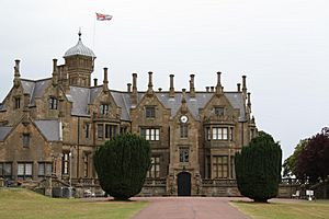
Lurgan is a good example of a town built during the Plantation of Ulster. It has wide, straight, planned streets. The town is home to important historic buildings like Brownlow House and Lurgan Town Hall. Lurgan Park is the biggest urban park in Northern Ireland.
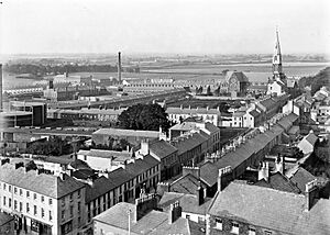
After the Industrial Revolution, Lurgan became famous for making linen. This industry was very important until it slowly declined in the late 1900s. In the 1960s, the new city of Craigavon was built. This brought many new industries to the area, which also affected Lurgan.
Contents
History of Lurgan
The name Lurgan comes from the Irish name An Lorgain. This means "the shin," but for places, it refers to a long, low, and narrow hill or ridge. Before the 1600s, the area was controlled by the Mac Cana (McCanns) family.
Around 1610, during the Plantation of Ulster, the land of Lurgan was given to an English lord named William Brownlow. His family built a castle and a strong wall (called a bawn) by 1619. They also built a town with 42 houses for English families. The streets were paved, and there were mills for grinding corn.
During the Irish Rebellion of 1641, Brownlow's castle was destroyed. He and his family were taken prisoner. They were later released, and the Brownlow family returned to Lurgan. They helped the linen industry grow in the late 1600s.
The Great Famine's Impact
In 1841, a workhouse was built in Lurgan. Workhouses were places where very poor people could get help. Lurgan's population grew quickly from 1821 to 1841. Many people moved to the town for jobs in the linen industry or construction.
This led to overcrowding and poor living conditions. When the potato crop failed in 1846, it caused a terrible famine. The workhouse, built for 800 people, became too full.
Local leaders set up a relief committee. They raised money to buy food and gave it out at soup kitchens. Lord Lurgan also created jobs by having people drain land on his estate. This helped some people earn money for food.
Between 1846 and 1849, the famine caused 2,933 deaths in the Lurgan area. A mural at Lurgan Hospital remembers this time.
A New City Develops
Lurgan grew for centuries as a town for industry and trade. In the 1960s, the government planned a "new town" called Craigavon. This was to help with Belfast's growing population. The idea was for Craigavon to connect Lurgan and Portadown.
This plan didn't fully work as intended. However, the Craigavon development did change Lurgan. New housing areas in Lurgan got special paths for bikes and walkers. More land was set aside for factories and businesses. The town's population also grew, though not as much as expected.
The textile industry was a main employer in Lurgan until the late 1900s. But then, it became cheaper to make clothes in other countries. This caused the textile industry in Lurgan to decline.
The Troubles in Lurgan
Lurgan, along with Portadown and Craigavon, saw many incidents during The Troubles. This was a period of conflict in Northern Ireland. Even today, there can be tension between different groups in the town. Sometimes, this tension leads to violence in certain areas where communities meet.
Geography of Lurgan
Lurgan is in the northeast part of County Armagh. It's a fairly flat area near the southeast shore of Lough Neagh. The town is close to the borders of County Down and County Antrim. The oldest part of Lurgan, the main street, is built on a long ridge. Brownlow House sits on a nearby hill, looking over Lurgan Park.
Townlands in Lurgan
Like other parts of Ireland, the Lurgan area is divided into townlands. These are small areas of land, and their names often come from the Irish language. Lurgan itself grew up in the townland of the same name. Many roads and housing areas in Lurgan are named after these surrounding townlands.
Here are some townlands in Lurgan's urban area and what their names might mean:
- Aghnacloy (from Irish Achadh na Cloiche, meaning 'field of the stone')
- Derry (from Doire meaning "oak grove")
- Drumnamoe (from Druim na mBó meaning "ridge of the cows")
- Shankill (from Seanchill meaning "old church" or Seanchoill meaning "old wood")
- Tannaghmore North & Tannaghmore South (from an Tamhnach Mór meaning "the big grassy field")
- Silverwood (an English name – used to be called Killinargit, from Coill an Airgid meaning "wood of the silver")
Lurgan's Climate
Lurgan has a temperate climate, like many inland areas in Ireland. In summer, temperatures can reach the 20s °C. It's rare for them to go above 30 °C (86 °F). Ireland's humid climate can make even these temperatures feel quite warm.
| Climate data for Lurgan | |||||||||||||
|---|---|---|---|---|---|---|---|---|---|---|---|---|---|
| Month | Jan | Feb | Mar | Apr | May | Jun | Jul | Aug | Sep | Oct | Nov | Dec | Year |
| Mean daily maximum °C (°F) | 7 (45) |
8 (46) |
10 (50) |
12 (54) |
15 (59) |
17 (63) |
19 (66) |
19 (66) |
16 (61) |
13 (55) |
10 (50) |
7 (45) |
13 (55) |
| Mean daily minimum °C (°F) | 2 (36) |
2 (36) |
3 (37) |
4 (39) |
6 (43) |
9 (48) |
11 (52) |
10 (50) |
9 (48) |
7 (45) |
4 (39) |
3 (37) |
6 (43) |
| Average precipitation cm (inches) | 5.6 (2.2) |
4.67 (1.84) |
4.46 (1.76) |
4.62 (1.82) |
4.22 (1.66) |
4.38 (1.72) |
4.49 (1.77) |
4.84 (1.91) |
4.58 (1.80) |
6.79 (2.67) |
5.94 (2.34) |
5.61 (2.21) |
60.2 (23.7) |
| Source: MSN.com | |||||||||||||
How Lurgan is Governed
Lurgan is part of the Upper Bann constituency. This is for elections to the UK Parliament in Westminster. The current MP is Carla Lockhart from the Democratic Unionist Party.
Members of the Northern Ireland Assembly at Stormont are also elected from this area.
Local government in Lurgan has changed over time. In 1855, town commissioners were elected. Later, the Lurgan Urban District Council took over. In 1973, this council was replaced. Lurgan became part of the Craigavon Borough Council. Today, Lurgan is part of the new Armagh, Banbridge and Craigavon District.
Population and Communities
| Historical population | ||
|---|---|---|
| Year | Pop. | ±% |
| 1821 | 2,715 | — |
| 1831 | 2,842 | +4.7% |
| 1841 | 4,677 | +64.6% |
| 1851 | 4,205 | −10.1% |
| 1861 | 7,772 | +84.8% |
| 1871 | 10,632 | +36.8% |
| 1881 | 10,135 | −4.7% |
| 1891 | 11,429 | +12.8% |
| 1901 | 11,782 | +3.1% |
| 1911 | 12,553 | +6.5% |
| 1926 | 12,500 | −0.4% |
| 1937 | 13,766 | +10.1% |
| 1951 | 16,183 | +17.6% |
| 1961 | 17,872 | +10.4% |
| 1966 | 20,673 | +15.7% |
| 1971 | 25,431 | +23.0% |
| 1981 | 20,991 | −17.5% |
| 1991 | 21,905 | +4.4% |
| 2001 | 23,534 | +7.4% |
| 2011 | 25,069 | +6.5% |
| 2021 | 28,634 | +14.2% |
For counting people, Lurgan is often grouped with Craigavon, Portadown, and Bleary. Together, they form the "Craigavon Urban Area." In 2021, the combined population of the Lurgan urban area was 31,068.
In 2011, about 62.2% of the people were from a Catholic background. About 33.7% were from a Protestant or other Christian background.
The town has areas where people from different backgrounds live. The north end of the town centre is mostly Catholic/Nationalist. The south end is mostly Protestant/Unionist. This "dividing line" starts at the end of Market Street. Over the years, some areas have changed from one community to another.
Lurgan's Economy
Lurgan has always been an industrial town. The linen industry was once the biggest employer. At the end of the 1800s, it's said that 18,000 people worked as handloom weavers. This was much more than the town's population at the time!
The linen industry changed as people wanted different things. Other textile factories kept providing jobs until the 1990s and 2000s. Then, many textile jobs moved to countries where labor was cheaper.
The large Goodyear factory was built in Lurgan as part of the Craigavon development. It made fan-belts. This factory closed in 1983, and 750 people lost their jobs. Other factories and engineering companies still operate in Lurgan's industrial areas.
A big shopping center called Rushmere Retail Park was built between Lurgan and Portadown. This has made it harder for shops in Lurgan's traditional town center to compete.
Culture and Community Life
Community Places
Oxford Island is a nature reserve on the shore of Lough Neagh. It has Kinnego Marina and the Lough Neagh Discovery Center. This center teaches visitors about local wildlife.
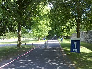
Lurgan Park is very close to the main street. It is the biggest urban park in Northern Ireland. It's the second largest in all of Ireland, after Phoenix Park in Dublin. The park used to be part of the Brownlow House estate. In 1893, the town bought the land. It opened as a public park in 1909. The park has a large artificial lake and a special fountain. Today, Lurgan Park hosts events like the Lurgan Agricultural Show. It also hosts the Lurgan Park Rally, a big motor sport event.
Mount Zion House is a community center in Edward Street. It used to be a convent. Now, it's a place for people from all parts of the community.
Famous Landmarks
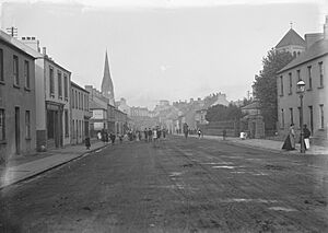
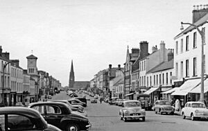
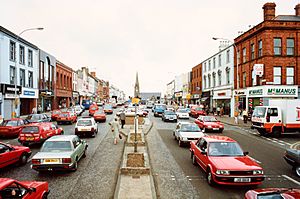
Lurgan town center is known for its wide main street, Market Street. It's one of the widest streets in Ireland. At one end, you can see Shankill (Anglican) Church. There's also a grey granite war memorial with a bronze statue. It lists the names of over 400 men from the town who died in the First World War.
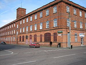
The town's straight streets are common in towns built during the Plantation. Lurgan's history of industry can still be seen. Many old linen mills have been changed for new uses today.
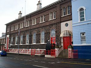
Lurgan Town Hall is a listed building from 1868. It's at the corner of Market Street and Union Street. It used to be the town's library. Today, it's used for meetings and community events.
Brownlow House, often called 'Lurgan Castle', is a special mansion. It was built in 1833 from Scottish sandstone. It looks like an Elizabethan manor house. The Brownlow family used to own it. Now, it belongs to the Lurgan Loyal Orange District Lodge. Lurgan Park, which is next door, used to be part of the same estate.
Places of Worship
Shankill cemetery has been a place of worship for centuries. It was once an ancient ring fort. Today, it's a historic burial site. It holds the remains of early town residents, including the Brownlow family. Dougher cemetery is another old graveyard. The Brownlows gave it to the Catholic people.
The two most noticeable churches are Shankill Parish Church and St Peter's Church. Their tall steeples can be seen from far away.
Shankill Parish Church belongs to the Anglican Church of Ireland. The first church was built in 1411. A new church was built in Lurgan in 1609. The current church was built in 1725. It is thought to be the largest parish church in Ireland.
St Peter's Church in North Street is a Catholic church. Work on it began in 1832. In 1966, another Catholic church, St Paul's, was built. It has a modern design with a copper roof and slim spire.
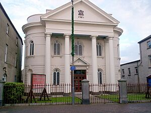
The first Methodist church in Lurgan was built in 1778. A new one was built on High Street in 1802, and then replaced in 1826. This church was updated in 1910 and is still there today.
Education in Lurgan
Formal education in Lurgan developed in the late 1800s. Before that, children often learned in less organized "hedge schools."
Today, schools in Lurgan use the Dickson Plan. This system lets 11-year-olds choose to take an exam to enter grammar schools. Students in other schools are placed into different learning groups. They can move between groups based on how well they do. At age 14, they can take exams to enter a grammar school for GCSEs and A-levels.
Most schools in Northern Ireland are mainly for children from one of the two main community groups. Some schools are Catholic schools. Others are state-controlled schools, which usually have mostly Protestant students.
Primary Schools
- Lurgan Model Primary School (Controlled) – This school was part of a national program started in 1831. It was meant to be an example for other schools. It welcomes students of all backgrounds.
- St. Francis' Primary School and Bunscoil Naomh Proinsias (Catholic Maintained)
- St Teresa's Primary School (Catholic Maintained)
- St Anthony's Primary School (Catholic Maintained)
- Tannaghmore Primary School (Catholic Maintained)
- Tullygally Primary School (Catholic Maintained)
- Carrick Primary School (Controlled)
- Dickson Primary School (Controlled)
- King's Park Primary School (Controlled)
Post-Primary Schools
- Lurgan College – This is a grammar school for students aged 14–18. It started in 1873 as an all-boys school. It focused on traditional academic subjects.
- St Ronan's College – This is a secondary school for students aged 11–18. It was formed by combining three other schools: St Mary's Junior High School, St Paul's Junior High School, and St Michael's Grammar School.
- Lurgan Junior High School – This is a high school for students aged 11–14.
Some students from Lurgan also go to Lismore Comprehensive School and Brownlow Integrated College in Craigavon.
- Southern Regional College – This college offers vocational courses and adult education. It was formed by combining several smaller colleges, including Lurgan Technical College.
Special Needs Education
Ceara School provides education for students aged 3 to 19 who have severe learning difficulties.
Sports and Fun Activities
Facilities for Sport
Lurgan has two 18-hole golf courses. There's also an artificial ski slope and a place for horse show jumping.
Gaelic Games
Lurgan has a strong GAA presence. Many clubs play Gaelic football, such as Clan na Gael CLG and Clann Éireann GAC. There's also a good girls' camogie club at Clann Éireann. The hurling club, Seán Treacy's, has joined with Portadown's St Malachy's for youth hurling.
Football
The town is home to NIFL Premiership club Glenavon. They were founded in 1889 and play at Mourneview Park. In 1952, Glenavon was the first club outside Belfast to win the Irish League title. They won two more titles in 1957 and 1960.
Other football clubs in Lurgan include Lurgan Town and Oxford Sunnyside. Lurgan Celtic used to play in higher leagues but stopped due to money problems. They plan to play in a lower league again.
Other Sports
Boxing is popular in Lurgan, with clubs like South Paw Boxing and The Fitness Factory.
For Cricket, there are two clubs: Lurgan Cricket Club and Victoria Cricket Club. Rugby union is played by Lurgan RFC. They share their ground with Lurgan Cricket Club.
Tennis is played at Lurgan Tennis Club in Lurgan Park. Lurgan Golf Club is an 18-hole course next to Lurgan lake.
The Lurgan Park Rally started in 1980. It was one of the biggest motorsport events in Ireland. However, it hasn't happened since 2017.
Lurgan Park also has Lurgan Bowling Club, which has teams for lawn bowling.
Getting Around Lurgan
Train Travel
Lurgan railway station opened in 1841. It connected Lurgan to Belfast and Portadown.
Today, Northern Ireland Railways runs trains from Lurgan railway station. You can take direct trains to Belfast Grand Central. The Enterprise train also passes through Lurgan, connecting Dublin Connolly to Belfast. You might need to change trains at Portadown to go to Newry or Dublin.
You can also connect to George Best Belfast City Airport from Sydenham on the line to Bangor.
Roads and Public Services
Lurgan is located near the M1 motorway, which connects it to Belfast. Translink provides regular bus services from Market Street. Buses go to Belfast, Portadown, Armagh, Dungannon, and nearby areas.
Northern Ireland Electricity supplies electricity. Northern Ireland Water provides water.
Local Media
Lurgan has two weekly local newspapers. The Lurgan Mail reports on news and sports from the area. The 'Lurgan and Portadown Examiner' used to report local news but stopped publishing in 2017.
Famous People from Lurgan
Living People
- Jocelyn Bell Burnell (born 1943) – A famous astrophysicist who helped discover pulsars.
- Barry Douglas (born 1960) – A classical pianist and conductor.
- Jim Harvey (born 1958) – A professional footballer and assistant manager for the Northern Ireland football team.
- Geraldine Heaney (born 1967) – A Canadian women's ice hockey player and Olympic gold medalist.
- Gayle Williamson (born 1980) – Miss Northern Ireland and Miss United Kingdom in 2002.
- Neil Lennon (born 1971) – A well-known football player and manager.
- Jonathan Magee (born 1972) – An academic and former footballer.
People from the Past
- Edward Costello (1887–1916) – Took part in the Easter Rising in 1916.
- John Cushnie (1943–2009) – A broadcaster known for the BBC Radio 4 show Gardeners' Question Time.
- Field Marshal Sir John Dill (1881–1944) – A British commander in World War I and World War II.
- William McFadzean (1895–1916) – A soldier who was awarded the Victoria Cross.
- Len Ganley (1943–2011) – A world championship snooker referee.
- James Logan (1674–1751) – Became an American statesman and scholar.
- Rosemary Nelson (1958–1999) – A human rights lawyer.
- Martin O'Hagan (1950–2001) – A journalist for the Sunday World newspaper.
- George William Russell (1867–1935) – A writer, poet, and painter who wrote under the name Æ.
- Philip Felix Smith (1825–1906) – A soldier who received the Victoria Cross.
- Norman Uprichard (1928–2011) – A goalkeeper who played for Northern Ireland.
- Ike Weir (1867–1908) – A boxer, known for being the first Featherweight Champion of the World.
See also
 In Spanish: Lurgan para niños
 | Jewel Prestage |
 | Ella Baker |
 | Fannie Lou Hamer |


