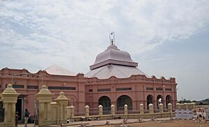
Cuddalore facts for kids
Quick facts for kids
Cuddalore
|
|
|---|---|
|
City
|
|
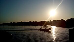 |
|
| Nickname(s):
Sugar bowl of Tamil Nadu
|
|
| Country | India |
| State | Tamil Nadu |
| District | Cuddalore |
| Region | Tondai Nadu |
| Government | |
| • Type | Municipal Corporation |
| • Body | Cuddalore City Municipal Corporation |
| Elevation | 1 m (3 ft) |
| Population
(2021)
|
|
| • Total | 308,781 |
| Demonym(s) | Cuddalorean |
| Languages | |
| • Official | Tamil, English |
| Time zone | UTC+5:30 (IST) |
| PIN |
607001-06 / 607401-02
|
| Telephone code | 04142 / 0413(some areas) |
| Vehicle registration | TN-31 |
| Website | https://cuddalore.nic.in/ |
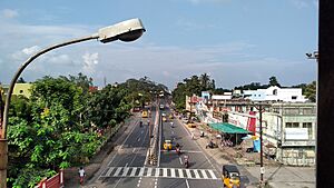
Cuddalore, also known as Kadalur, is a busy city and port in the Indian state of Tamil Nadu. It is the main city of the Cuddalore District. Cuddalore is located south of Chennai and was a very important city and port during the time of British rule in India.
The early history of Cuddalore is not fully clear. However, the city became well-known during the rule of the Pallavas and Medieval Cholas. After the Cholas, different groups ruled the town. These included the Pandyas, Vijayanagar Empire, Madurai Nayaks, Thanjavur Nayaks, Thanjavur Marathas, Tipu Sultan, the French, and the British Empire.
Cuddalore was a key location during the Seven Years' War and the Battle of Cuddalore in 1758, where the French and British fought. India became independent in 1947, and Cuddalore has been part of independent India since then. In 2004, a huge tsunami hit the Indian Ocean. Cuddalore was one of the towns affected, and sadly, 572 people lost their lives.
Besides fishing and port activities, Cuddalore has many industries. These include chemical, medicine, and energy companies. Many of these are in SIPCOT, an industrial area set up by the government. The city is managed by a municipal corporation and covers an area of 101.6 square kilometers. In 2011, its population was 308,781 people.
Cuddalore has many schools and colleges. It also has a government hospital and many private hospitals to care for its citizens. Roads are the main way to travel, but the city also has train connections. The closest major airport is Chennai International Airport, about 200 km away. There is also a local airport in Neyveli. The Cuddalore Port handles smaller cargo ships.
Contents
What Does the Name Cuddalore Mean?
Before the English took over, Cuddalore was called Kūṭalūr in Tamil. This name means "confluence," which refers to a place where rivers meet. Cuddalore is located where several rivers meet. These rivers are the Ponnaiyar River, Gadilam River, Uppanar River, and Paravanar River.
The Cuddalore district was historically part of Chola Nadu and Nadu Naadu. The name Nadu Naadu means "middle country." This name might come from its location between Chola Nadu and Tondaimandalam. It could also be because it was between the Pallavas and the Cholas, or between central areas and the ocean.
A Look at Cuddalore's Past
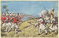
Cuddalore has been a seaport for a very long time. For two centuries, different foreign powers controlled Cuddalore. These included the Dutch, Portuguese, French, and the British. Until 1758, Cuddalore was the capital for the British-controlled areas in South India. The British ruled a large part of South India from Fort St. David in Cuddalore.
In the early 1600s, the Dutch wanted to build a fort here. However, they had to give up their plans because of pressure from their Portuguese rivals. Later, the French and English came to Cuddalore for trade. The French set up a settlement in Pondicherry in 1674. Then, in 1690, the British started their colony at Fort St. David in Cuddalore.
During the 1700s, wars between European countries often spread to their colonies, including those in India. The French and British fought many times in the Cuddalore area during this period.
- In 1746, during the First Carnatic War, French forces tried to capture Fort St. David from the British. The British held on until 1747.
- In 1758, during the Seven Years' War, the French took the fort. There was also a naval battle off the coast. The British later attacked Pondicherry, and the fort was left empty in 1760.
- In 1782, during the Second Anglo-Mysore War, the French took Cuddalore again. The British then tried to take it back in 1783. There were more naval battles off the coast. The British did not capture the fort then, but it was returned to them in 1795.
Some streets in Cuddalore still have their old British names. Examples include Clive Street and Wellington Street. The Cuddalore Central Prison, opened in 1865, is also a historic place. Famous leaders like Subramania Bharati were held there.
On December 26, 2004, tsunami waves hit India's eastern coast. Cuddalore was severely affected, and 572 people died. Many fishing villages were destroyed, and Silver Beach was badly damaged. However, Fort St. David was not harmed. In 2011, Cyclone Thane also caused a lot of damage to crops and buildings.
Cuddalore's Location and Land
Cuddalore is located at 11°45′N 79°45′E. It is about 6 meters (20 feet) above sea level. The land in Cuddalore is mostly flat. Inland, you'll find black and alluvial soil, which is good for farming. Near the coast, there is coarse sand. The town is known for its sandstone deposits.
The Pennayar River flows north of the town, and the Gadilam River flows through it. Cuddalore is about 200 km (120 miles) from Chennai, the state capital. It is also close to Puducherry, which is about 18 km (11 miles) away.
Weather in Cuddalore
Cuddalore has a tropical wet and dry climate. This means it has a hot, dry season and a wet season. The city gets a lot of rain during the North-East monsoon. The weather is very pleasant from December to February, with warm days and cool nights.
Summer starts in March, and temperatures reach their highest in May and June. Average temperatures range from 22.5 °C (72.5 °F) in May and June to 37 °C (99 °F) in January. Summer rains are not common. The South-West monsoon brings rain from June to September. The North-East monsoon brings even more rain from October to January. The average yearly rainfall is 1,400 mm (55 inches). The most rain recorded in 24 hours was 570 mm on May 18, 1943.
| Climate data for Cuddalore (1991–2020, extremes 1901–2020) | |||||||||||||
|---|---|---|---|---|---|---|---|---|---|---|---|---|---|
| Month | Jan | Feb | Mar | Apr | May | Jun | Jul | Aug | Sep | Oct | Nov | Dec | Year |
| Record high °C (°F) | 33.4 (92.1) |
36.1 (97.0) |
38.9 (102.0) |
42.2 (108.0) |
43.3 (109.9) |
42.8 (109.0) |
40.7 (105.3) |
40.0 (104.0) |
39.3 (102.7) |
38.9 (102.0) |
35.0 (95.0) |
35.0 (95.0) |
43.3 (109.9) |
| Mean daily maximum °C (°F) | 29.7 (85.5) |
31.0 (87.8) |
32.7 (90.9) |
34.5 (94.1) |
36.9 (98.4) |
37.0 (98.6) |
35.9 (96.6) |
35.1 (95.2) |
34.2 (93.6) |
32.2 (90.0) |
30.0 (86.0) |
29.1 (84.4) |
33.2 (91.8) |
| Daily mean °C (°F) | 25.3 (77.5) |
26.3 (79.3) |
28.1 (82.6) |
30.4 (86.7) |
32.1 (89.8) |
31.8 (89.2) |
30.9 (87.6) |
30.2 (86.4) |
29.7 (85.5) |
28.4 (83.1) |
26.6 (79.9) |
25.5 (77.9) |
28.7 (83.7) |
| Mean daily minimum °C (°F) | 20.8 (69.4) |
21.5 (70.7) |
23.3 (73.9) |
25.9 (78.6) |
26.9 (80.4) |
26.5 (79.7) |
25.8 (78.4) |
25.4 (77.7) |
25.2 (77.4) |
24.5 (76.1) |
23.1 (73.6) |
21.7 (71.1) |
24.2 (75.6) |
| Record low °C (°F) | 13.3 (55.9) |
14.3 (57.7) |
16.1 (61.0) |
19.4 (66.9) |
20.3 (68.5) |
20.7 (69.3) |
18.9 (66.0) |
20.6 (69.1) |
19.2 (66.6) |
18.9 (66.0) |
16.7 (62.1) |
11.1 (52.0) |
11.1 (52.0) |
| Average rainfall mm (inches) | 26.2 (1.03) |
13.6 (0.54) |
15.1 (0.59) |
19.8 (0.78) |
49.8 (1.96) |
53.9 (2.12) |
62.6 (2.46) |
118.2 (4.65) |
112.7 (4.44) |
272.3 (10.72) |
389.5 (15.33) |
236.1 (9.30) |
1,369.6 (53.92) |
| Average rainy days | 1.3 | 0.8 | 0.4 | 1.0 | 2.1 | 2.9 | 4.0 | 5.7 | 5.8 | 9.9 | 12.2 | 6.4 | 52.4 |
| Average relative humidity (%) (at 17:30 IST) | 71 | 70 | 71 | 73 | 73 | 66 | 64 | 68 | 74 | 78 | 80 | 76 | 72 |
| Source 1: India Meteorological Department | |||||||||||||
| Source 2: Météo Climat (mean temperature 1991-2020) | |||||||||||||
Who Lives in Cuddalore?
| Religious census | ||||
|---|---|---|---|---|
| Religion | Percent(%) | |||
| Hindu | 89.12% | |||
| Muslim | 6.09% | |||
| Christian | 3.98% | |||
| Jain | 0.27% | |||
| Sikh | 0.02% | |||
| Buddhist | 0.02% | |||
| Other | 0.48% | |||
| No religion | 0.25% | |||
In 2011, Cuddalore had a population of 173,636 people. There were 1,026 females for every 1,000 males, which is more than the national average. About 17,403 children were under six years old. The average literacy rate (people who can read and write) was 78.92%, higher than the national average.
Most people in Cuddalore are Hindu (89.12%). There are also significant numbers of Muslims (6.09%) and Christians (3.98%). Other religions like Jains, Sikhs, and Buddhists also have a small presence.
How Do People Travel in Cuddalore?
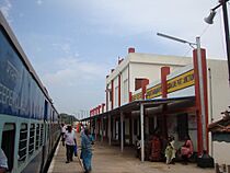
Cuddalore has three main railway stations. These are Cuddalore Port Junction, Tiruppadirippuliyur Cuddalore Castle, and Varakalpattu Cuddalore Moffusil. These stations are on the main train line connecting Viluppuram, Mayiladuthurai, and Tiruchirappalli. Cuddalore Port Junction also has a line to Virudhachalam Junction railway station through Neyveli and Vadalur.
The city has a good network of roads, totaling 230 km (140 miles). The National Highway NH-32 passes through Cuddalore. This highway connects many important cities like Viluppuram, Pondicherry, Chidambaram, and Thoothukudi.
Cuddalore has a local bus service that helps people travel within the town and to nearby areas. There are also smaller mini-bus services. The main bus stand is located in Thirupapuliyur.
The closest airport is in Pondicherry, about 25 km (15 miles) from Cuddalore. The nearest international airport is Chennai International Airport, which is about 200 km (120 miles) away. There is also a new airport in Neyveli, about 30 km (19 miles) from Cuddalore.
Cuddalore Port is a smaller port that mainly handles cargo. It is very close to the Cuddalore Port Junction railway station.
What is Cuddalore's Economy Like?
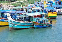
Since Cuddalore is a coastal town, its main industry has always been fishing. While it used to be a major port, most large shipping now goes through bigger centers. Cuddalore is also home to many heavy industries. These include chemical, medicine, and energy companies located in SIPCOT. SIPCOT is an industrial area set up by the state government.
The Cuddalore Port is located where the Gadilam River and Paravanar River meet. Ships usually anchor about 1 mile (1.6 km) from the shore. Cargo is then moved using smaller boats. There are also other ports being built or already in use nearby, like Thiruchopuram port and Parangipettai port.
Learning in Cuddalore
Cuddalore has many schools and colleges for students.
Schools
- CSI St Davids Matriculation School
- St. David's Higher Secondary School
- Sri Saraswathi Vidhyaalaya Matriculation School
- St. Joseph's Higher Secondary School
- St. Mary's
- ARLM
- Krishnasamy
- St. Anne's
- Crescent Primary and Nursery School
- CK
- Akshara Vidyaashram
Arts & Science Colleges
- Periyar Government Arts College
- Immaculate College for Women
- St. Joseph Arts & Science College
- C. Kandasamy Naidu College for Women (KNC)
Engineering Colleges
- Krishnasamy Memorial Engineering College
- CK College of Engineering and Technology
Polytechnic Colleges
- Krishnasamy Memorial Polytechnic
- Padaleeswarar Polytechnic
Industrial Training Institutes There are six Industrial Training Institutes (ITI) in the town. Two of these are run by the government.
City Services
Electricity The Tamil Nadu Electricity Board (TNEB) manages electricity supply in Cuddalore.
Water Supply The Cuddalore municipality provides water from three sources: the Pennaiyar River and borewells from Caper Hills and Thirvanthipuram. This water is stored in ten large tanks around the town.
Waste Management About 103 tonnes of solid waste are collected from Cuddalore every day. The municipality collects and sorts this waste. There is no underground sewage system. Waste water is managed using septic tanks and open drains.
Hospitals Cuddalore has one government hospital, six municipal maternity homes, and 37 private hospitals. These facilities provide healthcare to the people of Cuddalore.
Street Lights There are 4,517 street lights in the town. These include different types of lamps to light up the streets at night.
Local Markets
The municipality runs five markets in Cuddalore. These markets serve the needs of the town and nearby rural areas. They include Aringar Anna Daily Market, Banbari Daily Market, and Devanampattinam Daily Market.
Places to Visit in Cuddalore
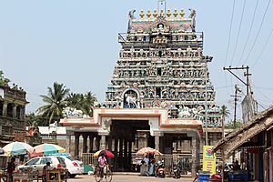
The Pataleeswarar Temple is a very old Hindu temple. It was built in the 7th century and is a major landmark in Cuddalore. The temple is mentioned in ancient poems by 7th-century saints.
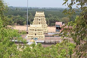
The Devanathaswami Temple in Thiruvanthipuram is another important Hindu pilgrimage site near Cuddalore.
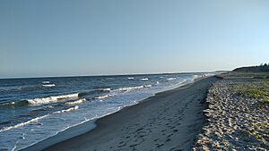
Silver Beach is a 2 km (1.2 miles) long beach in Cuddalore. It is a popular place for visitors. Pichavaram, about 57 km (35 miles) from Cuddalore, is famous for its mangrove forests.
Fort St David is located on the River Gadilam near Devanampattinam. It was acquired in 1653 CE by Elihu Yale. In 1677, the fort was captured by Shivaji. In 1690, the British East India Company bought the fort and nearby villages. The British strengthened the fort many times. In 1746, Fort St. David became the British headquarters for British India. The British ruled a large part of South India from this fort. The French captured the fort in 1758 but gave it back to the British in 1760. The French took it again in 1782 and held it during the Battle of Cuddalore in 1783. In 1785, the fort returned to British control.
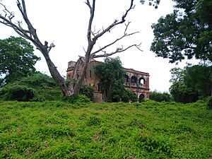
The Garden House was the official home of the Cuddalore District Collector, Robert Clive. It is a good example of old architecture. Its roof was built using only bricks and lime, without steel or wood.
Satyagnana Sabha is a temple built by saint Sri Raamalinga Swaamigal in Vadalur in 1872. It has an octagonal shape. The main part of the temple is hidden by seven curtains, which are opened only on the Thai Poosam day. All four towers of the Chidambaram Nataraajar temple can be seen from the Sabha. The temple is open all year, and many visitors come for festivals and monthly prayers.
Famous People from Cuddalore
- Anjalai Ammal, an Indian freedom fighter and social worker.
See also
 In Spanish: Cuddalore para niños
 | Dorothy Vaughan |
 | Charles Henry Turner |
 | Hildrus Poindexter |
 | Henry Cecil McBay |


