Deep River (North Carolina) facts for kids
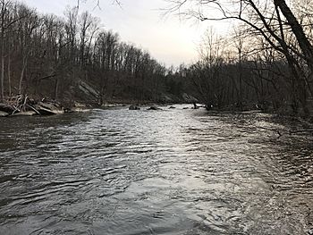
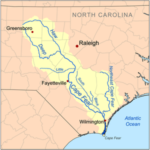
The Deep River is a river in central North Carolina, United States. It flows for about 125 miles (200 km). The river's name comes from an old Indian word, sapponah, which means "deep river". It is an important branch of the larger Cape Fear River system.
People enjoy paddling on the Deep River. You can also find many cool places along its banks. These include the planned Deep River State Trail, historic sites like House in the Horseshoe and Endor Iron Furnace, and nature spots like White Pines Nature Preserve. A special and rare fish called the Cape Fear shiner lives in the river. It's a small minnow that needs protection.
Where the Deep River Flows
The Deep River starts in the Piedmont area of western Guilford County. This is near Kernersville. From there, it flows southeast. It passes by cities like High Point and Randleman. Near Randleman, it forms a large body of water called Randleman Lake.
The river then continues east. It flows past Asheboro, Franklinville, and Ramseur. It also goes north of Sanford. A river called the Rocky River joins the Deep River at the White Pines Nature Preserve. Finally, the Deep River meets the Haw River near Haywood. Together, they form the Cape Fear River.
Dams and History
The Deep River has 12 dams or old dam structures. One big project on the river is the Randleman Lake. This lake covers about 3,000 acres (12 km²) of land. The river flows across the Fall Line of North Carolina. This area has many rocks and a steep slope. Long ago, this natural slope was used to power mills. These mills were important for the early textile industry in North Carolina.
The river was also a busy place during the American Revolution. Important events happened at places like Franklinville and the House in the Horseshoe historic site. The Lockville Dam, made of stone, is the only part left of a 19th-century system of locks and dams.
Until 2005, the Carbonton Dam was the biggest dam on the river. It was 17 feet (5.2 m) high and 270 feet (82 m) wide. This dam was removed to help the environment. Removing it allowed 10 miles (16 km) of the river to flow freely again. This was good for the river's natural ecosystem.
Main Tributaries
A tributary is a smaller stream or river that flows into a larger one. The Deep River has many tributaries that join it along its path. These smaller rivers and creeks add water to the Deep River. They also help shape the land around it.
Some of the important tributaries that flow into the Deep River include:
- Rocky River: This is the largest tributary. It joins the Deep River in Chatham County.
- McLendons Creek: This creek flows into the Deep River in Moore County.
- Bear Creek: Another large tributary, Bear Creek joins the Deep River in Randolph County.
- Sandy Creek: This creek meets the Deep River at Ramseur.
- Polecat Creek: This creek flows into the Deep River near Worthville.
- West Fork Deep River and East Fork Deep River: These two forks come together to form the very beginning of the Deep River in High Point.
These are just a few of the many streams that feed the Deep River. Each one plays a part in the river's journey to the Cape Fear River.
 | Janet Taylor Pickett |
 | Synthia Saint James |
 | Howardena Pindell |
 | Faith Ringgold |


