Dhankuta facts for kids
Quick facts for kids
Dhankuta
धनकुटा
|
|
|---|---|
|
City
|
|

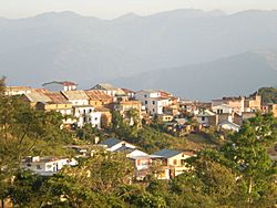
A view of Dhankuta hill town
|
|
| Nickname(s):
Eastern Hillstation
|
|
| Motto(s):
Hamro Dhankuta, Ramro Dhankuta
|
|
| Country | |
| Province | Koshi Province |
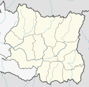
| District | Dhankuta District |
| Population
(2011)
|
|
| • Total | 26,440 |
| • Ethnicities | Athpare Yakkha Limbu Brahmin Chhetri Gurung |
| • Religions | Yuma Sammang Kirat Mundhum Hinduism Buddhist |
| Time zone | UTC+5:45 (NST) |
| Postal Code |
56800
|
| Area code(s) | 026 |
| Climate | Cwa |
| Highway | Koshi Highway |
Dhankuta (Nepali: धनकुटा) is a beautiful hill town in Eastern Nepal. It is the main city and headquarters of Dhankuta District in Koshi Province. In 2011, about 26,440 people lived here.
Contents
A Look Back: Dhankuta's History
Early Importance of Dhankuta
Before 1963, Dhankuta Bazaar was a very important place. It was the main administrative center for all of north-eastern Nepal. A powerful leader called the Bada Hakim used to govern the entire region from here. The town also had a jail and an army post. Because Dhankuta was quite isolated, it managed many of its own affairs.
Life in the Hills
People in Dhankuta earned money by selling local products like tangerines and potatoes. They also received money from Gorkha soldiers who served in the British and Indian armies. This money helped them buy things they couldn't make themselves, like cloth, medicine, and kerosene.
New Beginnings: Peace Corps and Panchayat System
In 1962, the first American Peace Corps Volunteers came to Dhankuta. They worked as teachers in the local high schools. A year later, in 1963, more volunteers arrived to help with a new development program called Panchayat.
Around this time, Nepal changed how it was governed. The old Dhankuta region was divided into smaller areas called Panchayat Districts. The power of the Bada Hakim was then given to government officers and elected leaders in each district.
Dhankuta's Educational Legacy
Dhankuta Bazaar was known for being a forward-thinking community. Even in the 1930s, it had the only high school in Nepal outside of the Kathmandu Valley. Later, it also opened a high school for girls and a two-year college. This shows how much Dhankuta valued education.
Town Life vs. Village Life
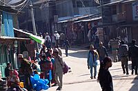
There's a big difference between Dhankuta Bazaar and the villages around it. The town is a busy place for trade, and many of its people are Newar. The surrounding villages are mostly farming areas, home to many different groups like Athpare, Limbu, Yakkha, Rai, Magar, Tamang, and Tibetan.
Famous Nearby Places
Hile is a well-known place near Dhankuta. It's like a gateway to Dhankuta and Panchthar districts. From Hile, you can also trek to the temple of Goddess Pahtibhara. Another interesting spot is the Rajarani valley, which has a rich history. People believe it was once the capital of the Limbu kingdom. It used to have two ponds called Raja and Rani, but now they are flat areas.
People and Cultures of Dhankuta
Languages Spoken
In 2011, most people in Dhankuta Municipality spoke Nepali (49.8%). Other languages spoken include Athpare (14.6%), Tamang (7.0%), Magar (6.6%), and Newar (6.2%). Many other languages are also spoken, showing the rich diversity of the area.
Diverse Ethnic Groups
Dhankuta is home to many different ethnic groups. The largest groups are Chhetri (20.5%), Aathpariya (15.7%), Rai (10.1%), and Hill Brahmin (9.6%). You'll also find Newar, Tamang, Magar, Limbu, and many others living here.
Religions Practiced
The main religion in Dhankuta is Hinduism, followed by 62.5% of the people. Other religions include Kirati (23.6%) and Buddhism (11.2%). There are also Christians, Muslims, and followers of other beliefs.
Education and Literacy
Most people in Dhankuta are able to read and write. About 81.7% of the population is literate, meaning they can read and write. A small number (1.5%) can only read, while 16.8% cannot read or write.
Dhankuta's Climate
| Climate data for Dhankuta, elevation 1,192 m (3,911 ft), (1991–2020) | |||||||||||||
|---|---|---|---|---|---|---|---|---|---|---|---|---|---|
| Month | Jan | Feb | Mar | Apr | May | Jun | Jul | Aug | Sep | Oct | Nov | Dec | Year |
| Mean daily maximum °C (°F) | 18.7 (65.7) |
20.4 (68.7) |
24.0 (75.2) |
26.6 (79.9) |
27.4 (81.3) |
27.9 (82.2) |
27.7 (81.9) |
28.0 (82.4) |
27.5 (81.5) |
26.1 (79.0) |
23.3 (73.9) |
20.4 (68.7) |
24.8 (76.6) |
| Daily mean °C (°F) | 12.8 (55.0) |
14.8 (58.6) |
18.4 (65.1) |
21.2 (70.2) |
22.7 (72.9) |
24.1 (75.4) |
24.2 (75.6) |
24.3 (75.7) |
23.5 (74.3) |
21.0 (69.8) |
17.5 (63.5) |
14.4 (57.9) |
19.9 (67.8) |
| Mean daily minimum °C (°F) | 6.9 (44.4) |
9.2 (48.6) |
12.8 (55.0) |
15.8 (60.4) |
18.0 (64.4) |
20.3 (68.5) |
20.7 (69.3) |
20.5 (68.9) |
19.4 (66.9) |
15.8 (60.4) |
11.7 (53.1) |
8.4 (47.1) |
15.0 (59.0) |
| Average precipitation mm (inches) | 11.7 (0.46) |
15.4 (0.61) |
26.9 (1.06) |
52.9 (2.08) |
113.7 (4.48) |
143.6 (5.65) |
239.0 (9.41) |
160.6 (6.32) |
120.4 (4.74) |
35.2 (1.39) |
10.9 (0.43) |
6.4 (0.25) |
936.7 (36.88) |
| Average precipitation days (≥ 1.0 mm) | 1.5 | 1.9 | 3.0 | 6.1 | 10.8 | 13.3 | 17.3 | 13.8 | 11.1 | 3.1 | 0.7 | 0.6 | 83.1 |
| Source: World Meteorological Organization | |||||||||||||
Dhankuta has a humid subtropical climate. This means it has warm, wet summers and mild winters. The weather box above shows more details about the temperatures and rainfall throughout the year.
Dhankuta Today
Dhankuta Bazaar is still a very important place. It's located on the North-South Koshi Highway. It serves as the administrative center for the Eastern Development Region. Many offices for NGOs (non-profit groups) and aid agencies are located here. These groups help people in the area.
The large market town of Hile, further up the road, is also a key trading center. It's a major road head for remote areas like the Arun valley and Bhojpur. People from surrounding districts walk for days to trade goods in Hile and Dhankuta markets. However, new roads being built might change how important these centers are in the future. Dhankuta has also been called 'Nepal's cleanest city' by The Kathmandu Post.
Nature and Farming
Vegetation Zones
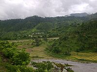
Dhankuta has different types of plant life because of its varied altitudes. Near the Tamor and Arun rivers, you'll find sub-tropical Sal forests. Higher up on the ridges, there are cooler temperate forests. The altitude in the district ranges from about 300 meters to 2500 meters.
Farming and Crops
Most people in Dhankuta work in agriculture. They grow crops like maize (corn), rice, and millet. Important crops that are sold for money include citrus fruits, cauliflower, cabbage, ginger, and recently, tea.
Rani Bhan Forest
There's a beautiful and well-preserved forest called Rani Bhan, or Queen's Forest. It stretches along a ridge on the northwest side of the village. This forest has old, tall rhododendron and pine trees.
Local Media
Radio Nepal has a regional station in Dhankuta that broadcasts many interesting programs for the public. There are also local community radio stations like Radio Lali Guransa (105.2 MHz), Radio Makalu Dhankuta (92.2 MHz), and Radio Dhankuta (106.2 MHz). These stations share local news and programs with the community.
 | Roy Wilkins |
 | John Lewis |
 | Linda Carol Brown |


