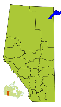
Division No. 6, Alberta facts for kids
Quick facts for kids
Division No. 6
|
|
|---|---|
|
Census division in Alberta
|
|
| Country | Canada |
| Province | Alberta |
| Area | |
| • Total | 12,646 km2 (4,883 sq mi) |
| Population
(2021)
|
|
| • Total | 1,590,639 |
| • Density | 125.782/km2 (325.774/sq mi) |
Division No. 6 is a special area in Alberta, Canada. It's like a big district used for counting people. This division includes the large city of Calgary and all the towns and lands around it. It's a very important part of Alberta.
Most of Division No. 6 is the Calgary Region. Some northern parts reach into central Alberta. This division is also the southern part of the Calgary–Edmonton Corridor. This is a busy area between Calgary and Edmonton. Division No. 6 has the most people of all census divisions in Alberta. It also has the most people living per square kilometer.
Places in Division No. 6
| Historical population | ||
|---|---|---|
| Year | Pop. | ±% |
| 1991 | 804,802 | — |
| 1996 | 880,859 | +9.5% |
| 2001 | 1,021,060 | +15.9% |
| 2006 | 1,160,936 | +13.7% |
| 2011 | 1,311,022 | +12.9% |
| 2016 | 1,498,778 | +14.3% |
| 2021 | 1,590,639 | +6.1% |
Division No. 6 has many different types of communities. These are called census subdivisions. They include big cities, smaller towns, and villages. There are also larger rural areas called municipal districts. Some First Nation reserves are also part of this division.
Here are some of the places you can find in Division No. 6:
- Cities
- Towns
- Carstairs
- Cochrane
- Crossfield
- Didsbury
- Diamond Valley
- High River
- Irricana
- Okotoks
- Olds
- Sundre
- Villages
- Municipal districts
- First Nation reserves
Population Facts
In 2021, Statistics Canada counted the people living in Division No. 6. The total population was 1,590,639 people. This was a change from 2016. In 2016, the population was 1,498,778.
The land area of Division No. 6 is about 12,614.18 km2 (4,870.36 sq mi). This means that in 2021, there were about 126.1/km2 (327/sq mi) people living in each square kilometer. This shows it is a very busy and populated area.
See also
 In Spanish: División n.º 6 (Alberta) para niños


