
Dordogne (river) facts for kids
Quick facts for kids Dordogne |
|
|---|---|

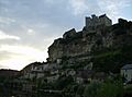
The Dordogne in Périgord, near Castelnaud-la-Chapelle
|
|

Location of the Dordogne in France
|
|
| Native name | La Dordogne |
| Country | France |
| Physical characteristics | |
| Main source | Massif Central 1,720 m (5,640 ft) |
| River mouth | Gironde estuary 45°2′29″N 0°36′24″W / 45.04139°N 0.60667°W |
| Length | 483 km (300 mi) |
| Basin features | |
| Basin size | 23,870 km2 (9,220 sq mi) |
The Dordogne (Occitan: Dordonha) is a beautiful river in south-central and southwest France. It's known for its stunning scenery and rich history. The river and the land around it, called its drainage basin, were named a Biosphere Reserve by UNESCO in 2012. This means it's a special place where nature and people live together in a balanced way.
Contents
About the Dordogne River
The Dordogne river is about 483 km (300.1 mi) long. That's like driving from Paris to London! The area of land that drains into the river, its drainage basin, is huge. It covers about 23,957 km2 (9,250 sq mi).
The river's average flow, or discharge, is about 274 cubic metres of water per second. This is measured near the town of Bergerac. Imagine 274 large boxes of water flowing by every second!
Where the River Flows

The Dordogne river begins high up in the Massif Central mountains. It starts on the sides of a mountain called Puy de Sancy. This is in a small town called Mont-Dore, in the Puy-de-Dôme area. The river starts at a height of about 1,380 m (4,528 ft).
From there, the river generally flows west. It passes through the Nouvelle-Aquitaine region and the Dordogne department. Finally, it flows into the Gironde estuary. Here, it meets another river, the Garonne river, near the city of Bordeaux. The Gironde estuary is a wide mouth of a river that flows into the sea.
The Dordogne river flows through many different places. It crosses 4 regions and 6 departments in France. Some of the main towns it passes through include:
- In the Auvergne-Rhône-Alpes region:
- Puy-de-Dôme: Mont-Dore, La Bourboule
- Cantal: Beaulieu, Lanobre
- In the Nouvelle-Aquitaine region:
- Corrèze: Bort-les-Orgues, Argentat, Beaulieu-sur-Dordogne
- In the Occitanie region:
- Lot: Carennac, Souillac
- Back in the Nouvelle-Aquitaine region:
Main Rivers Joining the Dordogne
Many smaller rivers flow into the Dordogne. These are called tributaries. Here are some of the main ones that are more than 50 kilometers (about 31 miles) long:
|
Rivers joining from the left:
|
Rivers joining from the right: |
Gallery
-
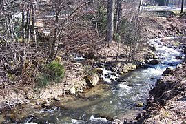
The Dordogne near the town of Mont-Dore
-
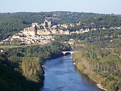
The Dordogne and the Beynac castle
-
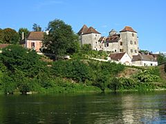
Meyronne and the Dordogne
-
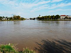
Confluence of the Dordogne and the Isle rivers


.JPG)
Related pages
Images for kids
-
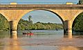
Canoeing on the Dordogne
-
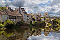
The Dordogne at Argentat in Corrèze, part of the Limousin region
-
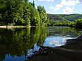
The Dordogne in the Périgord
-
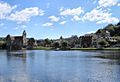
Beaulieu-sur-Dordogne and Dordogne view from Altillac
-
Beynac-et-Cazenac
-
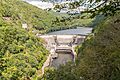
Barrage du Chastang


See also
 In Spanish: Río Dordoña para niños
