
Ely, Nevada facts for kids
Quick facts for kids
Ely
|
|
|---|---|

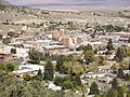
Downtown Ely
|
|

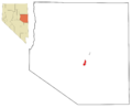
Location of Ely, Nevada
|
|

Ely
Location in the United States
|
|
| Country | United States |
| State | Nevada |
| County | White Pine |
| Area | |
| • Total | 7.63 sq mi (19.75 km2) |
| • Land | 7.63 sq mi (19.75 km2) |
| • Water | 0.00 sq mi (0.00 km2) |
| Elevation | 6,339 ft (1,932 m) |
| Population
(2020)
|
|
| • Total | 3,924 |
| • Density | 514.56/sq mi (198.68/km2) |
| Time zone | UTC−8 (Pacific (PST)) |
| • Summer (DST) | UTC−7 (PDT) |
| ZIP codes |
89301, 89315
|
| Area code(s) | 775 |
| FIPS code | 32-23500 |
| GNIS feature ID | 2410435 |
Ely (pronounced EE-lee) is the biggest city and county seat of White Pine County, Nevada, in the United States. Ely started as a stop for stagecoaches along the old Pony Express route.
In 1906, people found a lot of copper here. This discovery made Ely a mining town. The city's history is full of "boom-and-bust" times, meaning periods of fast growth followed by slower times. Even though many old railroads are gone, the one in Ely is now a special heritage railway. It is run by the Nevada Northern Railway and is called the Ghost Train of Old Ely. In 2020, about 3,924 people lived in Ely.
Contents
History of Ely

In 1878, a man named J. W. Long came to White Pine County. He started a camp called "Ely" after finding gold. The city's name might come from a few different people. It could be named after Long's hometown of Ely, Vermont. Or it might be named after Smith Ely, who helped pay for early mining work. Another idea is John Ely, who came to Nevada for mining.
Ely was an important stop for stagecoaches and the Pony Express. The big mining boom in Ely happened later than in other towns. This was because copper was discovered in 1906. Ely became a town focused on mining, especially for copper. One famous company was Kennecott Utah Copper.
When the price of copper dropped in the 1970s, Kennecott closed down. Copper mining stopped for a while. Later, new ways to get gold from low-quality rock were found. This brought another mining boom. Many companies started processing old mining waste or digging new gold mines. Mines like the Robinson Mine kept Ely going through the 1980s and 1990s.

Today, copper mining has started again in Ely. Copper from the mines is sent by train to Seattle. From there, it goes to Japan to be processed. The demand for copper grew a lot in 2005, making Ely a busy copper town once more.
Geography and Climate
Ely is located in a dry area. It is about 77 miles (124 km) east of Eureka, Nevada. The city covers about 7.1 square miles (18.4 square kilometers) of land.
Ely has a semi-arid climate, which means it is quite dry. The city often has very big differences between day and night temperatures. This is because of its high elevation, dry air, and clear skies. Ely is known as one of the coldest places in the contiguous United States at night. It has many nights each year where the temperature drops below freezing. Frost can even happen in July!
The average temperature in January is about 26.7°F (-2.9°C). In July, it is about 69.3°F (20.7°C). Temperatures can reach 90°F (32°C) or higher about 29 days a year. The highest temperature ever recorded was 101°F (38°C) in July 1998. The lowest was -30°F (-34°C) in February 1989.
_-_Ely_Area,_NV(ThreadEx).svg)
Ely gets about 9.41 inches (239 mm) of rain each year. It also gets about 54.1 inches (137 cm) of snow annually. The most snow in one month was 42.0 inches (107 cm) in March 1894.
| Climate data for Ely, Nevada (Ely Airport), 1991–2020 normals, extremes 1893–present | |||||||||||||
|---|---|---|---|---|---|---|---|---|---|---|---|---|---|
| Month | Jan | Feb | Mar | Apr | May | Jun | Jul | Aug | Sep | Oct | Nov | Dec | Year |
| Record high °F (°C) | 68 (20) |
67 (19) |
76 (24) |
83 (28) |
95 (35) |
99 (37) |
101 (38) |
98 (37) |
97 (36) |
86 (30) |
78 (26) |
67 (19) |
101 (38) |
| Mean maximum °F (°C) | 54.5 (12.5) |
57.3 (14.1) |
66.9 (19.4) |
74.8 (23.8) |
83.2 (28.4) |
91.4 (33.0) |
96.5 (35.8) |
93.3 (34.1) |
87.9 (31.1) |
78.2 (25.7) |
67.1 (19.5) |
56.0 (13.3) |
96.7 (35.9) |
| Mean daily maximum °F (°C) | 41.0 (5.0) |
43.8 (6.6) |
52.4 (11.3) |
58.9 (14.9) |
68.9 (20.5) |
81.1 (27.3) |
89.4 (31.9) |
87.3 (30.7) |
78.0 (25.6) |
64.5 (18.1) |
50.9 (10.5) |
40.8 (4.9) |
63.1 (17.3) |
| Daily mean °F (°C) | 26.7 (−2.9) |
30.0 (−1.1) |
37.7 (3.2) |
43.2 (6.2) |
51.5 (10.8) |
61.3 (16.3) |
69.3 (20.7) |
67.5 (19.7) |
58.4 (14.7) |
46.4 (8.0) |
35.1 (1.7) |
26.2 (−3.2) |
46.1 (7.8) |
| Mean daily minimum °F (°C) | 12.4 (−10.9) |
16.2 (−8.8) |
22.9 (−5.1) |
27.5 (−2.5) |
34.0 (1.1) |
41.4 (5.2) |
49.1 (9.5) |
47.6 (8.7) |
38.8 (3.8) |
28.3 (−2.1) |
19.2 (−7.1) |
11.7 (−11.3) |
29.1 (−1.6) |
| Mean minimum °F (°C) | −9.6 (−23.1) |
−5.7 (−20.9) |
4.7 (−15.2) |
12.2 (−11.0) |
20.6 (−6.3) |
28.4 (−2.0) |
38.5 (3.6) |
36.8 (2.7) |
24.9 (−3.9) |
12.2 (−11.0) |
0.5 (−17.5) |
−9.3 (−22.9) |
−14.9 (−26.1) |
| Record low °F (°C) | −27 (−33) |
−30 (−34) |
−13 (−25) |
−5 (−21) |
7 (−14) |
18 (−8) |
28 (−2) |
24 (−4) |
15 (−9) |
−7 (−22) |
−20 (−29) |
−29 (−34) |
−30 (−34) |
| Average precipitation inches (mm) | 0.75 (19) |
0.84 (21) |
0.98 (25) |
1.07 (27) |
1.05 (27) |
0.56 (14) |
0.63 (16) |
0.79 (20) |
0.64 (16) |
0.80 (20) |
0.63 (16) |
0.67 (17) |
9.41 (239) |
| Average snowfall inches (cm) | 10.5 (27) |
9.1 (23) |
9.5 (24) |
5.6 (14) |
2.0 (5.1) |
0.0 (0.0) |
0.0 (0.0) |
0.0 (0.0) |
0.2 (0.51) |
2.0 (5.1) |
5.9 (15) |
9.6 (24) |
54.1 (137) |
| Average precipitation days (≥ 0.01 in) | 7.1 | 7.0 | 6.5 | 8.4 | 7.6 | 4.2 | 5.4 | 5.8 | 4.7 | 4.8 | 5.0 | 6.6 | 72.9 |
| Average snowy days (≥ 0.1 in) | 5.9 | 5.9 | 5.2 | 4.4 | 1.4 | 0.1 | 0.0 | 0.0 | 0.0 | 1.1 | 3.7 | 6.0 | 33.7 |
| Average relative humidity (%) | 65.3 | 64.5 | 59.4 | 51.8 | 47.0 | 39.8 | 35.2 | 38.7 | 42.4 | 50.5 | 59.6 | 64.3 | 51.5 |
| Average dew point °F (°C) | 12.6 (−10.8) |
16.9 (−8.4) |
19.4 (−7.0) |
21.9 (−5.6) |
27.7 (−2.4) |
31.5 (−0.3) |
35.4 (1.9) |
36.0 (2.2) |
29.8 (−1.2) |
24.3 (−4.3) |
18.7 (−7.4) |
12.7 (−10.7) |
23.9 (−4.5) |
| Mean monthly sunshine hours | 215.0 | 211.0 | 265.0 | 286.8 | 329.3 | 362.8 | 365.3 | 335.8 | 309.1 | 266.5 | 199.6 | 197.8 | 3,344 |
| Percent possible sunshine | 71 | 70 | 71 | 72 | 74 | 81 | 81 | 79 | 83 | 77 | 66 | 68 | 75 |
| Source 1: NOAA (sun, dew points and relative humidity 1961–1990) | |||||||||||||
| Source 2: Weather Channel (extremes) | |||||||||||||
People in Ely
| Historical population | |||
|---|---|---|---|
| Census | Pop. | %± | |
| 1890 | 203 | — | |
| 1900 | 525 | 158.6% | |
| 1910 | 2,055 | 291.4% | |
| 1920 | 2,090 | 1.7% | |
| 1930 | 3,045 | 45.7% | |
| 1940 | 4,140 | 36.0% | |
| 1950 | 3,558 | −14.1% | |
| 1960 | 4,018 | 12.9% | |
| 1970 | 4,176 | 3.9% | |
| 1980 | 4,882 | 16.9% | |
| 1990 | 4,756 | −2.6% | |
| 2000 | 4,041 | −15.0% | |
| 2010 | 4,255 | 5.3% | |
| 2020 | 3,924 | −7.8% | |
| U.S. Decennial Census | |||
In 2000, there were 4,041 people living in Ely. There were 1,727 homes and 1,065 families. About 28% of homes had children under 18. Many homes were married couples living together.
The people in Ely were of different backgrounds. Most were White, with smaller groups of Native American, Asian, and African American people. About 12% of the population was Hispanic or Latino.
The average age of people in the city was 41 years old. About 25% of the population was under 18.
Ely's Economy
Tourism in Ely

Ely is a popular place for tourists. It is home to the Nevada Northern Railway Museum. This museum has the Ghost Train of Old Ely. It is a real steam train that takes visitors on a ride along historic tracks. The train goes from Ely to the old mining area.
The historic six-story Hotel Nevada and Gambling Hall is in downtown Ely. It opened in 1929. For a short time, it was the tallest building in Nevada. It was also the state's first fire-proof building. It is a popular place for people to stay, eat, and visit.
A long road near Ely, Nevada State Route 318, is famous for a car race. It is called the Silver State Classic Challenge. Drivers from all over the world come to race on this 90-mile (145 km) course.
The Ely Renaissance Society has created over 20 outdoor murals and sculptures. These artworks are in the downtown area. Artists from around the world have painted pictures of the area's history. The society also keeps a historical village. It has an old general store and small houses. These show how people lived when they came to work for the railroad and mines.
Ely is also close to many outdoor places. These include Great Basin National Park and Cave Lake State Park. People enjoy hiking, mountain biking, and cross-country skiing in the areas around Ely. The Bureau of Land Management has an area where visitors can see an elk herd up close.
Mining in Ely

Mining has been important in Ely for a long time. Starting in 1867, people mined for precious metals like gold in Lane Valley. The Aultman and Saxton Mines were working by the 1870s. The Chainman Mine became the most active in the 1890s.
In 1903, companies started mining copper. The Nevada Consolidated Copper Company began mining in 1904. Later, in 1943, Kennecott Copper Corporation took over many of the mines.
Today, a company called KGHM International Ltd. owns a large copper mine near Ely. This mine employs many people in the area. The Joana Mine, located north of Ely, is famous for a type of rock called Joana Limestone.
Sports
From 2006 to 2014, the UNLV Rebels football team used Ely for their training camp.
Transportation
Air Travel
Ely used to have commercial flights at Ely Airport. However, these flights stopped on March 31, 2013.
Roads
Several important roads pass through Ely:
- U.S. Route 6
- U.S. Route 50 (Ely is the start of the part of US 50 known as "The Loneliest Road in America")
- U.S. Route 93
The historic Lincoln Highway, which was the first road across America, also went through Ely.
Education
Ely has a public library. It is a part of the White Pine County Library system. The city is also part of the White Pine County School District.
Media
Ely's local newspaper is called The Bristlecone Tribune. The city also has two local radio stations: KDSS (92.7 FM) and KELY (1230 AM). KELY is heard across much of rural Nevada.
Notable People
- Helen Delich Bentley - She was born to Yugoslavian parents and went to Ely High School. She later became a leader in the Federal Maritime Regulatory Agency. She also served as a representative for Maryland in the US Congress from 1985 to 1995.
- Patricia Nixon - The former First Lady of the United States was born in Ely. Her father worked as a miner in the area. Her family moved away when she was two years old. Patricia and her husband, Richard Nixon, visited Ely during his 1952 vice-presidential campaign.
Images for kids
-
Downtown Ely
-
Location of Ely, Nevada
See also
 In Spanish: Ely (Nevada) para niños
