Green Hill (Lancashire) facts for kids
Quick facts for kids Green Hill |
|
|---|---|
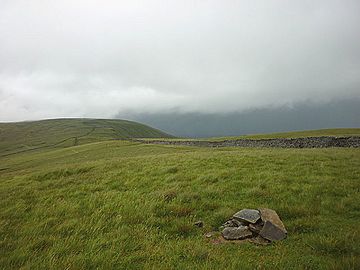
Green Hill—the cairn marks the summit
|
|
| Highest point | |
| Elevation | 626 m (2,054 ft) |
| Prominence | 24m. (79 ft) |
| Parent peak | Great Coum |
| Listing | Nuttall, sub-Hewitt |
| Geography | |
| Location | Lancashire-Cumbria, |
| OS grid | SD701820 |
| Topo map | OS Landranger 98 |
Green Hill is a cool mountain or "fell" in northwest England. Its highest point, called the summit, is 626 meters (about 2,054 feet) above sea level.
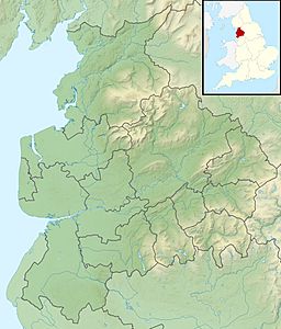
You can find Green Hill near Cowan Bridge in Lancashire. It is also close to Kirkby Lonsdale in Cumbria and Ingleton in North Yorkshire. The top of Green Hill is about 4 kilometers (2.5 miles) west of another mountain called Whernside.
Green Hill acts like a natural dividing line for water. Rainwater falling on one side flows into the River Dee. Water on the other side goes into the Leck Beck. Both of these rivers eventually join the bigger River Lune.
Where is Green Hill?
For a long time, the highest point in the old county of Lancashire was Coniston Old Man. But in 1974, that area became part of Cumbria.
Some guides for walkers say Green Hill is now the highest point for Lancashire. It sits right on the border with Cumbria. However, maps from the Ordnance Survey show that Gragareth is one meter taller. Gragareth is about 2 kilometers (1.2 miles) southwest of Green Hill. The very top of Gragareth, at 627 meters, is clearly inside Lancashire.
Another high point near Green Hill is Whernside. It is 736 meters (2,415 feet) tall. Whernside is the highest point in North Yorkshire.
Amazing Views from the Summit
The very top of Green Hill might seem a bit plain. But it offers amazing views in every direction!
To the north, you can see the Howgill Fells and the beautiful Lakeland fells. Looking east, you can spot the Pennines mountain range. And to the south, you can see a large part of North Yorkshire. It's a great spot to take in the scenery!
The County Stone
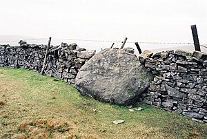
Close to the top of Green Hill, you'll find a special rock called the County Stone. This is a very large boulder that was left behind by a glacier long ago.
The County Stone is important because it marks a "triple point." This is where the borders of three old counties used to meet: Westmorland, Yorkshire, and Lancashire.
 | Calvin Brent |
 | Walter T. Bailey |
 | Martha Cassell Thompson |
 | Alberta Jeannette Cassell |


