Hatfield, South Yorkshire facts for kids
Quick facts for kids Hatfield |
|
|---|---|
| Town and civil parish | |
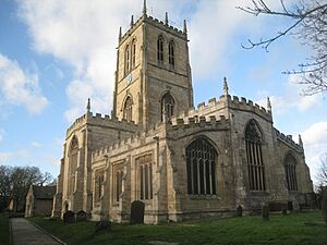
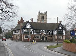 The Ingram Arms & St Lawrence's Church |
|
| Area | 23.96 sq mi (62.1 km2) |
| Population | 17,236 (2011 census) |
| • Density | 719/sq mi (278/km2) |
| Civil parish |
|
| Metropolitan borough |
|
| Metropolitan county | |
| Region | |
| Country | England |
| Sovereign state | United Kingdom |
| Post town | DONCASTER |
| Postcode district | DN7 |
| Dialling code | 01302 |
| Police | South Yorkshire |
| Fire | South Yorkshire |
| Ambulance | Yorkshire |
| EU Parliament | Yorkshire and the Humber |
| UK Parliament |
|
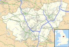
Hatfield is a town and civil parish located in the City of Doncaster in South Yorkshire, England. In 2011, about 17,236 people lived there. The town is on the A18 road, which connects Doncaster and Scunthorpe. It's also west of the M18 motorway. Hatfield shares a train station with Stainforth on the line between Goole and Scunthorpe, and Doncaster. Records show that Hatfield has been around since at least 730 AD. At that time, Bede, a famous historian, wrote about the Northumbrian King, Edwin, who was killed in a battle nearby.
Contents
Hatfield's Past: A Look at History
Hatfield, once called Heathfield, is a very old settlement. It was even a palace for the Northumbrian Kingdom known as Meicen.
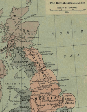
A major event happened here on October 12, 633 AD. King Edwin was killed in the Battle of Hatfield Chase. He was fighting against Penda, the King of Mercia. Penda had help from the Welsh, led by Cadwallon ap Cadfan, the King of Gwynedd. Another important person, Osric, who might have become king after Edwin, also died in this battle. Edwin's son, Edfrith, later surrendered to Penda.
People believe that a local road, Slay Pit Lane, got its name from this battle. It's rumored that the battle took place there, and many soldiers' bodies were left nearby.
Hatfield is also mentioned in the Domesday Book, a famous survey from 1086. It noted that Hatfield had a church, a priest, and land for farming. At that time, the area belonged to William de Warenne. The name Hatfield comes from Old English and Scandinavian words. Hæþfeld means "the field or open land where heather and other shrubs grew." Bede recorded the name as Heathfelth in 730 AD.
Hatfield Manor House is a very old building, dating back to the 1100s. It's thought to be where King Edwin's palace once stood. Many important people have visited the manor over the years. These include Edward Balliol, Elizabeth, Countess of Ulster, John of Gaunt, and even the famous writer Geoffrey Chaucer. The local church, St Lawrence's Church, Hatfield, was built around the same time as the manor house.
In 1629, King Charles I sold a huge area of land called Hatfield Chase. He sold about 180,000 acres to a Dutch engineer named Cornelius Vermuyden. Vermuyden then sold parts of this land to others. He spent a lot of money, about £400,000, draining the wet land to make it suitable for farming. After the draining, one-third of the land went to Vermuyden, one-third to the King, and the last third became common land for local people to use.
Hatfield used to be in the West Riding of Yorkshire. In 1974, county boundaries changed, and it became part of South Yorkshire. In 2001, the population was 16,164. By 2011, it had grown to 17,236 people.
Today, Hatfield has an outdoor water activity center. There are also two prisons, Hatfield Main and Hatfield Lakes, located across the M18 motorway to the east. HMP Lindholme is southeast of the town, built on what used to be RAF Lindholme, an old air force base.
Exploring Hatfield's Geography
Hatfield is located within the historic boundaries of the West Riding of Yorkshire. It sits near the border of Yorkshire and Lincolnshire. The main road through Hatfield is the A18, which connects Doncaster and Scunthorpe. Another road, the A1146, links Hatfield to Thorne. The town is split by the M18 motorway. Junctions 4 and 5 of the M18, and Junction 1 of the M180 motorway, are all within the Hatfield area. Hatfield is part of the Don Valley area for parliamentary elections.
Hatfield parish includes several smaller villages:
Dunscroft: A Village on the A18
Dunscroft is on the A18 road. It's about 6 miles from the center of Doncaster. There is a school here called Sheep Dip Lane Primary School. The local church is dedicated to St Edwin. However, there are plans to combine the churches of Dunscroft and Hatfield, which would mean St Edwin's Church might close.
Dunsville: Close to Doncaster
Dunsville is also on the A18 road. It's about 5 miles from the center of Doncaster.
Hatfield: The Main Town Area
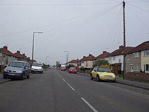
Hatfield itself is on the A18 road, about 7 miles from the center of Doncaster. It has a train station called Hatfield and Stainforth railway station, which is shared with Stainforth and Thorne. Hatfield has several pubs, including The Bay Horse, The Hatfield Chase, Hatfields, The Blue Bell, The Ingram Arms, and The Green Tree. An old building known as the Abbey or Dunscroft Grange was taken down in 1966–67. This building might have been a dormitory for Roche Abbey in Maltby. It had to be demolished because its old stonework was not safe. The main secondary school for the area is Ash Hill Academy. There are also two primary schools: Travis St. Lawrence Church of England Primary School and Hatfield Crookesbroom Primary School.
Hatfield Woodhouse: A Semi-Rural Village
Hatfield Woodhouse means "House in the Hatfield Wood." It's a small, quiet village on the A614 road, about 7 miles from the center of Doncaster.
Hatfield Woodhouse was also home to RAF Hatfield Woodhouse, an air force base two miles south of the village. This airfield was later renamed RAF Lindholme.
Recently, there was a plan to knock down the local pub and build flats instead. However, this plan was stopped because local people protested against it. Hatfield Woodhouse Primary School was rated "Good" by Ofsted in 2019.
West End: A Small Community
West End is a small village located southwest of Hatfield Woodhouse.
Travel and Transport in Hatfield
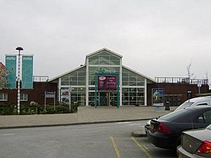
The A18 road goes through the eastern part of Hatfield town. The M18 and M180 motorways are also in the eastern part of the parish. There's a plan to build houses and warehouses near Junction 5 of the M18. This project is called Unity Park. It's expected to include homes, a marina, and a new school. A new road has already been built from Junction 5 to Waggons Way in Stainforth because of this development. Junction 5 also has a motorway service area, called Doncaster North, run by Moto.
A railway line from Doncaster to Thorne first opened in July 1856. The station was simply called Stainforth at first. It was replaced by a newer station named Hatfield and Stainforth in October 1866.
Local Media and News
For local news and TV shows, people in Hatfield can watch BBC Yorkshire and ITV Yorkshire. These signals come from the Emley Moor TV transmitter.
Local radio stations include BBC Radio Sheffield, Heart Yorkshire, Capital Yorkshire, Hits Radio South Yorkshire, Greatest Hits Radio Yorkshire, TX1 Radio, and TMCR 95.3. TMCR 95.3 is a community radio station that broadcasts from its studios in Thorne.
The town is also served by local newspapers like the Doncaster Free Press and Thorne Times.
Famous People from Hatfield
- William of Hatfield (1336–1337): He was the second son of Edward III, a King of England.
- Cornelius Vermuyden (1595–1677): A Dutch engineer who helped drain the land in Hatfield Chase. He was given a lot of land in the area for his hard work.
 | Ernest Everett Just |
 | Mary Jackson |
 | Emmett Chappelle |
 | Marie Maynard Daly |


