History of El Paso, Texas facts for kids
El Paso is a city in Texas, USA, with a rich history. It was first called El Paso del Norte by Spanish Franciscan friars. This name meant "The Pass of the North" because it was located at an important mountain pass. The area became a small farming community. Most people settled south of the river, where Ciudad Juárez, Mexico, is today. Under Spanish rule, El Paso was part of New Mexico and had strong economic ties to Santa Fe, New Mexico and mining areas in Chihuahua.
When Texas fought for independence from Mexico, El Paso was part of Chihuahua and not involved. But after Texas joined the United States, the state claimed this important trading center as its own. As railroads were built, El Paso grew into a busy commercial hub. The World Wars and the Texas oil boom helped the city develop even more. Today, with growing international trade and Juárez becoming a big manufacturing center, El Paso's importance continues to expand.
Contents
Ancient Times in El Paso
Archaeological finds at places like Keystone Wetlands and Hueco Tanks show that people lived in the El Paso area for thousands of years. A hueco is a Spanish word for a hollow space, often used for holding water or grinding corn. The early people here were corn farmers. At Hueco Tanks, there are over two thousand ancient images, including one of Tlaloc, a rain god.
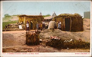
The Manso, Suma, and Jumano Indians lived here when the first Spanish explorers arrived. These groups eventually blended with the local settlers, becoming part of the Mestizo culture common in Mexico and the Southwest. Others joined different Mescalero Apache groups who traveled through the region for many years.
Spanish Explorers Arrive
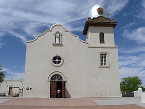
The first European explorer to reach the Rio Grande near El Paso was a Spaniard named Juan de Oñate. This happened on April 20, 1598, near the small town of San Elizario. His group rested there and held a special church service to celebrate reaching the river.
El Paso del Norte (now Ciudad Juárez) was founded in 1659 by Fray García de San Francisco on the south bank of the Río Bravo del Norte (Rio Grande). Farming thrived thanks to a clever irrigation system built by the Spanish and Native Americans. This included a large earthen dam. Vineyards and fruits were the main crops. The Spanish government tried to encourage farming on the north side of the river (present-day El Paso). However, Apache attacks made it too dangerous for settlers to cross the river. The river itself offered some protection.
In 1680, after the Pueblo Revolt in New Mexico, El Paso became the center for Spanish rule of New Mexico. From here, the Spanish, led by Diego de Vargas, regrouped to take back their territory, which included Santa Fe and Taos. The 1700s saw fast growth, with over 5,000 people living along the river from El Paso to other settlements. These included Spaniards, criollos, mestizos, and native people.
The first permanent farm north of the Rio Grande in present-day El Paso was the Ponce de León Ranch, started in 1825. Earlier attempts failed because of Native American raids and floods. El Paso remained mostly undeveloped under Spanish control. Instead, Spanish settlement focused on El Paso del Norte (Ciudad Juárez). Frequent Native American raids, especially by the Apache and Comanche, made the northern region unstable. The river, sand dunes, and forts provided some defense, but large Apache groups sometimes raided deep into Mexico.
Texas Becomes Independent
El Paso was the southernmost part of New Mexico and connected to Santa Fe and Mexico City by the Royal Road. Few foreign travelers came this far north. American traders and fur trappers visited the area starting in 1804. Some even married into local Hispanic families. Famous travelers included Zebulon Pike. American families only started arriving in large numbers after the Mexican–American War in 1849.
The Mexican Independence movement did not involve fighting in El Paso. However, it hurt the town's trade of wines and produce. Also, a major river change left the towns of Ysleta, San Elizario, and Socorro on the other side of the Rio Grande. In 1824, El Paso del Norte became part of the state of Chihuahua after being part of New Mexico for 200 years. The town elected its first local government in 1825 and opened its first official school in 1829.
The Texas Revolution (1836) did not affect this region. The area was not considered part of Texas until 1848. The Battle of El Brazito near Las Cruces was fought by Missouri volunteers. The Treaty of Guadalupe Hidalgo made the settlements on the north bank of the river a formal American settlement, separate from Old El Paso del Norte.
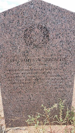
The current boundary between Texas and New Mexico, which placed El Paso on the Texas side, was set in the Compromise of 1850. In the 1850s, important changes happened north of the river. The Stephenson-Azcárate family bought land that became "El Rancho de la Concordia" or "Stephensonville." This area is now Concordia Cemetery. Further west, a settlement called Franklin became the start of El Paso, Texas. El Paso County was created in March 1850.
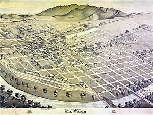
A military post called The Post opposite El Paso was set up in 1854. Mail routes like the San Antonio-El Paso Mail and the Butterfield Overland Mail soon passed through Franklin. In 1859, pioneer Anson Mills mapped out the town, calling it El Paso. This caused confusion until El Paso del Norte across the river changed its name to Ciudad Juárez in 1888. El Paso was officially made a city in 1873.
El Paso During the Civil War
During the American Civil War, Texas joined the Confederacy. Many people in Franklin supported the Confederate cause. Confederate forces took over Fort Bliss in 1861. But Union soldiers captured the city in 1862. After the war, the town's population began to grow.
County Seat Moves to Ysleta
The Tigua Indians had lived on land around Ysleta since 1680. But in 1874, a Texas law caused the Tiguas to lose almost all their land. The El Paso county seat was moved to Ysleta that year and stayed until it moved to El Paso in 1883. This was a time of conflicts, including the San Elizario Salt War, between Mexicans, Americans, Tiguas, and Apaches.
A Busy Frontier Town
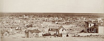
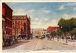
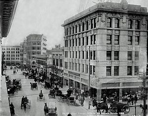
When the Southern Pacific, Texas and Pacific, and Atchison, Topeka and Santa Fe railroads arrived in 1881, El Paso's population quickly grew to 10,000 by 1890. With its pleasant climate, the town attracted many new people. These included merchants, business owners, and professionals who wanted to benefit from the Mexican Free Trade zone. Others came seeking a cure for breathing problems in the warm, dry air.
Small groups of immigrants—Jewish, Italian, and Chinese—also arrived, adding to the town's diversity. The Jewish community started in the 1880s, and the first synagogue was built in 1898. The city also developed many schools and cultural places, including a symphony orchestra. Catholic priests, especially Jesuits, built many churches and schools in the area. Father Carlos Pinto, known as "the apostle of El Paso," was very important for his work among the Mexican population.
However, like other frontier towns, El Paso also attracted some tough characters. The town hired a marshal named Dallas Stoudenmire, who was known for being very quick to act. A famous gunfight called the "Four Dead in Five Seconds Gunfight" happened here on April 14, 1881. Stoudenmire was hired to bring order to the wild town, and he used his reputation to control the city.
In 1883, the county seat moved from Ysleta to El Paso after a very close election. In 1887, a smelter was built west of town to process lead and copper ore from Mexico. This facility was later bought by Asarco. Two small communities grew around the smelter, called "La Esmelda."
Taft-Díaz Meeting
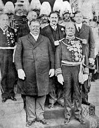
In 1909, U.S. President William Howard Taft and Mexican President Porfirio Díaz planned a meeting in El Paso and Ciudad Juárez. This was the first time a U.S. president would cross the border into Mexico. Because of threats, many security forces were called in, including Texas Rangers, U.S. and Mexican troops, and Secret Service agents. On October 16, a scout named Frederick Russell Burnham and Private C.R. Moore caught a man with a hidden gun near Taft and Díaz. They stopped the possible assassin just feet away from the presidents.
The Mexican Revolution's Impact

The Mexican Revolution (1910–1920) involved heavy fighting in Ciudad Juárez. Sometimes, stray bullets even hit civilians on the El Paso side. El Paso became a place where many exiled Mexican leaders, like Victoriano Huerta and Pancho Villa, were seen. In 1914, General John J. Pershing was stationed at Fort Bliss. He was in charge of border security and led an expedition against Pancho Villa after a raid on Columbus, New Mexico. During this time, many Mexican refugees came to El Paso to escape the violence.
A large Mexican middle class in El Paso created their own cultural and educational places. The Jesuit Order, who were forced out of Mexico during the Revolution, also helped develop community institutions and schools in El Paso. South El Paso street became a lively cultural center with cinemas and theaters. Mexican cinemas in El Paso were important for developing subtitles for movies.
Modern El Paso: Growth and Change
In the 1920s and 1930s, El Paso saw the start of several well-known businesses and events. In 1930, Conrad Hilton opened his first tall hotel in El Paso, now the Plaza Hotel. The Plaza Theatre also opened in 1930. In 1934, Varney Speed Lines, a passenger airline, started in El Paso. This airline later became Continental Airlines.
The college football Sun Bowl has been held in El Paso since 1936. It is the second oldest bowl game in the nation, after the Rose Bowl. The Great Depression in the 1930s slowed the city's growth. Many people moved away. El Paso also saw an increase in Mexicans and Mexican Americans who were forced to leave other parts of the country. Government programs like the Civilian Conservation Corps helped many unemployed people find work building roads and public buildings.
After World War II, German rocket scientists, including Wernher von Braun, came to Fort Bliss in El Paso. They brought V2 rockets and parts, starting the American rocket program. The famous drink, the Margarita, is also said to have been first mixed in the El Paso-Juárez area in 1945 by Francisco "Pancho" Morales.
From World War II until the 1980s, El Paso grew quickly. The expansion of Fort Bliss into a major military center brought in thousands of soldiers and their families. The city's economy was strong in copper smelting, oil refining, and clothing manufacturing. New neighborhoods were built, expanding El Paso far to the west, northeast, and east.
With the election of Raymond Telles, El Paso's first Hispanic mayor, in 1957, the demand for civil rights for Hispanic people began. This continued into the 1960s and 1970s. Mexican American groups worked to provide better education for Mexican American youth.
In 1963, the U.S. agreed to give Chamizal, a disputed part of El Paso, to Mexico. This was because the Rio Grande, which forms the border, had changed its course. The river was re-channeled, and the area was redeveloped. The Chamizal National Memorial is now a major park in El Paso.
In the 1960s and 1970s, El Paso's economy boomed, helped by lower wages and its location as an international crossing point. Clothing manufacturers were very successful, providing jobs for thousands of Mexican Americans and Mexicans. The growth of factories in Ciudad Juárez also helped the textile industry. However, workers also fought for better conditions and formed labor unions.
Since 1990, El Paso's economy has faced challenges. Competition from low-wage labor abroad and the closure of the main copper smelter affected jobs. The North American Free Trade Agreement (NAFTA) in 1994 led to more transport and service jobs but also the loss of many industrial jobs. El Paso is sensitive to changes in Mexico's economy and border rules.
Recently, El Paso has seen new growth. The Base Realignment and Closure (BRAC) commission has planned for Fort Bliss to receive over 30,000 more soldiers. This is expected to add a lot of money to El Paso's economy and bring many new people to the city. The city is also working on big projects, like fixing up the Plaza Theatre downtown. New roads are being built to help with urban growth and connect to the expanded Biggs Army Airfield.
 | John T. Biggers |
 | Thomas Blackshear |
 | Mark Bradford |
 | Beverly Buchanan |


