
Houston County, Georgia facts for kids
Quick facts for kids
Houston County
|
|
|---|---|
.JPG)
Houston County courthouse in Perry
|
|

Location within the U.S. state of Georgia
|
|
 Georgia's location within the U.S. |
|
| Country | |
| State | |
| Founded | May 15, 1821 |
| Named for | John Houstoun |
| Seat | Perry |
| Largest city | Warner Robins |
| Area | |
| • Total | 380 sq mi (1,000 km2) |
| • Land | 376 sq mi (970 km2) |
| • Water | 4.4 sq mi (11 km2) 1.2%% |
| Population
(2020)
|
|
| • Total | 163,633 |
| • Density | 373/sq mi (144/km2) |
| Time zone | UTC−5 (Eastern) |
| • Summer (DST) | UTC−4 (EDT) |
| Congressional district | 8th |
Houston County (/ˈhaʊstən/ HOW-stən) is a county located in the central part of the U.S. state of Georgia. A county is like a smaller area within a state, often with its own local government. In 2020, about 163,633 people lived here.
The main town, or county seat, is Perry. However, the city of Warner Robins is much bigger in both size and population.
Houston County was created on May 15, 1821. It was one of five new counties formed at that time. Over the years, parts of Houston County were used to create other nearby counties like Bibb and Peach.
The county is named after John Houstoun, who was a governor of Georgia. The spelling of the name changed over time to "Houston," but people still say it the old way: "HOW-stən." The center of the county was first called Wattsville, but its name was later changed to Perry.
Houston County is part of the larger Warner Robins metropolitan area. This means it's connected to the economy and community of Warner Robins. You can also find the Flat Creek Public Fishing Area in Houston County, which is a great spot for fishing.
Contents
Geography
Houston County is located in the upper Atlantic coastal plain region of Georgia. This means it's in a flatter area closer to the coast, but not right on the ocean.
According to the U.S. Census Bureau, the county covers a total area of about 380 square miles. Most of this area, about 376 square miles, is land. The remaining 4.4 square miles (about 1.2%) is water, like rivers and lakes.
Most of the water in Houston County flows into the Lower Ocmulgee River. This river is part of the larger Altamaha River basin, which eventually flows into the Atlantic Ocean. A small part of the northern county flows into the Upper Ocmulgee River. The very southwest corner of the county is part of the Flint River system.
Adjacent counties
Houston County shares borders with these other counties:
- Bibb County - to the north
- Peach County - to the west
- Twiggs County - to the east
- Bleckley County - to the southeast
- Pulaski County - to the south-southeast
- Dooly County - to the south
- Macon County - to the southwest
Communities
Houston County has several cities and smaller communities:
Cities
- Byron (partially in the county)
- Centerville
- Perry (the county seat, slightly extends into Peach County, Georgia)
- Warner Robins (the largest city)
Census-designated place
- Robins Air Force Base (a special area defined for census purposes)
Unincorporated communities
These are smaller towns or areas that are not officially part of a city:
Demographics
A census is a count of the population. The 2020 United States census found that 163,633 people lived in Houston County. There were 58,417 households and 39,810 families living there.
Here's a look at the different groups of people living in Houston County in 2020:
| Race | Number of People | Percentage |
|---|---|---|
| White (not Hispanic) | 86,211 | 52.69% |
| Black or African American (not Hispanic) | 51,992 | 31.77% |
| Native American | 339 | 0.21% |
| Asian | 4,905 | 3.0% |
| Pacific Islander | 124 | 0.08% |
| Other/Mixed | 8,255 | 5.04% |
| Hispanic or Latino | 11,807 | 7.22% |
Education

The public schools in Houston County are run by Houston County Schools. They work to provide education for all the students in the area.
Transportation
Major highways
Many important roads run through Houston County, helping people travel around the area and to other parts of Georgia.
 Interstate 75
 U.S. Route 41
 U.S. Route 129
 U.S. Route 341
 State Route 7
 State Route 7 Spur
 State Route 11
 State Route 11 Business
 State Route 11 Connector
 State Route 26
 State Route 49
 State Route 96
 State Route 127
 State Route 224
 State Route 247
 State Route 247 Connector
 State Route 247 Spur
 State Route 329
 State Route 401 (this is an unofficial name for I-75)
Pedestrians and cycling
For people who like to walk or bike, Houston County has some trails:
- Big Indian Creek Trail (planned for the future)
- Walker's Pond Trail
- Wellston Trail
- The Walk at Sandy Run Creek
Images for kids
-
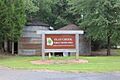
Flat Creek Public Fishing Area

See also
 In Spanish: Condado de Houston (Georgia) para niños
