Humboldt County, Iowa facts for kids
Quick facts for kids
Humboldt County
|
|
|---|---|
|
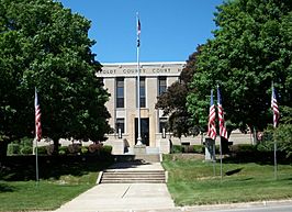
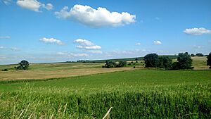
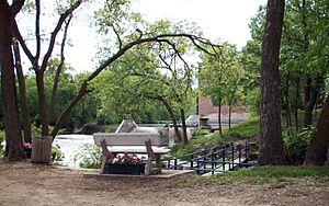
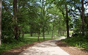
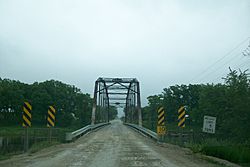
Clockwise from top: Humboldt County Courthouse, Fountain in Humboldt's John Brown Park, the Des Moines River at Gotch Park, Sumner Avenue in Humboldt, and Old Settler's Park in Livermore
|
|
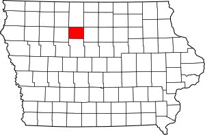
Location within the U.S. state of Iowa
|
|
 Iowa's location within the U.S. |
|
| Country | |
| State | |
| Founded | January 28, 1857 |
| Named for | Alexander von Humboldt |
| Seat | Dakota City |
| Largest city | Humboldt |
| Area | |
| • Total | 436 sq mi (1,130 km2) |
| • Land | 434 sq mi (1,120 km2) |
| • Water | 1.3 sq mi (3 km2) 0.3% |
| Population
(2020)
|
|
| • Total | 9,597 |
| • Density | 22.011/sq mi (8.499/km2) |
| Time zone | UTC−6 (Central) |
| • Summer (DST) | UTC−5 (CDT) |
| Congressional district | 4th |
Humboldt County is a place in the state of Iowa, USA. It is a county, which is like a smaller region within a state. In 2020, about 9,597 people lived here. The main town, or county seat, is Dakota City. The county was started in 1857. It was named after Alexander von Humboldt, a famous explorer and scientist.
Contents
History of Humboldt County
How Humboldt County Was Formed
Iowa became a state in the USA on December 28, 1846. To set up local governments, the state leaders created many counties. Humboldt County was one of these. It was officially created on January 15, 1851.
At first, Humboldt County was bigger than it is today. It included some areas that are now part of Webster County. The county was named after Alexander von Humboldt, a well-known German explorer.
Later, in 1855, Humboldt County was actually removed from the map! Its northern part joined Kossuth County. The southern part became part of Webster County.
Re-establishing the County
But then, on January 28, 1857, state leaders decided to bring Humboldt County back. It officially started again on February 26, 1857. However, there was a mistake in the new law. Four townships (smaller areas) that were supposed to return to Humboldt County stayed in Webster County.
This mistake led to a court case. The Iowa Supreme Court had to decide which county these four townships belonged to. The court ruled that the townships still belonged to Webster County. This was because the law to move them back to Humboldt County had not been voted on by the people living there, as required by Iowa's new constitution.
In 1872, a school called Humboldt College opened in the county. It closed in 1916 because of disagreements about taxes.
Geography of Humboldt County
Humboldt County covers about 436 square miles. Most of this area, about 434 square miles, is land. Only a small part, about 1.3 square miles, is water.
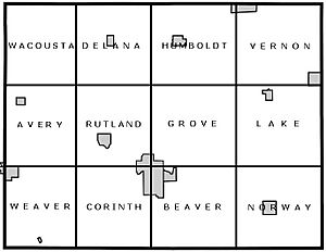
Unlike many counties nearby, Humboldt County has only 12 townships. When it was first created in 1851, it had 16 townships. But after it was briefly removed and then re-established, it ended up with 12.
Counties Nearby
Humboldt County shares its borders with these other counties:
- Kossuth County to the north
- Wright County to the east
- Webster County to the south
- Pocahontas County to the west
Nature and Environment
Humboldt County is part of a flat area in Iowa called the Des Moines Lobe. This area was shaped by glaciers long ago. Today, it is mostly used for farming.
The land here is mostly flat or gently rolling. You might see some small hills or dips left behind by the glaciers. Unlike some other parts of Iowa, this area does not have much loess (a type of fine soil).
The rivers and streams here are not very dense. Major rivers have cut deep valleys. Most of the natural lakes in Iowa are found north of this region. A lot of the original wetlands (swampy areas) have been drained for farms.
Rivers and Waterways
Humboldt County is located in the Des Moines River watershed. This means that all the rain and water in the county eventually flows into the Des Moines River. The East and West Forks (branches) of the Des Moines River meet in southern Humboldt County, at Frank Gotch State Park. The eastern part of the county is also part of the Boone River watershed, which is another river that flows into the Des Moines River.
Parks and Protected Areas
Humboldt County has several county parks, even though it doesn't have any state parks.
South of the town of Humboldt is Frank A. Gotch County Park. This park is named after Frank Gotch, a famous wrestler from Humboldt who was a world champion. The park is near where he grew up. It's also where the East and West Forks of the Des Moines River come together. The park has places for camping and a cool old railroad bridge. This bridge is now part of the Three Rivers Trail, a path for walking and biking.
Near Bradgate is the Willow Access Area. This spot is very wooded. In southern Rutland is Rose Mill Park. You can camp here and get to the Rutland Dam and the West Fork of the Des Moines River. The river in this area is known for its beautiful limestone cliffs and grassy banks.
Further along the river, near Humboldt, is Oxbow Park. It has boat ramps and lots of open space. South of Oxbow Park is Joe Sheldon County Park. This park has two parts: one for camping and one for fun activities. You can get to the West Fork of the Des Moines River from the lower part of this park.
Even further down the river, you'll find the Lake Nokomis area. This place is popular for its woods and small ponds. The Cottonwood Trail also runs through this area.
West of Livermore, Lott's Park gives you access to Lott's Creek. It's a nice spot with benches and picnic tables. South of Ottosen is the Ottosen Marsh State Game Management Area, also called the Ottosen Potholes. East of Dakota City is the Dakota City River Park, which is near an old dam and the Humboldt County Historical Museum. Near the small community of Pioneer is the Pioneer Prairie Pothole Wildlife Area.
People of Humboldt County
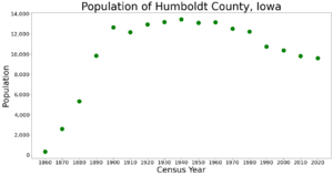
| Historical population | |||
|---|---|---|---|
| Census | Pop. | %± | |
| 1860 | 332 | — | |
| 1870 | 2,596 | 681.9% | |
| 1880 | 5,341 | 105.7% | |
| 1890 | 9,836 | 84.2% | |
| 1900 | 12,667 | 28.8% | |
| 1910 | 12,182 | −3.8% | |
| 1920 | 12,951 | 6.3% | |
| 1930 | 13,202 | 1.9% | |
| 1940 | 13,459 | 1.9% | |
| 1950 | 13,117 | −2.5% | |
| 1960 | 13,156 | 0.3% | |
| 1970 | 12,519 | −4.8% | |
| 1980 | 12,246 | −2.2% | |
| 1990 | 10,756 | −12.2% | |
| 2000 | 10,381 | −3.5% | |
| 2010 | 9,815 | −5.5% | |
| 2020 | 9,597 | −2.2% | |
| 2023 (est.) | 9,500 | −3.2% | |
| U.S. Decennial Census 1790-1960 1900-1990 1990-2000 2010-2018 |
|||
Population in 2020
In 2020, the county had 9,597 people. This means there were about 22 people living in each square mile. Most people, about 96.79%, said they belonged to one race. About 88.47% were non-Hispanic White. About 4.48% were Hispanic. Other groups included Black (0.58%), Native American (0.17%), and Asian (0.22%).
There were 4,571 homes in the county. Of these, 4,073 homes were lived in.
| Race | Num. | Perc. |
|---|---|---|
| White (NH) | 8,823 | 92% |
| Black or African American (NH) | 53 | 0.6% |
| Native American (NH) | 16 | 0.2% |
| Asian (NH) | 21 | 0.22% |
| Pacific Islander (NH) | 6 | .06% |
| Other/Mixed (NH) | 248 | 2.6% |
| Hispanic or Latino | 430 | 4.5% |
Population in 2010
In 2010, the county had 9,815 people. There were 4,684 homes, and 4,209 of them were lived in.
Towns and Communities
Cities in Humboldt County
Small Unincorporated Communities
These are small places that are not officially cities or towns:
- Arnold
- Pioneer
Ghost Town
- Unique (a town that no longer exists)
Townships in Humboldt County
- Avery
- Beaver
- Corinth
- Delana
- Grove
- Humboldt
- Lake
- Norway
- Rutland
- Vernon
- Wacousta
- Weaver
Population Ranking of Cities
This table shows the cities in Humboldt County from largest to smallest, based on the 2020 census.
† county seat (the main town)
| Rank | City/Town/etc. | Type | Population (2020 Census) |
|---|---|---|---|
| 1 | Humboldt | City | 4,792 |
| 2 | † Dakota City | City | 759 |
| 3 | Livermore | City | 381 |
| 4 | Bode | City | 302 |
| 5 | Gilmore City (partially in Pocahontas County) | City | 270 (487 total) |
| 6 | Renwick | City | 234 |
| 7 | Thor | City | 181 |
| 8 | Rutland | City | 113 |
| 9 | Bradgate | City | 75 |
| 10 | Hardy | City | 57 |
| 11 | Ottosen | City | 40 |
| 12 | Lu Verne (partially in Kossuth County) | City | 30 (258 total) |
| 13 | Pioneer | City | 4 |
Roads and Transportation
Main Highways
These are the most important roads that go through Humboldt County:
Education in Humboldt County
Here are the school districts that serve students in Humboldt County:
- Algona Community School District
- Clarion-Goldfield-Dows Community School District
- Eagle Grove Community School District
- Gilmore City-Bradgate Community School District
- Humboldt Community School District
- Twin Rivers Community School District
- West Bend-Mallard Community School District
Past School Districts
Some school districts that used to be in the area have changed or joined others:
- Clarion-Goldfield Community School District (joined Clarion-Goldfield-Dows CSD in 2014)
- Lu Verne Community School District (joined Algona CSD in 2023)
- Boone Valley School District in Renwick (closed in 1989)
See also
 In Spanish: Condado de Humboldt (Iowa) para niños
 | Aurelia Browder |
 | Nannie Helen Burroughs |
 | Michelle Alexander |


