
Idabel, Oklahoma facts for kids
Quick facts for kids
Idabel, Oklahoma
Bokhoma (Choctaw)
|
|
|---|---|
.jpg)
Idabel City Hall
|
|
| Nickname(s):
Dogwood Capital of Oklahoma
|
|

Location of Idabel, Oklahoma
|
|
| Country | United States |
| State | Oklahoma |
| County | McCurtain |
| Government | |
| • Type | Mayor-council |
| Area | |
| • Total | 16.75 sq mi (43.38 km2) |
| • Land | 16.63 sq mi (43.08 km2) |
| • Water | 0.12 sq mi (0.30 km2) |
| Elevation | 463 ft (141 m) |
| Population
(2020)
|
|
| • Total | 6,961 |
| • Density | 418.51/sq mi (161.58/km2) |
| Time zone | UTC-6 (Central (CST)) |
| • Summer (DST) | UTC-5 (CDT) |
| ZIP code |
74745
|
| Area code(s) | 580 |
| FIPS code | 40-36750 |
| GNIS feature ID | 2410089 |
Idabel is a city in Oklahoma, United States. It is the main city, or county seat, of McCurtain County. In 2010, about 7,010 people lived there. Idabel is located in the southeast part of Oklahoma, in an area known as Choctaw Country, which is popular for tourism.
Contents
History of Idabel
Idabel started in 1902 as a train station for the Arkansas and Choctaw Railway. This railway later became part of the St. Louis and San Francisco Railway. Today, the Kiamichi Railroad uses these tracks.
The city was first called Purnell, named after a railroad official named Isaac Purnell. But postal workers said that name couldn't be used. So, the name was changed to Mitchell, after another railroad officer. Again, postal workers said no because another town already had that name. They then named the post office Bokhoma, which is a Choctaw word meaning Red River. This post office opened on December 15, 1902.
Finally, railroad officials chose the name Idabel. This name was created by combining the names of Isaac Purnell's two daughters, Ida and Bell. The post office was then officially renamed Idabel.
When Idabel was founded, it was part of the Choctaw Nation in what was called Indian Territory. For the first four years, the local government for Choctaw people in Idabel was run by the Choctaw tribe. The United States government handled laws for non-Choctaw people. In 1906, the citizens of Idabel elected their first mayor and set up a mayor-council government, where a mayor and a council make decisions for the city.
When Oklahoma became a state on November 16, 1907, Idabel was chosen as the county seat for McCurtain County. A count of the population that year showed 726 residents. By 1910, the population had grown to 1,493. In 1920, there were 3,617 residents. The number dropped to 2,581 in 1930, but the city started growing again after the Great Depression in the late 1930s.
In April 2019, Idabel residents elected their first African-American mayor, Craig Young.
2022 Tornado Event
On November 4, 2022, Idabel was hit by a very strong tornado. This tornado was rated as an EF4, which means it caused a lot of damage. It was an EF3 strength when it passed through the city. The tornado caused major damage, especially in the southeast part of Idabel.
Geography and Climate
Idabel is located between two rivers: the Little River and the Red River. It is about 21 miles (34 km) west of the border between Oklahoma and Arkansas. It is also about 40 miles (64 km) east of Hugo.
The city covers an area of about 15.9 square miles (41.2 km2). Most of this area is land, with a very small amount of water.
Climate in Idabel
The weather in Idabel has hot and humid summers. The winters are usually mild to cool. Idabel has a humid subtropical climate, which means it gets a good amount of rain throughout the year and has warm temperatures.
| Climate data for Idabel, Oklahoma (1991–2020 normals, extremes 1907–present) | |||||||||||||
|---|---|---|---|---|---|---|---|---|---|---|---|---|---|
| Month | Jan | Feb | Mar | Apr | May | Jun | Jul | Aug | Sep | Oct | Nov | Dec | Year |
| Record high °F (°C) | 87 (31) |
89 (32) |
94 (34) |
97 (36) |
99 (37) |
107 (42) |
111 (44) |
114 (46) |
109 (43) |
101 (38) |
89 (32) |
82 (28) |
114 (46) |
| Mean daily maximum °F (°C) | 54.4 (12.4) |
58.9 (14.9) |
67.3 (19.6) |
74.9 (23.8) |
81.8 (27.7) |
89.1 (31.7) |
93.5 (34.2) |
93.6 (34.2) |
87.1 (30.6) |
77.1 (25.1) |
65.4 (18.6) |
56.7 (13.7) |
75.0 (23.9) |
| Daily mean °F (°C) | 41.9 (5.5) |
46.3 (7.9) |
54.1 (12.3) |
61.4 (16.3) |
70.2 (21.2) |
77.5 (25.3) |
81.8 (27.7) |
81.3 (27.4) |
74.3 (23.5) |
63.1 (17.3) |
52.2 (11.2) |
44.4 (6.9) |
62.4 (16.9) |
| Mean daily minimum °F (°C) | 29.4 (−1.4) |
33.8 (1.0) |
40.9 (4.9) |
48.0 (8.9) |
58.7 (14.8) |
66.0 (18.9) |
70.1 (21.2) |
68.9 (20.5) |
61.4 (16.3) |
49.0 (9.4) |
39.1 (3.9) |
32.2 (0.1) |
49.8 (9.9) |
| Record low °F (°C) | −6 (−21) |
−12 (−24) |
9 (−13) |
21 (−6) |
31 (−1) |
45 (7) |
45 (7) |
49 (9) |
36 (2) |
23 (−5) |
11 (−12) |
−2 (−19) |
−12 (−24) |
| Average precipitation inches (mm) | 3.77 (96) |
4.09 (104) |
5.02 (128) |
5.37 (136) |
6.35 (161) |
4.12 (105) |
3.61 (92) |
3.03 (77) |
4.31 (109) |
5.18 (132) |
4.68 (119) |
4.98 (126) |
54.51 (1,385) |
| Average snowfall inches (cm) | 0.6 (1.5) |
0.9 (2.3) |
0.2 (0.51) |
0.0 (0.0) |
0.0 (0.0) |
0.0 (0.0) |
0.0 (0.0) |
0.0 (0.0) |
0.0 (0.0) |
0.0 (0.0) |
0.0 (0.0) |
0.3 (0.76) |
2.0 (5.1) |
| Average precipitation days (≥ 0.01 in) | 8.7 | 8.5 | 9.6 | 8.5 | 9.9 | 7.5 | 6.3 | 6.6 | 6.2 | 8.0 | 8.2 | 9.3 | 97.3 |
| Average snowy days (≥ 0.1 in) | 0.3 | 0.5 | 0.1 | 0.0 | 0.0 | 0.0 | 0.0 | 0.0 | 0.0 | 0.0 | 0.0 | 0.1 | 1.0 |
| Source: NOAA | |||||||||||||
Population of Idabel
| Historical population | |||
|---|---|---|---|
| Census | Pop. | %± | |
| 1910 | 1,493 | — | |
| 1920 | 3,067 | 105.4% | |
| 1930 | 2,581 | −15.8% | |
| 1940 | 3,689 | 42.9% | |
| 1950 | 4,671 | 26.6% | |
| 1960 | 4,967 | 6.3% | |
| 1970 | 5,946 | 19.7% | |
| 1980 | 7,622 | 28.2% | |
| 1990 | 6,957 | −8.7% | |
| 2000 | 7,658 | 10.1% | |
| 2010 | 7,010 | −8.5% | |
| 2020 | 6,961 | −0.7% | |
| 2021 (est.) | 7,004 | −0.1% | |
| U.S. Decennial Census | |||
The census is a count of the population. In 2020, there were 6,961 people living in Idabel. There were 2,707 households, which are groups of people living together.
The people living in Idabel come from many different backgrounds. In 2020, the population was made up of:
- 46.39% White people
- 22.61% African American people
- 10.86% Native American people
- 0.46% Asian people
- 1.81% Pacific Islander people
- 5.56% from other races
- 12.31% from two or more races.
About 10.37% of the population identified as Hispanic or Latino.
Transportation in Idabel
.jpg)
Idabel is connected by several important roads. These include US-259, US-70, SH-3, and SH-37.
For air travel, the McCurtain County Regional Airport (FAA ID: 4O4) is located just 2 miles (3.2 km) northwest of Idabel. It has a paved runway that is 5,002 feet (1,525 m) long. If you need to fly on a commercial airline, the Texarkana Regional Airport is about 73 miles (117 km) southeast of Idabel.
Idabel also has train service for moving goods, provided by the Kiamichi Railroad.
Economy of Idabel
When Idabel first started, the main business was cutting down trees for timber. But after many forests were cleared, people started growing cotton instead. In 1904, there was one cotton gin (a machine that separates cotton fibers) in Idabel. By 1930, there were six!
However, the Great Depression, along with soil that was no longer good for growing cotton and harmful insects, caused the cotton industry to almost disappear around Idabel. So, landowners changed their farms. They turned their land into pastures to raise beef cattle. Chicken farms also became popular in the area. Land that wasn't good for farming was used to plant pine trees for timber again.
Parks, Recreation, and Attractions
There are several fun places to visit in and around Idabel:
- Garvin City Park is a park located right in Idabel.
- The Little River National Wildlife Refuge is a protected area northeast of the city.
- Further northeast, you can find Broken Bow Lake, Beavers Bend State Park, Hochatown State Park (which is now part of Beavers Bend), the McCurtain County Game Reserve, and the Carson Creek Recreation Area. These places are great for outdoor activities.
- To the southeast is the Red Slough Wildlife Management Area, another place for nature lovers.
Museums and Historic Sites
- The Museum of the Red River is a museum that displays art and archaeological finds. It is home to a skeleton of an Acrocanthosaurus atokensis, which is the official state dinosaur of Oklahoma!
- The Barnes-Stevenson House is a historic house built in 1912. It has been restored and decorated with furniture from that time period. It is listed on the National Register of Historic Places.
- Other places in Idabel that are on the National Register of Historic Places include the Frisco Station (the old train station), the Idabel Armory, the Rouleau Hotel, and the Spaulding-Olive House.
Education in Idabel

.jpg)
Public Schools
Idabel Public Schools serves the students in the community. Here are some of the schools:
- Idabel High School (Grades 9–12)
- Idabel Middle School (Grades 6–8)
- Central Elementary (Grades 3–5)
- Idabel Primary South (Grades 1–2, and Pre-Kindergarten–Kindergarten)
- EvenStart (for ages 2–4)
- Southeast Elementary (Pre-Kindergarten–4th grade, and Adult Education)
- Denison Elementary (Pre-Kindergarten–8th grade)
Advanced Education
For students who want to continue their education after high school, Idabel offers:
- Kiamichi Technology Center
- Southeastern Oklahoma State University, McCurtain County campus (also known as the ET Dunlap Center)
- Eastern Oklahoma State College
Notable People from Idabel
Many interesting people have come from Idabel, Oklahoma, including:
- Vice Admiral Phillip Balisle, who served in the United States Navy.
- Randall Burks, a former professional football player.
- Ray Burris, a professional baseball player.
- Hadley Caliman, a jazz musician.
- Robert Evans, a podcaster and journalist.
- Earl Grant, an organist.
- Larzette Hale-Wilson, the first Black woman in the U.S. to earn a PhD in accounting and the first Black female CPA in Georgia.
- Jeff Keith, the lead singer for the rock band Tesla.
- Sunny Murray, a jazz drummer, composer, and band leader.
- Harold Stevenson, an artist (1929–2018).
- Countess Vaughn, an actress.
Images for kids
-
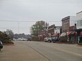
Part of downtown Idabel
-
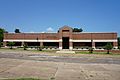
Martha A. Johnson Library in Idabel

.jpg)
See also
 In Spanish: Idabel (Oklahoma) para niños
