Jump Off Joe (Washington) facts for kids
Quick facts for kids Jump off Joe |
|
|---|---|

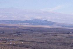
Jump off Joe from Thompson Hill in Kennewick.
|
|
| Highest point | |
| Elevation | 2,203 ft (671 m) NAVD 88 |
| Prominence | 720 ft (220 m) |
| Isolation | 27.61 mi (44.43 km) |
| Geography | |
| Parent range | Horse Heaven Hills |
| Topo map | USGS Johnson Butte |
| Climbing | |
| Easiest route | Drive |
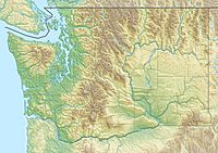
Jump off Joe is a special hill, also called a butte, located in the Horse Heaven Hills in Washington State, U.S. It stands tall south of Kennewick. You can see Jump off Joe from many places in the Tri-Cities area. It is even visible from parts of Oregon to the south.
If you visit the top, there is a gravel road that leads up a steep slope. On a clear day, you can see amazing views of big mountains like Mount Hood, Mount Adams, and Mount Rainier.
Because Jump off Joe is so high, it's a great spot for communication towers. These towers help send radio and TV signals far and wide. Many local TV stations, like KNDU (NBC) and KVEW (ABC), have their towers here. Some FM radio stations, such as KUJ-FM and KORD-FM, also use towers on Jump off Joe. There is even a special amateur radio repeater that helps people talk across a large area called the Columbia Basin.
How Jump off Joe Formed
Jump off Joe is part of the Horse Heaven Hills. These hills are like giant folds in the Earth's crust. They are called anticlines. These folds are part of a larger system of fault lines that stretch across south-central Washington. This system is known as the Yakima Fold Belt.
The rocks around Jump off Joe are mostly basalt. Basalt is a type of rock formed from cooled lava. This lava came from a place called the Yellowstone hotspot. About 10 to 15 million years ago, this hotspot was in western Idaho. Huge amounts of lava flowed out, covering large parts of Washington and Oregon. Some areas were covered in basalt up to 5,900 feet (1,800 meters) thick!
The Ice Age and Giant Floods
Long ago, during the last glacial maximum (a very cold period), huge sheets of ice covered parts of the Earth. One ice sheet blocked the Clark Fork River in the Idaho Panhandle. This created a massive lake called Glacial Lake Missoula.
Over about 2,000 years, the weight of the water behind this ice dam became too much. The ice dam broke many times! This sent huge floods of water rushing towards the Pacific Ocean. When these floods reached the Horse Heaven Hills, the water backed up. It then flowed through and deepened a narrow passage called Wallula Gap, which is a few miles southeast of Jump off Joe.
Weather and Nature at Jump off Joe
Jump off Joe is in a semi-arid (dry) area. It is in the rain shadow of the Cascade Mountains. This means the mountains block most of the rain.
Jump off Joe is nearly 2,000 feet (610 meters) higher than the Columbia River nearby. Because it's so high, it gets more snow than the Tri-Cities. It can stay covered in snow for much of the winter.
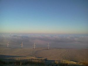
The area also has strong winds. These winds are perfect for wind turbines to create electricity. Like most of the Mid Columbia region, Jump off Joe does not have many trees. The plants you will see are mostly native grasses and sagebrush.
The nearest airport, Tri-Cities Airport in Pasco, gets about 7.94 inches (20.2 cm) of rain each year. Summer afternoons can be very hot, often over 100°F (38°C). In winter, Jump off Joe often sits above inversions. These are weather conditions where warm air traps cooler air below it in the Columbia Basin.
 | James B. Knighten |
 | Azellia White |
 | Willa Brown |


