Kisdon facts for kids
Quick facts for kids Kisdon |
|
|---|---|

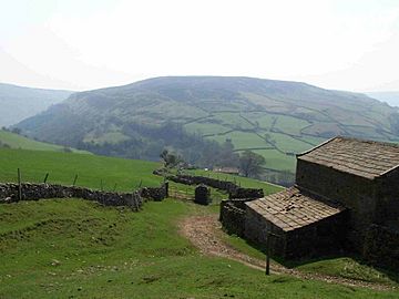
Kisdon seen from the Pennine Way above Keld
|
|
| Highest point | |
| Elevation | 499 m (1,637 ft) |
| Prominence | c. 184 m |
| Parent peak | Great Shunner Fell |
| Listing | Marilyn |
| Naming | |
| Language of name | Old Norse |
| Geography | |
| Parent range | Pennines |
| OS grid | SD898998 |
| Topo map | OS Landrangers 92, 98 OS Explorer Outdoor Leisure 30 |
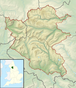
Kisdon, also known as Kisdon Hill, is a cool fell (which is a type of mountain or hill) located in the upper part of Swaledale. You can find it in the amazing Yorkshire Dales National Park in North Yorkshire, England.
Contents
The Unique Geography of Kisdon
Kisdon got its name from early Norse settlers who lived here long ago. There's even a farm called Kisdon Farm on its southern slopes, near Straw Beck.
What makes Kisdon special is that it stands all by itself. It's an isolated hill with no ridges connecting it to other fells. This happened at the end of the last Ice age. A huge glacier moved through the area, and when it melted, it left behind piles of rock and dirt called a moraine. This moraine blocked the original path of the River Swale on the west side of Kisdon. The river had to find a new way, so it carved out a deep gorge to the east. This left Kisdon completely separated from other high ground.
Because Kisdon is so isolated, it's known as a Marilyn. A Marilyn is a hill in the British Isles that is at least 150 metres (492 feet) higher than the land around it. Even though Kisdon is only 499 metres (1,636 feet) tall, its unique isolation gives it this special status!
Paths and Trails on Kisdon
It's quite interesting that Kisdon doesn't have an official path directly to its highest point. However, two popular walking routes cross high up on the fell.
One of these is the famous Pennine Way. This long-distance trail passes between the small villages of Thwaite and Keld. It reaches a height of 420 metres (1,378 feet) on the eastern side of Kisdon.
Another important path is a bridleway that connects Keld and Muker. This path is also known as the Old Corpse Road. It got this name because, a long time ago, it was used to carry bodies for burial in churches further down the valley. This bridleway crosses the western side of Kisdon at a height of 470 metres (1,542 feet).
Kisdon is made of a type of rock called Yoredale limestone. On Kisdon, this layer of limestone is at its thickest, reaching about 40 metres (131 feet) deep.
Reaching the Summit of Kisdon
Getting to the very top of Kisdon can be a bit tricky because there are many tall, dry-stone walls with wire on top crossing the fell.
If you want to reach the summit, you can start your walk from Muker, Thwaite, or Keld. It's best to follow the bridleway until you reach the high, flat area near the top. From there, you'll find a tall wall that you can follow north. This wall leads you to the summit of the fell.
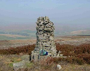
The highest point is marked by a large pile of stones called a cairn. However, the very highest spot seems to be a few metres east of this cairn. About 100 metres (328 feet) east of the summit, there's a five-metre-deep hole in the ground called a shake hole. On maps, it might be marked as a pothole, which means it could go even deeper!
From the top of Kisdon, which is covered in grass and heather, you get amazing views all around. To the east, you can see the large hill called Rogan's Seat and the deep cut of Swinner Gill. To the south-west, you'll see Great Shunner Fell and Lovely Seat, with the famous Buttertubs Pass in between them.
After exploring Kisdon, many walkers choose to go east towards the Pennine Way. There, you can discover the impressive waterfalls around Keld. These include Kisdon Force, East Gill Force, Catrake Force, and Wain Wath Force.
Scar Closes, Kisdon Side: A Special Place for Nature
The western side of Kisdon is a very important area for nature. Since 1988, it has been named a Site of Special Scientific Interest (SSSI). This means it's a protected area because of its unique plants and wildlife.
This SSSI covers about 3.7 hectares (9.1 acres) and includes four fenced areas where animals graze. The combination of calcareous grassland (grass that grows on limestone rock) supports an amazing variety of plant species.
One of the steepest parts of these enclosures has a lot of Juniperus communis (common juniper) plants. These juniper plants have been growing here since the last ice age and seem to be growing new plants, which is great news! Other special plants you might find here include Sesleria albicans (blue moor grass), Carex pulicaris (flea sedge), Galium sterneri (limestone bedstraw), Orchis mascula (early purple orchid), and Primula vulgaris (primrose).
 | Delilah Pierce |
 | Gordon Parks |
 | Augusta Savage |
 | Charles Ethan Porter |


