Kittson County, Minnesota facts for kids
Quick facts for kids
Kittson County
|
|
|---|---|

|
|

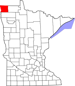
Location within the U.S. state of Minnesota
|
|
 Minnesota's location within the U.S. |
|
| Country | |
| State | |
| Founded | March 9, 1878 (created by re-naming Pembina Co.) February 25, 1879 (organized) |
| Named for | Norman Wolfred Kittson |
| Seat | Hallock |
| Largest city | Hallock |
| Area | |
| • Total | 1,104 sq mi (2,860 km2) |
| • Land | 1,099 sq mi (2,850 km2) |
| • Water | 4.8 sq mi (12 km2) 0.4%% |
| Population
(2020)
|
|
| • Total | 4,207 |
| • Estimate
(2023)
|
4,060 |
| • Density | 3.8/sq mi (1.5/km2) |
| Time zone | UTC−6 (Central) |
| • Summer (DST) | UTC−5 (CDT) |
| Congressional district | 7th |
Kittson County is a county located in the very northwest corner of Minnesota. It sits right on the border with Canada, just south of the Canadian province of Manitoba. As of the 2020 census, about 4,207 people lived here. The main town and county seat (where the county government is) is Hallock.
Contents
History of Kittson County
Early Inhabitants and Fur Trade
People have lived in the Kittson County area for a very long time. Scientists found proof of people living here 1,800 years ago. This evidence came from ancient burial mounds found on sand ridges in the eastern part of the county. These mounds are from a time called the Woodland Period.
About 400 years ago, different Native American groups lived here. These included the Cree, Assiniboine, Sioux, and Ojibway people.
The first European explorers in this region were fur traders. Pembina, a very old settlement in North Dakota, is just across the Red River from Kittson County. The first trading post there was set up in 1797. Big companies like the Hudson Bay Company and American Fur Company also traded furs here.
Fur traders and voyageurs (people who transported furs by canoe) traveled along the eastern side of the Red River. Alexander Henry the younger was one of the first Europeans to try farming in this valley.
Two important people who helped open up this area were Joe Rolette and Norman W. Kittson. The county is named after Norman Kittson! They created the Red River Ox Cart trails. These trails helped transport furs and supplies using oxcarts. Later, steamboats and then railroads took over from the oxcarts.
How Kittson County Was Formed
Kittson County started as a much larger area called Pembina County. The Minnesota Territory government created Pembina County in 1849. However, it wasn't officially organized yet.
On March 9, 1878, the government changed the name of Pembina County to Kittson County. Then, on February 25, 1879, Kittson County was divided. This created Marshall County. The county seat, Hallock, was officially organized in 1880.
Kittson County became even smaller in 1894 when Roseau County was created from its eastern part. Kittson County has kept its current borders since 1894.
Railroads and New Settlements
The town of St. Vincent, located across the Red River from Pembina, was formed in 1857. In 1878, the St. Paul & Pacific Railroad line reached St. Vincent. This railroad brought many new settlers to the area.
Many of the first settlers in Pembina and St. Vincent were Métis people. They had lived in the region since the late 1700s. The railway went through the western part of the county. Towns like Donaldson, Kennedy, Hallock, Northcote, Humboldt, and St. Vincent grew along this line.
The eastern part of the county was settled later, in the early 1900s. The Soo Line railroad was finished in 1904. This led to the creation of towns like Karlstad, Halma, Bronson (now Lake Bronson), Lancaster, Orleans, and Noyes.
Many different groups of people settled in Kittson County. These included Scandinavians, Ukrainians, Polish, Scottish, Irish, English, Germans, French Canadians, and Métis. This mix of cultures made the county a true "melting pot."
At one point, over 10,000 people lived in Kittson County. However, by 2006, the population had dropped below 5,000.
Historic Sites to Visit
Kittson County has some important historic places. Three of these are listed on the National Register of Historic Places:
- The St. Nicholas Orthodox Church in Caribou Township.
- The ancient burial mounds known as the "Lake Bronson Site" in Norway and Percy Townships.
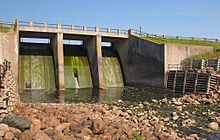
- The Lake Bronson State Park historic resources. These include an observation tower and buildings built by the WPA. The park also has signs explaining the tower, a pioneer cemetery, and the old WPA camp.
Geography of Kittson County
Kittson County is located in the very northwest corner of Minnesota. It shares borders with North Dakota and Canada. The Red River flows north along the county's western edge.
Several rivers flow through the county. The South Fork of Two Rivers flows east through the middle of the county. It joins the Middle Fork at Hallock, and then they meet the North Fork before flowing into the Red River. The Joe River flows northwest out of the county into Canada. It also eventually flows into the Red River.
The land in Kittson County has gentle, rolling hills. Most of the land is used for farming. The land slopes downwards towards the north and west. The highest point is in the southeast corner, about 1,079 feet (329 meters) above sea level.
The county covers about 1,104 square miles (2,860 square kilometers). Most of this is land (1,099 sq mi or 2,846 sq km), with a small amount of water (4.8 sq mi or 12 sq km).
Ancient Lake Agassiz
Kittson County was once covered by a huge ancient lake called Lake Agassiz. You can still see signs of this prehistoric lake in the county's landscape. For example, you can find parts of McCauleyville Beach in the eastern part of the county. This area has sandy soil and sand ridges.
Another sign of the ancient lake and glaciers is the big drop in elevation. The eastern part of the county is about 140 feet higher than the western part, near the Red River Valley. The Red River Valley is known for its rich, black soil. Lake Bronson is a man-made lake that was finished in 1937.
Major Roads and Highways
 U.S. Highway 59
 U.S. Highway 75
 Minnesota State Highway 11
 Minnesota State Highway 171
 Minnesota State Highway 175
 Minnesota State Highway 220
Neighboring Areas
Kittson County shares borders with:
- Town of Emerson, Manitoba (north)
- Rural Municipality of Franklin, Manitoba (north)
- Rural Municipality of Stuartburn, Manitoba (north)
- Roseau County, Minnesota (east)
- Marshall County, Minnesota (south)
- Walsh County, North Dakota (southwest)
- Pembina County, North Dakota (west)
Protected Natural Areas
- Beaches State Wildlife Management Area
- Lake Bronson Parklands Scientific and Natural Area
- Lake Bronson State Park
Lakes in Kittson County
- Lake Bronson
- Lake Stella
- Twin Lakes
Population and People
| Historical population | |||
|---|---|---|---|
| Census | Pop. | %± | |
| 1860 | 1,612 | — | |
| 1870 | 64 | −96.0% | |
| 1880 | 905 | 1,314.1% | |
| 1890 | 5,387 | 495.2% | |
| 1900 | 7,889 | 46.4% | |
| 1910 | 9,669 | 22.6% | |
| 1920 | 10,638 | 10.0% | |
| 1930 | 9,688 | −8.9% | |
| 1940 | 10,717 | 10.6% | |
| 1950 | 9,649 | −10.0% | |
| 1960 | 8,343 | −13.5% | |
| 1970 | 6,853 | −17.9% | |
| 1980 | 6,672 | −2.6% | |
| 1990 | 5,767 | −13.6% | |
| 2000 | 5,285 | −8.4% | |
| 2010 | 4,552 | −13.9% | |
| 2020 | 4,207 | −7.6% | |
| 2023 (est.) | 4,060 | −10.8% | |
| U.S. Decennial Census 1790-1960 1900-1990 1990-2000 2010-2020 |
|||
The population of Kittson County has changed a lot over the years. It reached its highest point in 1920 with over 10,000 people. Since then, the population has slowly decreased.
2020 Census Information
The 2020 Census collected information about the people living in Kittson County. Here's a quick look at the different groups:
| Race | Number of People | Percentage |
|---|---|---|
| White | 3,974 | 94.5% |
| Black or African American | 1 | 0.02% |
| Native American | 15 | 0.4% |
| Asian | 17 | 0.4% |
| Pacific Islander | 6 | 0.1% |
| Other/Mixed | 111 | 2.64% |
| Hispanic or Latino | 83 | 2% |
Towns and Areas in Kittson County
Cities
- Donaldson
- Hallock (the county seat)
- Halma
- Humboldt
- Karlstad
- Kennedy
- Lake Bronson (was called "Bronson" until 1939)
- Lancaster
- St. Vincent
Unincorporated Communities
These are smaller communities that are not officially organized as cities.
Ghost Town
- Pelan (a town that no longer has people living there)
Townships
Townships are smaller local government areas within the county.
- Arveson Township
- Cannon Township
- Caribou Township
- Clow Township
- Davis Township
- Deerwood Township
- Granville Township
- Hallock Township
- Hampden Township
- Hazelton Township
- Hill Township
- Jupiter Township
- Norway Township
- Pelan Township
- Percy Township
- Poppleton Township
- Richardville Township
- St. Joseph Township
- St. Vincent Township
- Skane Township
- South Red River Township
- Spring Brook Township
- Svea Township
- Tegner Township
- Teien Township
- Thompson Township
Unorganized Territories
These are areas within the county that do not have their own local government.
- East Kittson
- McKinley
- North Red River
See also
 In Spanish: Condado de Kittson para niños

