Knightdale, North Carolina facts for kids
Quick facts for kids
Knightdale, North Carolina
|
|
|---|---|
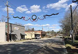
Downtown Knightdale
|
|
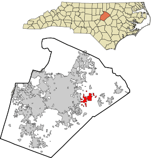
Location in Wake County and the state of North Carolina.
|
|
| Country | United States |
| State | North Carolina |
| County | Wake |
| Incorporated | 1927 |
| Area | |
| • Total | 8.50 sq mi (22.01 km2) |
| • Land | 8.49 sq mi (22.00 km2) |
| • Water | 0.01 sq mi (0.02 km2) |
| Elevation | 249 ft (76 m) |
| Population
(2020)
|
|
| • Total | 19,435 |
| • Density | 2,288.36/sq mi (883.50/km2) |
| Time zone | UTC−5 (Eastern (EST)) |
| • Summer (DST) | UTC−4 (EDT) |
| ZIP code |
27545
|
| Area code(s) | 919 |
| FIPS code | 37-36080 |
| GNIS feature ID | 2405958 |
Knightdale is a town in Wake County, North Carolina, United States. In 2020, about 19,435 people lived there. This was a big jump from 11,401 people in 2010. Knightdale grew very fast between 2010 and 2013. It was the second fastest-growing place in the Research Triangle area.
The town is named after Henry Haywood Knight. He was a local landowner who gave land for a train station. Knightdale officially became a town in 1927. By the 1960s, the main part of town moved to U.S. Highway 64. This road was north of the old downtown. Since 1990, many more people have moved to Knightdale. A new high school opened in 2004. A new highway bypass was built in 2006. Since 2010, new shopping centers have appeared along Knightdale Boulevard. This is the main road through town. A large park, Knightdale Station Park, opened in 2013. It was expanded in 2018 to add an outdoor stage. Major highways like Interstate 540 and Interstate 87 also pass through Knightdale.
Contents
History of Knightdale
Early Beginnings
In 1700, the King of England's representatives hired John Lawson to explore the land. He traveled about 1,000 miles (1,600 km) through the area. In 1701, he met the Tuscarora Native American tribe. They met near the Neuse River. Lawson made peace with them.
After Lawson's report, the King of England gave land to settlers. In 1730, John Hinton settled in the area that would become Knightdale. He lived near the Neuse River. As more people arrived, Hinton became a local leader. He helped govern the area. When the American Revolution started, Hinton joined the American side. He was a military leader. He helped in the Battle of Moore's Creek Bridge. This was the first battle of the Revolution in North Carolina.
19th Century Growth
After the American Revolution, more people moved to the area. Farmers grew crops like tobacco and cotton. During the Civil War, both armies were in the area. After the war, people worked to rebuild their homes and farms. Nearby Raleigh grew a lot. So, Wake County was divided into smaller areas called townships. Knightdale became part of St. Matthew's Township.
For many years, Knightdale was just a small crossroads with a post office. People decided they needed a town. Henry Haywood Knight gave some of his land to a railroad company. He wanted them to build a train line for goods and people. Henry Knight passed away in 1904. Soon after, the railroad came to the community named after him.
20th Century Development
After the train station was built, the area grew quickly. The railroad company moved families to Knightdale to work on the trains. Many old homes in Knightdale were built for these workers. The first train stationmaster's house is still there.
Knightdale officially became an incorporated town on March 9, 1927. This means it could set up its own local government. Bennett L. Wall was the first mayor. In 1940, a fire broke out in the town center. Firefighters from Raleigh helped put it out. Several businesses and homes were destroyed. But the townspeople rebuilt the historic downtown.
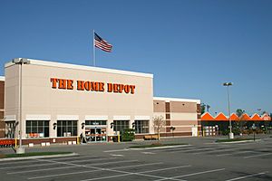
After World War II, Knightdale's population grew steadily. A municipal water system was installed in 1952. Starting in the 1960s, most new businesses opened along US 64. In the late 1980s, new neighborhoods like Parkside and Planter's Walk were built. This made the town's population grow even faster. Between 1990 and 2000, Knightdale's population jumped from 1,700 to over 6,000 residents. It became one of the fastest-growing towns in North Carolina.
Frankie Muniz, a famous actor, grew up in Knightdale. He is best known for playing the main character in the TV show Malcolm in the Middle.
21st Century Progress
In 2002, Jeanne Milliken Bonds became Knightdale's first female mayor.
Several historic places in Knightdale are listed on the National Register of Historic Places. These include Beaver Dam, Henry H. and Bettie S. Knight Farm, and Midway Plantation House and Outbuildings.
Geography and Climate
Where is Knightdale?
Knightdale is in the northeast central part of North Carolina. It sits where two major land regions meet: the North American Piedmont and the Atlantic Coastal Plain. This area is called the "Fall Line." It's where rivers start to have waterfalls. Because of its location, Knightdale is about two hours from Wrightsville Beach, NC by car. It is also about four hours from the Great Smoky Mountains.
Knightdale's Weather
Knightdale has a mild subtropical climate. This means it has moderate temperatures in spring, fall, and winter. Summers are usually hot and humid. In winter, temperatures are often in the 50s°F (10-13°C). They can drop to the 30s°F (-2-2°C) at night. Sometimes, winter days can even reach 60°F (15°C) or warmer. Spring and fall days are usually in the 70s°F (low 20s°C). Nights are in the 50s°F (10-14°C). Summer days often reach the upper 80s to low 90s°F (29-35°C). July and August are the months with the most rain.
Population Information
| Historical population | |||
|---|---|---|---|
| Census | Pop. | %± | |
| 1930 | 243 | — | |
| 1940 | 352 | 44.9% | |
| 1950 | 461 | 31.0% | |
| 1960 | 622 | 34.9% | |
| 1970 | 815 | 31.0% | |
| 1980 | 985 | 20.9% | |
| 1990 | 1,884 | 91.3% | |
| 2000 | 5,958 | 216.2% | |
| 2010 | 11,401 | 91.4% | |
| 2020 | 19,435 | 70.5% | |
| U.S. Decennial Census | |||
People in Knightdale
In 2020, there were 19,435 people living in Knightdale. There were 6,110 households. About 4,114 of these were families.
In 2010, Knightdale had 11,406 people. The average value of a home was $174,300. About 71.7% of people owned their homes. The average income for a household was $75,285 in 2011. This was much higher than North Carolina's average of $46,291. About 5.9% of the people lived below the poverty line.
Many adults in Knightdale have a good education. About 41.2% of adults aged 25 and older had a bachelor's degree or higher. About 93% had at least a high school degree.
The town's population was made up of different groups. In 2010, 50% were White. About 38.3% were African American. About 11.4% were Hispanic or Latino. The average age in Knightdale was 31.6 years.
Education in Knightdale
Public Schools
Knightdale's public schools are part of the Wake County Public School System. This is one of the largest school districts in the country. Students in Knightdale go to these schools:
Elementary Schools
- Beaverdam Elementary
- Forestville Elementary
- Hodge Road Elementary
- Knightdale Elementary
- Lake Myra Elementary
- Lockhart Elementary
Middle Schools
- Carnage Middle School
- Neuse River Middle School
- Wendell Middle School
High Schools
- Knightdale High School
- East Wake High School
Colleges and Universities
Knightdale does not have any colleges or universities. But there are many nearby in Raleigh. These include North Carolina State University, Meredith College, Shaw University, and Saint Augustine's College. Wake Technical Community College is also nearby.
Public Library
The Wake County Public Library System has a branch in Knightdale. It is called the East Regional Library.
Parks and Fun Things to Do
Knightdale has two parks and a community center. The Eugene F. Harper Memorial Park is downtown. The Knightdale Recreation Center is next to Forestville Elementary's gym. The Knightdale Environmental Park has walking trails.
Knightdale Station Park
Knightdale Station Park is a big park on the east side of town. It opened in stages in 2013, 2014, and 2018. The park has walking trails and a dog park. There is a large playground and a splash pad. You can also find several soccer fields. There is a covered area for events and an amphitheater for shows. The park also has a nine-hole disc golf course.
Mingo Creek Greenway
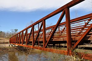
The Mingo Creek Greenway is a 3.5-mile (5.6 km) long trail. It was finished in 2014. This trail connects Mingo Creek Park to the 33-mile (53 km) Neuse River Trail in Raleigh. The two trails connect with a new bridge over the Neuse River.
Getting Around Knightdale
Air Travel
- For commercial flights, people in Knightdale use Raleigh-Durham International Airport (RDU). It is about 27.9 miles (44.9 km) away.
- A small airport for private planes, Raleigh East Airport, is on the edge of Knightdale.
Train Travel
- The closest passenger train service is about 12.8 miles (20.6 km) away in Raleigh. This is for Amtrak trains.
Bus Service
- The Triangle Transit Authority runs a bus called the Knightdale-Raleigh Express (KRX). This bus connects Knightdale riders to bus systems in Raleigh, Durham, and Chapel Hill.
Roads and Highways
Major roads in and near Knightdale include:
 I-87,
I-87,  US 64, and
  US 264 all run together. They form the Knightdale Bypass south and east of town. You can get to Knightdale from exits like Hodge Road (Exit 6) and Smithfield Road (Exit 9).
 I-540 runs along the west side of town. You can access Knightdale from the US 64 Business interchange (Exit 24).
 US 64 Bus. is known as Knightdale Boulevard. It used to be part of US 64/US 264. Now, it is the main shopping area in town. It connects Knightdale to Raleigh and Wendell.
Famous People from Knightdale
- Ronnie Ash: A track and field athlete who ran hurdles. He competed in the 2016 Summer Olympics.
- Burkheart Ellis: A track and field sprinter. He represented Barbados in the 2016 Summer Olympics.
- Jesse Ferguson: A professional heavyweight boxer.
- Frankie Muniz: An actor, famous for Malcolm in the Middle. He lived in Knightdale.
- Jeanne Milliken Bonds: A politician who served as Mayor of Knightdale.
- Stan Okoye: A professional basketball player.
- Barbara Pierre: A track and field sprinter. She represented Haiti in the 2008 Summer Olympics.
See also
 In Spanish: Knightdale para niños
 | Shirley Ann Jackson |
 | Garett Morgan |
 | J. Ernest Wilkins Jr. |
 | Elijah McCoy |


