
Lane Cove facts for kids
Quick facts for kids Lane CoveSydney, New South Wales |
|||||||||||||||
|---|---|---|---|---|---|---|---|---|---|---|---|---|---|---|---|

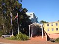
Lane Cove Plaza
|
|||||||||||||||
| Population | 10,817 (2016 census) | ||||||||||||||
| • Density | 4,330/km2 (11,200/sq mi) | ||||||||||||||
| Postcode(s) | 2066 | ||||||||||||||
| Area | 2.5 km2 (1.0 sq mi) | ||||||||||||||
| Location | 9 km (6 mi) north-west of Sydney CBD | ||||||||||||||
| LGA(s) | Lane Cove Council | ||||||||||||||
| State electorate(s) | Lane Cove, Willoughby | ||||||||||||||
| Federal Division(s) | North Sydney | ||||||||||||||
|
|||||||||||||||
Lane Cove is a suburb located on the Lower North Shore of Sydney, in New South Wales, Australia. It is about nine kilometres north-west of the Sydney CBD. Lane Cove is also the main office area for the Lane Cove Council, which manages the local government area. Nearby suburbs like Lane Cove West and Lane Cove North are separate places.
Lane Cove sits on a piece of land that sticks out into Port Jackson (Sydney Harbour). It is near where the Lane Cove River opens up. The big shopping and business area of Chatswood is only 3 kilometres away. Macquarie Park is also close, about 4 kilometres away.
Contents
Discovering Lane Cove's Past

The name 'Lane Cove' has a few possible origins. The first time the name was written down was in 1788 by Lieutenant William Bradley. He had just sailed along the river. Some people think it was named after Lieutenant Michael Lane. He was a respected mapmaker who worked with Captain Cook. Others believe it was named to honour John Lane. He was the son of the London Lord Mayor and a friend of the first Governor, Arthur Phillip.
No matter how it started, the name stuck. By the 1800s, it was used for all the land north of the river.
Aboriginal Heritage in Lane Cove
Before the First Fleet arrived, the Lane Cove area was home to the Cam-mer-ray-gal Group. They were part of the Ku-ring-gai Aboriginal Tribe. This group lived on the north shore of Port Jackson. They were one of the largest Aboriginal groups in the Sydney area. Today, there is still a strong Aboriginal Community in Lane Cove.
European Settlement and Growth
Lieutenant Ralph Clark was the first European to land here. He arrived on February 14, 1790, near the Lane Cove River entrance. Land grants were given out in 1794 to some soldiers. However, few of them actually settled there. The land was steep and covered in trees, making it hard to live on.
But Lane Cove was great for getting timber and other things the settlers needed. During the 1800s, farms and dairies also started up. Many factories were built around Greenwich too.
Most of the homes in the area were built after World War II. This was when soldiers returning from the war were given land blocks in Lane Cove. The land was quite cheap then. But its value went way up in the 1980s and 1990s. This was because people loved the water views, big yards, easy transport, and quiet streets.
In 2005, Lane Cove got worldwide attention for a short time. Part of an apartment building collapsed during digging for the Lane Cove Tunnel. This building is now in the new suburb of North Lane Cove. A pet bird in the building was saved by a robot!
Lane Cove North officially became a separate suburb on January 20, 2006.
Lane Cove's Old Tram Line
The tram service to Lane Cove started in February 1900. It was an electric line from Crows Nest. Trams connected with other electric services at Ridge St. It first opened to Gore Hill. Then it was extended to Lane Cove in March 1909. Some trams went all the way to Milsons Point.
In September 1909, a new line opened from McMahons Point to Victoria Cross, North Sydney. A new direct route also opened from Victoria Cross to Crows Nest. This new route was along what is now the Pacific Highway. Trams to Lane Cove and Chatswood then started going to and from McMahons Point. This was part of building the Sydney Harbour Bridge.
In March 1932, the Sydney Harbour Bridge opened. It had railway and tramway tracks. Trams from Lane Cove to the city then went to Wynyard Station. They used the Sydney Harbour Bridge route. Trams entered Wynyard station through a tunnel at the bridge's south-eastern pylon.
You could also take a tram from Lane Cove to Balmoral. From the Lane Cove stop, trams went north on Longueville Road. They turned right onto the Pacific Highway. At Crows Nest, lines branched off onto Falcon Street. They went through Cammeray, Neutral Bay, Cremorne Junction, and Mosman. Then they joined Military Road. The line then split into two at Middle Head Road and Bradleys Head Road. Turning left into Gordon Street, the line went onto its own special path. It crossed small streets and went down to Henry Plunkett Reserve. It ended near The Esplanade, close to Botanic Road.
Getting Around Lane Cove
The Gore Hill Freeway brings traffic from the city and airport. It connects to two main roads in Lane Cove: the Pacific Highway (going north) and Epping Road (going north-west). All the traffic at these intersections led to building the Lane Cove Tunnel. This tunnel takes cars straight from the Gore Hill Expressway to the M2.
Now, cars can travel from the Baulkham Hills Shire to the airport without stopping at any traffic lights. However, you do have to pay tolls both ways. Since the Lane Cove Tunnel opened, two lanes of Epping Road have been removed. The left lane in each direction became a bus lane. This means Epping Road sometimes has only one lane for general traffic, causing more traffic jams. Getting in and out of Lane Cove can take 20-30 minutes by car during busy times.
Lane Cove used to be the end point of one of Sydney's northern tram lines. This line closed in the late 1950s. Trams went to Wynyard in the city and Balmoral. They also went through Crows Nest. The current 254 bus route mostly follows the old city tram route. It goes from Longueville Road to Wynyard, via Crows Nest and North Sydney.
A new big bus interchange opened in March 2008. It is at the intersection of Epping Road and Longueville Road. About 25 different bus routes use this interchange. This includes school routes. It connects Lane Cove to north-west Sydney, with services to Castle Hill and Rouse Hill. Public buses also go to Chatswood, Epping, North Sydney, Macquarie Park/Centre, Gladesville, and Drummoyne. City express services to the QVB are very busy in the mornings.
A bike path has been built along the southern side of Epping Road. It goes from the Pacific Highway to the Lane Cove River. This path connects to the Gore Hill Freeway Cyclepath. Other connecting paths let cyclists ride to Chatswood, North Sydney, Willoughby, and the Macquarie Park area.
A ferry service travels partway down the Lane Cove River. It stops at Longueville Wharf and Greenwich Wharf.
The closest train stations are about 3 kilometres away. They are at Chatswood and Artarmon. Because of this, only 4.1% of people traveled to work by train alone in 2001. Other ways to travel included train and bus (1.7%), walking or cycling (5.9%), bus only (14.3%), and car (71.0%).
Learning, Arts, and Beliefs
Schools in Lane Cove include:
- Currambena School - an independent primary and preschool.
- Saint Ignatius' College, Riverview - a Jesuit high school for boys, started in 1880.
Cultural groups and services offer many activities:
- The Lane Cove Youth Orchestra
- The Lane Cove Concert Band
- The Lane Cove Art Society
- The Lane Cove Dance Academy
- The Lane Cove Music and Cultural Centre
- The Lane Cove Historical Society
- The Lane Cove Theatre Company
- The Lane Cove Bushland and Conservation Society
Annual festivals are also held here:
- The Lane Cove Autumn Harmony Festival
- The Cameraygal Festival
Places of worship in Lane Cove are:
- The Christian City Church meets every Sunday on Longueville Rd.
Parks and Nature in Lane Cove

About 16% of Lane Cove is public parks and recreation areas. These include Burns Bay Park, Tambourine Bay Park, Pottery Green, Blackman Park, and Tantallon Oval. There is also a lot of bushland along the river's edge, especially near Riverview and Lane Cove West.
Lane Cove has many small creeks and rivers flowing through it. This means there are many areas of bushland. The Lane Cove River is the biggest river in the area. The Lane Cove National Park is very close to the suburb. The Lane Cove Bushland Park is home to a rare type of fungus, Hygrocybe lanecovensis. This fungus is found nowhere else in the world. It was discovered in the 1990s.
Lane Cove's Population Snapshot
According to the 2016 census, Lane Cove had 10,817 people living there. Here's a quick look at the population:
- Gender: There were fewer males (5,142 or 47.5%) than females (5,675 or 52.5%).
- Age: The average age was 37 years, which is similar to the national average of 38 years. Kids under 15 made up 18.8% of the population. People aged 65 and over made up 15.3%.
- Background: 58.6% of people were born in Australia. Other common birthplaces were England (5.2%), China (4.5%), India (2.6%), New Zealand (2.2%), and Malaysia (1.3%). Most people (69.5%) spoke only English at home. Other languages included Mandarin (5.0%), Cantonese (2.8%), Hindi (1.2%), Spanish (1.2%), and Persian (1.1%).
- Religion: The most common responses for religion were No Religion (33.5%), Catholic (25.4%), and Anglican (13.0%).
- Money Matters: The average household income per week was $2,192. This is higher than the national average. This also shows in the high house prices. The average monthly mortgage payment in Lane Cove was $2,600, compared to the national average of $1,755.
- Getting to Work: On the day of the Census, 29.8% of employed people used public transport to get to work. 51.2% used a car (either driving or as a passenger).
- Homes: 58.0% of homes were flats or apartments. 33.8% were separate houses. 7.8% were semi-detached homes (like townhouses). The average household had 2.4 people.
Lane Cove in Pop Culture
In 2009, the shopping centre on Longueville Road was used for filming. It appeared in the TV show Underbelly: The Golden Mile. In the show, it looked like Darlinghurst Road in Kings Cross.
Sports and Recreation
The Lane Cove Aquatic Leisure Centre has great facilities. It is next to Pottery Green Oval. This oval is used for cricket in summer and soccer and baseball in winter. The Lane Cove Cricket Club and Lane Cove Rugby Club play their home games at Tantallon Oval. The cricket club started in 1893, and the Rugby Club in 1949.
The Longueville Bowling Club, now called the Longueville Sporting Club, has a lawn bowls green. It is close to the Lane Cove Country Club's 9-hole golf course. Saint Ignatius' College, Riverview is very active in the Athletic Association of the Great Public Schools of New South Wales. They have had cricket and rugby teams in this competition for over a century. The college also hosts the historic Riverview Gold Cup Regatta on the Lane Cove River. This rowing race day began in 1882.
Lane Cove also has many junior sports clubs:
- Lane Cove Junior Rugby Union Club - for ages U-5 to U-16
- Lane Cove Junior Rugby Club - Minis, U-10 to U-16
- Lane Cove Tigers Junior Rugby League Club
- Lane Cove Cats AFL Club - Auskick, U-9 to U-11
- Lane Cove Football Club - U-6 to U-18
- Lane Cove Cricket Club - U-9 to Seniors
Famous People from Lane Cove

- Writers
- Christopher Brennan, a poet who lived at Riverview.
- Robert Dessaix's book, A Mother's Disgrace, talks about growing up in Lane Cove in the 1950s.
- Robert Hughes, an art critic. His book Things I Didn't Know discusses his high school days at St Ignatius' College, Riverview.
- Artists
- Lloyd Rees, a well-known landscape artist.
- Brett Whiteley, an artist who won the Archibald Prize twice.
- Politicians
- Billy Hughes, who later became Prime Minister, built a house called 'Osborne Park' (later 'Kermadec') in Osborne Rd in 1906.
- Barnaby Joyce, a former Deputy Prime Minister of Australia, lived at Riverview as a boarder.
- Sportspeople
- Brett Lee, an Australian cricketer and Bollywood star. He lived in Lane Cove for some time, leaving in 2013.
- Sam Newman, an Australian rules football player and TV presenter.
- Entertainers
- Natarsha Belling, a journalist.
- Smoky Dawson, an actor, singer, and radio star.
- Michael Hutchence, the lead singer of INXS (1960-1997).
- Nicole Kidman, a famous actress.
Images for kids
-
Lane Cove Town Hall
-

The interior of Lane Cove Library in 2020


See also
 In Spanish: Lane Cove para niños
