List of islands of North Dakota facts for kids

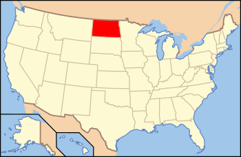
Location of North Dakota within the United States.
|
|
| Geography | |
|---|---|
| Location | North Dakota |
| Major islands | Grahams Island, Mallard Island |
| Administration | |
| State | |
North Dakota is a state located in the Upper Midwest region of the United States. It is a "landlocked" state, meaning it doesn't have a coastline on an ocean. Most of North Dakota is covered by grassland and farm fields.
Only a small part of the state, about 2.4%, is water. This means there are not many natural lakes or islands. Most of the islands you can find in North Dakota are in large man-made lakes called reservoirs or in the Missouri River. After dams were built on the Missouri River, some islands were flooded and disappeared. These are now listed as historical islands.
Islands You Can Visit Today
This section lists the islands in North Dakota that still exist and have names. Many of these islands are found in large lakes like Lake Metigoshe and Lake Sakakawea. Lake Sakakawea was created when the Missouri River was dammed.
| Island Name | Body of Water | County | Area (square miles) | Location (Coordinates) |
|---|---|---|---|---|
| Bear Island | Lake Metigoshe | Bottineau | 0.03 | 48°59′38″N 100°21′45″W / 48.9939002°N 100.3623638°W |
| Grahams Island | Devils Lake | Benson, Ramsey | 6.02 | 48°03′14″N 99°05′48″W / 48.0538881°N 99.0967958°W |
| Mackay Island | Lake Metigoshe | Bottineau | 0.01 | 48°58′33″N 100°20′51″W / 48.9758434°N 100.3473624°W |
| Mallard Island | Lake Sakakawea | McLean | 4.75 | 47°34′00″N 101°18′45″W / 47.5666658°N 101.3123802°W |
| Masonic Island | Lake Metigoshe | Bottineau | 0.01 | 48°59′07″N 100°20′40″W / 48.9852881°N 100.3443068°W |
| The Island | Lake Ibsen | Benson | 0.09 | 48°15′26″N 99°24′04″W / 48.2572212°N 99.4012459°W |
| Winona Island | Lake Oahe | Emmons | 0.65 | 46°06′35″N 100°36′01″W / 46.1097180°N 100.6004041°W |
Islands That No Longer Exist
This section lists islands that used to be in North Dakota but are now gone. These islands were once part of the Missouri River. They disappeared when the water level rose due to the construction of large dams. The Oahe Dam and the Garrison Dam were built by the United States Army Corps of Engineers.
| Island Name | Body of Water | County | Location (Coordinates) |
|---|---|---|---|
| Bear Island | Missouri River | Williams | 48°08′40″N 103°02′07″W / 48.1444668°N 103.0351847°W |
| Goldfinch Towhead | Missouri River | McLean | 47°40′50″N 102°15′27″W / 47.6805633°N 102.2573964°W |
| Gros Ventres Island | Missouri River | McLean | 47°34′26″N 101°04′02″W / 47.5738875°N 101.0670941°W |
| Knifer Towhead | Missouri River | McKenzie | 47°56′18″N 102°37′13″W / 47.9383495°N 102.6201850°W |
| Little Bason Island | Missouri River | McLean | 47°30′14″N 101°49′45″W / 47.5038913°N 101.8290600°W |
| Little Bear Island | Missouri River | McKenzie | 48°08′08″N 102°57′59″W / 48.1355778°N 102.9662955°W |
| Sibley Island | Missouri River | Morton | 46°43′41″N 100°47′06″W / 46.7280499°N 100.7851273°W |
| Strawberry Island | Missouri River | Williams | 48°07′52″N 102°53′50″W / 48.1311322°N 102.8971289°W |
| Sunday Island | Missouri River | Mountrail | 47°47′47″N 102°35′29″W / 47.7964013°N 102.5912990°W |
See also

