List of national nature reserves in Somerset facts for kids
Somerset is a beautiful county in England, known for its amazing countryside and wildlife. It's home to many special places called National Nature Reserves (NNRs). These are like protected homes for plants, animals, and unique natural features. They help keep our environment healthy and safe for future generations.
What are National Nature Reserves?
National Nature Reserves (NNRs) are super important places in England. They are chosen by an organization called Natural England because they have special wildlife or cool geological features. The main goal of NNRs is to protect the most important habitats and rock formations. Many of these reserves are looked after by Natural England itself, but some are also managed by groups like the Somerset Wildlife Trust, the National Trust, or the Royal Society for the Protection of Birds.
Somerset has 15 National Nature Reserves. The biggest one is Bridgwater Bay, which is a huge area of mudflats, saltmarsh, and shingle ridges covering about 2,639 hectares. It's so important that it's recognized internationally! The smallest reserve is Hardington Moor, which is about 8.7 hectares. Many of these special places are found near rivers and the low-lying areas of the Somerset Levels. The highest NNR is Dunkery and Horner Wood on Exmoor, which has wet and dry heathland, old woodlands, and open grasslands. It even includes Dunkery Beacon, the highest point in Somerset! Ebbor Gorge is another cool spot, important for both its plants and animals, and its interesting rocks.
Somerset's National Nature Reserves
| Site | Photograph | District | Area | Location | Map | Details | Description |
|---|---|---|---|---|---|---|---|
| Barrington Hill | South Somerset | 17.8 hectares (44.0 acres) | Broadway 50°56′53″N 2°59′49″W / 50.948°N 2.997°W ST300170 |
Map | Details | This reserve has four meadows with old hedges and clay-rich soil. It's a great example of traditional grasslands, which are now rare in Britain. You can find many types of grasses and flowers here, including 74 different kinds of orchids! | |
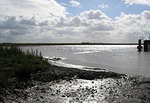
| Bridgwater Bay | Sedgemoor | 2,639 hectares (6,521 acres) | Otterhampton 51°10′59″N 3°04′48″W / 51.183°N 3.080°W ST246431 |
Map | Details | Bridgwater Bay is on the Bristol Channel, near the mouth of the River Parrett. It has huge areas of mud flats, saltmarsh, and shingle beaches. It's a very important wetland for birds and other wildlife, recognized worldwide. | |
| Dunkery and Horner Wood | West Somerset | 1,604 hectares (3,964 acres) | Luccombe 51°11′20″N 3°33′32″W / 51.189°N 3.559°W SS910445 |
Map | Details | This is one of the biggest nature reserves in England. It includes Dunkery Hill, the highest point on Exmoor and in Somerset. You'll find wet and dry heathland, very old woodlands, and open grasslands here. Much of it is owned by the National Trust. | |
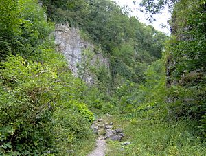
| Ebbor Gorge | Mendip | 47 hectares (116 acres) | St Cuthbert Out 51°14′02″N 2°40′55″W / 51.234°N 2.682°W ST525485 |
Map | Details | Ebbor Gorge is a cool limestone gorge with interesting rock formations. People lived here long ago, and tools and pottery from the Neolithic and Bronze Age have been found. It's also home to many flowers, butterflies, and bats. | |
| Gordano Valley | North Somerset | 126 hectares (311 acres) | Walton in Gordano 51°27′11″N 2°48′50″W / 51.453°N 2.814°W ST433731 |
Map | Details | The Gordano Valley is important for its birds, insects, and geology. Many parts of the valley are managed by the Avon Wildlife Trust. You can find over 130 types of flowering plants here, including three rare water plants in its ditches. | |
| Ham Wall | Mendip | 87.27 hectares (215.6 acres) | Sharpham 51°09′18″N 2°40′55″W / 51.155°N 2.682°W ST525485 |
Map | Details | The Ham Wall reserve is managed by the Royal Society for the Protection of Birds. It's a new wetland habitat created from old peat diggings. It has reedbeds, open water, and woodlands, attracting many bird species like the bearded tit, bittern, and huge groups of starlings. | |
| Hardington Moor | South Somerset | 8.7 hectares (21.5 acres) | Hardington Mandeville 50°54′50″N 2°41′28″W / 50.914°N 2.691°W ST515130 |
Map | Details | Hardington Moor is the smallest NNR in Somerset. It has three meadows with rich, untouched grasslands, which are very rare now. You can find many plant species, including the rare French oat-grass and lots of green-winged orchids. It's also home to many butterflies. | |
| Hawkcombe Woods | West Somerset | 98 hectares (242 acres) | Porlock 51°12′07″N 3°35′35″W / 51.202°N 3.593°W SS886459 |
Map | Details | Hawkcombe Woods is near Porlock on Exmoor. These woodlands are special for their lichens, the heath fritillary butterfly, red wood ant colonies, and ancient trees. They are part of a larger protected area called North Exmoor SSSI. | |
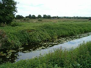
| Huntspill River | Sedgemoor | 149 hectares (368 acres) | East Huntspill 51°12′29″N 3°00′50″W / 51.208°N 3.014°W ST291459 |
Map | Details | The River Huntspill is a man-made river in the Somerset Levels. It was built to help with water flow and reduce flooding. A part of this river is a national nature reserve, managed by the Environment Agency. It flows into the River Parrett. | |
| Leigh Woods | North Somerset | 64 hectares (158 acres) | Leigh Woods 51°27′47″N 2°38′20″W / 51.463°N 2.639°W ST559733 |
Map | Details | Leigh Woods is a woodland area near the Clifton Suspension Bridge. Part of it was given to the National Trust to protect it from building. You can find rare trees here, including many types of Sorbus (rowan trees). There are also special flowers like Bristol rockcress and different kinds of orchids. | |
| Rodney Stoke | Mendip | 51 hectares (126 acres) | Rodney Stoke 51°15′11″N 2°43′44″W / 51.253°N 2.729°W ST492507 |
Map | Details | Rodney Stoke has a mix of old woodlands, bushes, and grasslands full of different plant species. Two rare plants, purple gromwell and the special whitebeam tree, grow here. It's also home to badgers, bats, and many invertebrates, including beautiful butterflies like the marbled white. | |
| Shapwick Heath | Sedgemoor | 509 hectares (1,258 acres) | Shapwick 51°09′32″N 2°48′50″W / 51.159°N 2.814°W ST436400 |
Map | Details | Shapwick Heath is a former raised bog in the Somerset Levels. It's managed by Natural England and is part of a bigger conservation project. This site is home to many land and water insects, including two nationally rare diving beetles. | |
| Somerset Levels | Sedgemoor | 463 hectares (1,144 acres) | Moorlinch 51°07′16″N 2°52′55″W / 51.121°N 2.882°W ST383361 |
Map | Details | The Somerset Levels NNR covers several areas of the wider Somerset Levels. It includes open water and grasslands, which are visited by many different birds throughout the year. The ground is often wet, especially in winter, creating a perfect home for wetland plants. | |
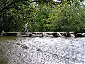
| Tarr Steps Woodland | West Somerset | 33.4 hectares (82.5 acres) | Winsford 51°04′37″N 3°37′05″W / 51.077°N 3.618°W SS863324 |
Map | Details | Owned by Exmoor National Park Authority, Tarr Steps Woodland is in the River Barle valley. It's mostly sessile oak woodland, with other trees like beech and ash. It's super important for its mosses, liverworts, and lichens, which love the cool, damp air. You might spot red deer, dormice, or even rare barbastelle bats here! | |
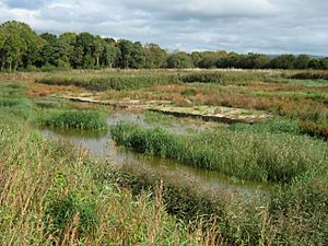
| Westhay Moor | Mendip | 105 hectares (259 acres) | Meare 51°11′49″N 2°46′52″W / 51.197°N 2.781°W ST454443 |
Map | Details | Westhay Moor is a low-lying, swampy area where peat has formed over thousands of years. People have been digging peat here since Roman times. Now, the nature reserve is managed by the Somerset Wildlife Trust and is known for its flooded peat workings. It's especially famous for the millions of starlings that gather here! |
See also


